<< Text Pages >> Brandwall Hohestein - Hillfort in Germany in Hesse
Submitted by KaiHofmann on Tuesday, 26 September 2017 Page Views: 719
Iron Age and Later PrehistorySite Name: Brandwall HohesteinCountry: Germany Land: Hesse Type: Hillfort
Nearest Town: Eschwege Nearest Village: Motzenrode
Latitude: 51.249595N Longitude: 10.042126E
Condition:
| 5 | Perfect |
| 4 | Almost Perfect |
| 3 | Reasonable but with some damage |
| 2 | Ruined but still recognisable as an ancient site |
| 1 | Pretty much destroyed, possibly visible as crop marks |
| 0 | No data. |
| -1 | Completely destroyed |
| 5 | Superb |
| 4 | Good |
| 3 | Ordinary |
| 2 | Not Good |
| 1 | Awful |
| 0 | No data. |
| 5 | Can be driven to, probably with disabled access |
| 4 | Short walk on a footpath |
| 3 | Requiring a bit more of a walk |
| 2 | A long walk |
| 1 | In the middle of nowhere, a nightmare to find |
| 0 | No data. |
| 5 | co-ordinates taken by GPS or official recorded co-ordinates |
| 4 | co-ordinates scaled from a detailed map |
| 3 | co-ordinates scaled from a bad map |
| 2 | co-ordinates of the nearest village |
| 1 | co-ordinates of the nearest town |
| 0 | no data |
Internal Links:
External Links:
Hillfort in Hesse
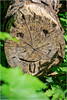
Two large well preserved ramparts of the Hallstatt-age hillfort on the Hohesetin hill.
You may be viewing yesterday's version of this page. To see the most up to date information please register for a free account.
Do not use the above information on other web sites or publications without permission of the contributor.
Nearby Images from Flickr

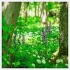
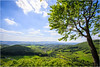
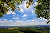
The above images may not be of the site on this page, but were taken nearby. They are loaded from Flickr so please click on them for image credits.
Click here to see more info for this site
Nearby sites
Click here to view sites on an interactive map of the areaKey: Red: member's photo, Blue: 3rd party photo, Yellow: other image, Green: no photo - please go there and take one, Grey: site destroyed
Download sites to:
KML (Google Earth)
GPX (GPS waypoints)
CSV (Garmin/Navman)
CSV (Excel)
To unlock full downloads you need to sign up as a Contributory Member. Otherwise downloads are limited to 50 sites.
Turn off the page maps and other distractions
Nearby sites listing. In the following links * = Image available
8.0km WSW 238° Todstein Natural Stone / Erratic / Other Natural Feature
16.7km E 81° Drei Kreuze Küllstedt Ancient Cross
18.9km SE 146° Hüneburg Schnellmannshausen Causewayed Enclosure
19.3km WSW 246° Hollensteine Natural Stone / Erratic / Other Natural Feature
23.7km SE 144° Scherbdaer Struth Barrow Cemetery
24.5km N 352° Bielstein Natural Stone / Erratic / Other Natural Feature
24.9km N 354° Bärental Kreuz Early Christian Sculptured Stone
25.8km SE 137° Über dem Bocksgraben Barrow Cemetery
29.5km ESE 108° Seeheiligtum Niederdorla* Ancient Temple
29.8km SSE 162° Brandenburg Lauchröden Ancient Village or Settlement
29.9km ESE 109° Ausstellung Opfermoor Vogtei* Museum
30.7km NW 312° Schalenstein Wiershausen* Rock Art
32.2km NW 323° Altarstein Dransfeld Rock Art
33.4km SE 129° Alte Burg Berka vor dem Hainich Hillfort
34.2km W 274° Summstein Grüne Mitte Modern Stone Circle etc
35.9km NW 309° Steinkreis Gimte* Stone Circle
36.1km S 177° Becks Grab Artificial Mound
37.0km SSE 150° Eisenacher Burg Ancient Village or Settlement
39.0km W 280° Hessisches Landesmuseum Kassel* Museum
39.9km W 278° Summstein Schönfeld Modern Stone Circle etc
40.9km W 267° Guntershausen Riesenstein Standing Stone (Menhir)
41.7km ENE 70° Helbeburg Causewayed Enclosure
42.1km W 262° Riesenstein von Wolfershausen* Standing Stone (Menhir)
42.1km NNE 26° Rhumequelle* Holy Well or Sacred Spring
42.6km ENE 73° Mittelholz Artificial Mound
View more nearby sites and additional images


 We would like to know more about this location. Please feel free to add a brief description and any relevant information in your own language.
 Wir möchten mehr über diese Stätte erfahren. Bitte zögern Sie nicht, eine kurze Beschreibung und relevante Informationen in Deutsch hinzuzufügen.
 Nous aimerions en savoir encore un peu sur les lieux. S'il vous plaît n'hesitez pas à ajouter une courte description et tous les renseignements pertinents dans votre propre langue.
 Quisieramos informarnos un poco más de las lugares. No dude en añadir una breve descripción y otros datos relevantes en su propio idioma.