<< Our Photo Pages >> Luine - Rock Art in Italy in Lombardia
Submitted by AlexHunger on Tuesday, 15 April 2008 Page Views: 4384
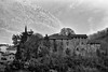
Rock ArtSite Name: Luine Alternative Name: Parco del Lago moroCountry: Italy
NOTE: This site is 10.945 km away from the location you searched for.
Region: Lombardia Type: Rock Art
Nearest Town: Bergamo Nearest Village: Gorzone
Latitude: 45.887439N Longitude: 10.173597E
Condition:
| 5 | Perfect |
| 4 | Almost Perfect |
| 3 | Reasonable but with some damage |
| 2 | Ruined but still recognisable as an ancient site |
| 1 | Pretty much destroyed, possibly visible as crop marks |
| 0 | No data. |
| -1 | Completely destroyed |
| 5 | Superb |
| 4 | Good |
| 3 | Ordinary |
| 2 | Not Good |
| 1 | Awful |
| 0 | No data. |
| 5 | Can be driven to, probably with disabled access |
| 4 | Short walk on a footpath |
| 3 | Requiring a bit more of a walk |
| 2 | A long walk |
| 1 | In the middle of nowhere, a nightmare to find |
| 0 | No data. |
| 5 | co-ordinates taken by GPS or official recorded co-ordinates |
| 4 | co-ordinates scaled from a detailed map |
| 3 | co-ordinates scaled from a bad map |
| 2 | co-ordinates of the nearest village |
| 1 | co-ordinates of the nearest town |
| 0 | no data |
Internal Links:
External Links:
I have visited· I would like to visit
mfrincu visited on 24th Aug 2016 - their rating: Cond: 3 Amb: 5 Access: 5 The lady at the reception is well informed and pleasant to talk to.
")
Pictograms on expoed bedrock of mountain side dating to between Paleolithic to Iron Age.
You may be viewing yesterday's version of this page. To see the most up to date information please register for a free account.
")
")
")
Do not use the above information on other web sites or publications without permission of the contributor.
Nearby Images from Flickr
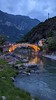

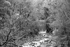
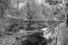
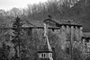
The above images may not be of the site on this page, but were taken nearby. They are loaded from Flickr so please click on them for image credits.
Click here to see more info for this site
Nearby sites
Click here to view sites on an interactive map of the areaKey: Red: member's photo, Blue: 3rd party photo, Yellow: other image, Green: no photo - please go there and take one, Grey: site destroyed
Download sites to:
KML (Google Earth)
GPX (GPS waypoints)
CSV (Garmin/Navman)
CSV (Excel)
To unlock full downloads you need to sign up as a Contributory Member. Otherwise downloads are limited to 50 sites.
Turn off the page maps and other distractions
Nearby sites listing. In the following links * = Image available
2.0km ENE 77° Boario Terme Archeopark Museum
6.8km NNE 20° Borno Stone* Standing Stone (Menhir)
7.5km NNE 27° Borno 4 Sculptured Stone
10.0km NE 42° Ossimo Stones Sculptured Stone
10.1km NE 34° Asino-Anvoia* Standing Stones
10.1km NE 36° Anvoia Stones* Standing Stones
15.9km SSW 199° Pyramids of Zone* Natural Stone / Erratic / Other Natural Feature
16.0km NNE 31° Concarena* Natural Stone / Erratic / Other Natural Feature
19.5km NE 45° Nadro Cup-Marked-Stone* Rock Art
19.6km NE 45° Foppe-Nadro Museum* Museum
19.8km NE 44° Nadro Ancient Road* Ancient Trackway
20.0km NE 43° Foppe-Nadro Stone* Standing Stone (Menhir)
20.1km NE 43° Foppe-Nadro Villaggio Prehistorico* Museum
20.1km NE 43° Foppe-Nadro Rock 1* Rock Art
20.2km NE 42° Foppe-Nadro Rock 6* Rock Art
20.2km NE 42° Foppe-Nadro Rock 4* Rock Art
20.2km NE 42° Foppe-Nadro Rock 21* Rock Art
20.2km NE 42° Foppe-Nadro Rock 22* Rock Art
20.3km NE 43° Sotto Roccia shelter II* Cave or Rock Shelter
20.3km NE 43° Foppe-Nadro Rock 23* Rock Art
20.3km NE 42° Foppe-Nadro Rock 24* Rock Art
20.3km NE 42° Foppe-Nadro Rock 25* Rock Art
20.3km NE 42° Foppe-Nadro Rock 29* Rock Art
20.3km NE 42° Foppe-Nadro Rock 26* Rock Art
20.4km NE 42° Foppe-Nadro Rock 34* Rock Art
View more nearby sites and additional images


 We would like to know more about this location. Please feel free to add a brief description and any relevant information in your own language.
 Wir möchten mehr über diese Stätte erfahren. Bitte zögern Sie nicht, eine kurze Beschreibung und relevante Informationen in Deutsch hinzuzufügen.
 Nous aimerions en savoir encore un peu sur les lieux. S'il vous plaît n'hesitez pas à ajouter une courte description et tous les renseignements pertinents dans votre propre langue.
 Quisieramos informarnos un poco más de las lugares. No dude en añadir una breve descripción y otros datos relevantes en su propio idioma.