<< Our Photo Pages >> Dolmen des Alberts - Burial Chamber or Dolmen in France in Midi:Tarn (81)
Submitted by holger_rix on Tuesday, 19 January 2016 Page Views: 1848
Neolithic and Bronze AgeSite Name: Dolmen des AlbertsCountry: France
NOTE: This site is 1.188 km away from the location you searched for.
Département: Midi:Tarn (81) Type: Burial Chamber or Dolmen
Nearest Town: Montricoux Nearest Village: Penne
Latitude: 44.086370N Longitude: 1.721780E
Condition:
| 5 | Perfect |
| 4 | Almost Perfect |
| 3 | Reasonable but with some damage |
| 2 | Ruined but still recognisable as an ancient site |
| 1 | Pretty much destroyed, possibly visible as crop marks |
| 0 | No data. |
| -1 | Completely destroyed |
| 5 | Superb |
| 4 | Good |
| 3 | Ordinary |
| 2 | Not Good |
| 1 | Awful |
| 0 | No data. |
| 5 | Can be driven to, probably with disabled access |
| 4 | Short walk on a footpath |
| 3 | Requiring a bit more of a walk |
| 2 | A long walk |
| 1 | In the middle of nowhere, a nightmare to find |
| 0 | No data. |
| 5 | co-ordinates taken by GPS or official recorded co-ordinates |
| 4 | co-ordinates scaled from a detailed map |
| 3 | co-ordinates scaled from a bad map |
| 2 | co-ordinates of the nearest village |
| 1 | co-ordinates of the nearest town |
| 0 | no data |
Internal Links:
External Links:
")
From LaDragonne:
Dolmen ruiné non loin du domaine des Alberts. Facilement accessible par un chemin empierré donnant sur la route départementale RD33, à 50m de celle-ci. Il reste un tumulus de près de 2m de haut en pierres sèches et terre sur 7m de diamètre. La chambre mesurait 2 mètres 50 de longueur sur 1m de large. La dalle ou une des dalles de couverture a été déplacée à 3m du tumulus et maintenue oblique par deux pierres, pour constituer un coupe-vent pour chasseurs.
Source: T4T35.fr
You may be viewing yesterday's version of this page. To see the most up to date information please register for a free account.
")
")
Do not use the above information on other web sites or publications without permission of the contributor.
Nearby Images from Flickr
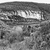
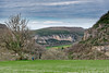
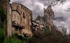
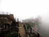
The above images may not be of the site on this page, but were taken nearby. They are loaded from Flickr so please click on them for image credits.
Click here to see more info for this site
Nearby sites
Click here to view sites on an interactive map of the areaKey: Red: member's photo, Blue: 3rd party photo, Yellow: other image, Green: no photo - please go there and take one, Grey: site destroyed
Download sites to:
KML (Google Earth)
GPX (GPS waypoints)
CSV (Garmin/Navman)
CSV (Excel)
To unlock full downloads you need to sign up as a Contributory Member. Otherwise downloads are limited to 50 sites.
Turn off the page maps and other distractions
Nearby sites listing. In the following links * = Image available
1.2km NNW 344° Ciste de Puech Moureau* Cist
1.5km ENE 74° Dolmen de Suquets* Burial Chamber or Dolmen
2.3km NNW 333° Dolmen de la Devèze de Barsalès* Burial Chamber or Dolmen
2.8km ENE 67° Dolmen de Martres de Bel-Air* Burial Chamber or Dolmen
3.1km NW 313° Dolmen de Lautanel* Burial Chamber or Dolmen
3.4km WNW 283° Dolmen des Arrendies* Burial Chamber or Dolmen
3.6km S 178° Dolmen des Jasses * Burial Chamber or Dolmen
3.6km S 177° Ciste de la Jasse n°2* Cist
3.8km SW 235° Bruniquel Cave* Cave or Rock Shelter
3.8km NW 316° Dolmen du Pech de Montgrès* Burial Chamber or Dolmen
4.0km WNW 299° Dolmen de La Barraque* Burial Chamber or Dolmen
4.5km ENE 60° Dolmen de Gabach* Burial Chamber or Dolmen
4.7km NE 54° Dolmen de Cante Sigale 2* Burial Chamber or Dolmen
4.7km NE 43° Dolmen de Clausel* Burial Chamber or Dolmen
4.9km NE 54° Dolmen de Cante Sigale 1* Burial Chamber or Dolmen
5.0km WNW 299° Dolmen de la Forêt de la Garrigue du Loup* Burial Chamber or Dolmen
5.5km SW 233° Abris sous roche du château de Bruniquel* Cave or Rock Shelter
5.7km NE 53° Dolmen d'Al Roux* Burial Chamber or Dolmen
5.8km WNW 303° Dolmen de la Garrigue (Cazals)* Burial Chamber or Dolmen
5.8km ESE 107° Alignement des Grèzes* Stone Row / Alignment
5.9km WNW 302° Ciste du Loup* Cist
5.9km WNW 291° Dolmen de Brétou 1* Burial Chamber or Dolmen
6.1km SSW 212° Grotte de Mayrière Supérieure Cave or Rock Shelter
6.3km NNW 339° Dolmen de Les Bretelles Burial Chamber or Dolmen
6.5km NW 324° Dolmen du Pech (Cazals)* Burial Chamber or Dolmen
View more nearby sites and additional images


 We would like to know more about this location. Please feel free to add a brief description and any relevant information in your own language.
 Wir möchten mehr über diese Stätte erfahren. Bitte zögern Sie nicht, eine kurze Beschreibung und relevante Informationen in Deutsch hinzuzufügen.
 Nous aimerions en savoir encore un peu sur les lieux. S'il vous plaît n'hesitez pas à ajouter une courte description et tous les renseignements pertinents dans votre propre langue.
 Quisieramos informarnos un poco más de las lugares. No dude en añadir una breve descripción y otros datos relevantes en su propio idioma.