<< Our Photo Pages >> Cross Well (Faversham) - Holy Well or Sacred Spring in England in Kent
Submitted by HOLYWELl on Saturday, 26 July 2008 Page Views: 4436
Springs and Holy WellsSite Name: Cross Well (Faversham)Country: England County: Kent Type: Holy Well or Sacred Spring
Nearest Town: Faversham
Map Ref: TR016613
Latitude: 51.315083N Longitude: 0.891472E
Condition:
| 5 | Perfect |
| 4 | Almost Perfect |
| 3 | Reasonable but with some damage |
| 2 | Ruined but still recognisable as an ancient site |
| 1 | Pretty much destroyed, possibly visible as crop marks |
| 0 | No data. |
| -1 | Completely destroyed |
| 5 | Superb |
| 4 | Good |
| 3 | Ordinary |
| 2 | Not Good |
| 1 | Awful |
| 0 | No data. |
| 5 | Can be driven to, probably with disabled access |
| 4 | Short walk on a footpath |
| 3 | Requiring a bit more of a walk |
| 2 | A long walk |
| 1 | In the middle of nowhere, a nightmare to find |
| 0 | No data. |
| 5 | co-ordinates taken by GPS or official recorded co-ordinates |
| 4 | co-ordinates scaled from a detailed map |
| 3 | co-ordinates scaled from a bad map |
| 2 | co-ordinates of the nearest village |
| 1 | co-ordinates of the nearest town |
| 0 | no data |
Internal Links:
External Links:
I have visited· I would like to visit
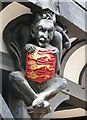
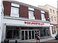
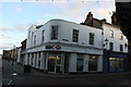
wildtalents visited on 1st Apr 2024 - their rating: Cond: 3 Amb: 2 Access: 5 A 'part of the furniture' in Faversham market place, rarely give it a second glance if I'm honest. Often invaded by a fruit and veg stall on the Tuesday and Saturday markets. The Guildhall is quite picturesque and the nearby building that is partly occupied by a Chinese restaurant has an ancient-looking wooden door and the plaque commemorating Ss Crispan and Crispianus. There's a large house near the zebra crossing further down the Market Place that has a well in its kitchen, tapping the same spring. Most of the water is slurped up free of charge by the local mafia, er, I mean Shepherd Neame brewery,
 (PID:261357)")
You may be viewing yesterday's version of this page. To see the most up to date information please register for a free account.
 (PID:260693)")
Do not use the above information on other web sites or publications without permission of the contributor.
Nearby Images from Geograph Britain and Ireland:
©2023(licence)
©2009(licence)
©2013(licence)

©2013(licence)

©2019(licence)
The above images may not be of the site on this page, they are loaded from Geograph.
Please Submit an Image of this site or go out and take one for us!
Click here to see more info for this site
Nearby sites
Key: Red: member's photo, Blue: 3rd party photo, Yellow: other image, Green: no photo - please go there and take one, Grey: site destroyed
Download sites to:
KML (Google Earth)
GPX (GPS waypoints)
CSV (Garmin/Navman)
CSV (Excel)
To unlock full downloads you need to sign up as a Contributory Member. Otherwise downloads are limited to 50 sites.
Turn off the page maps and other distractions
Nearby sites listing. In the following links * = Image available
1.5km WSW 253° Holywell (Ospringe) Holy Well or Sacred Spring (TR002608)
8.8km WNW 284° St. Thomas a Becket's Spring (Bapchild)* Holy Well or Sacred Spring (TQ930631)
9.6km SE 132° Pilgrims Way 9 Ancient Trackway (TR090552)
10.1km SE 145° Julliberrie's Grave* Long Barrow (TR077532)
10.6km ESE 113° Bigbury Camp* Hillfort (TR116576)
10.7km NW 311° Elmley Barrow Misc. Earthwork (TQ93306801)
10.8km WNW 298° Castle Rough (Kent) Ancient Village or Settlement (TQ9183265969)
10.9km W 274° Highsted Gravel Pit Not Known (by us) (TQ907617)
11.0km S 170° Kings Wood Barrow* Round Barrow(s) (TR04005060)
11.2km S 189° The Lees Denehole Ancient Mine, Quarry or other Industry (TR003502)
11.2km S 173° Kings Wood Mound* Misc. Earthwork (TR034502)
11.4km E 80° Clowes Wood Barrows* Round Barrow(s) (TR12746378)
11.6km W 271° Highsted Settlement Ancient Village or Settlement (TQ900610)
11.7km NNW 343° Kingsborough 1* Causewayed Enclosure (TQ977723)
11.7km ESE 108° Black Prince's Well* Holy Well or Sacred Spring (TR129581)
11.8km S 174° Jackets Field Long Barrow* Long Barrow (TR03304961)
11.8km SE 140° Denge Wood Earthworks Misc. Earthwork (TR095525)
12.0km SE 142° Denge Wood Tumulus Round Barrow(s) (TR0933852069)
13.0km NNW 335° Birth Bracelet Well* Holy Well or Sacred Spring (TQ95667292)
13.1km NNW 336° The Abbess's Well* Holy Well or Sacred Spring (TQ9569673029)
13.1km NNW 335° Well of the Triple Goddess* Holy Well or Sacred Spring (TQ95577300)
13.2km NNW 335° Minster Gatehouse Museum* Museum (TQ95567300)
13.3km SE 145° Eggringe Wood Barrow Cemetery* Barrow Cemetery (TR097507)
13.5km SE 143° Eggringe Wood East Bowl Barrow* Round Barrow(s) (TR10115083)
13.5km WSW 252° Oorlair Round Barrow Round Barrow(s) (TQ88885661)
View more nearby sites and additional images


 We would like to know more about this location. Please feel free to add a brief description and any relevant information in your own language.
 Wir möchten mehr über diese Stätte erfahren. Bitte zögern Sie nicht, eine kurze Beschreibung und relevante Informationen in Deutsch hinzuzufügen.
 Nous aimerions en savoir encore un peu sur les lieux. S'il vous plaît n'hesitez pas à ajouter une courte description et tous les renseignements pertinents dans votre propre langue.
 Quisieramos informarnos un poco más de las lugares. No dude en añadir una breve descripción y otros datos relevantes en su propio idioma.