<< Our Photo Pages >> Menhir de l'Eglise de Mourrens - Standing Stone (Menhir) in France in Aquitaine:Lot-et-Garonne (47)
Submitted by LaDragonne on Wednesday, 16 August 2017 Page Views: 971
Neolithic and Bronze AgeSite Name: Menhir de l'Eglise de MourrensCountry: France Département: Aquitaine:Lot-et-Garonne (47) Type: Standing Stone (Menhir)
Nearest Town: Agen Nearest Village: Ste Colombe en Bruilhois
Latitude: 44.191230N Longitude: 0.497480E
Condition:
| 5 | Perfect |
| 4 | Almost Perfect |
| 3 | Reasonable but with some damage |
| 2 | Ruined but still recognisable as an ancient site |
| 1 | Pretty much destroyed, possibly visible as crop marks |
| 0 | No data. |
| -1 | Completely destroyed |
| 5 | Superb |
| 4 | Good |
| 3 | Ordinary |
| 2 | Not Good |
| 1 | Awful |
| 0 | No data. |
| 5 | Can be driven to, probably with disabled access |
| 4 | Short walk on a footpath |
| 3 | Requiring a bit more of a walk |
| 2 | A long walk |
| 1 | In the middle of nowhere, a nightmare to find |
| 0 | No data. |
| 5 | co-ordinates taken by GPS or official recorded co-ordinates |
| 4 | co-ordinates scaled from a detailed map |
| 3 | co-ordinates scaled from a bad map |
| 2 | co-ordinates of the nearest village |
| 1 | co-ordinates of the nearest town |
| 0 | no data |
Internal Links:
External Links:
")
Petit menhir conservé le long du mur du cimetière de l’Église de Mourrens. Affleure dans les graviers de l'allée. Sa partie haute (30cm) affleure dans les graviers de l'allée.
You may be viewing yesterday's version of this page. To see the most up to date information please register for a free account.
Do not use the above information on other web sites or publications without permission of the contributor.
Nearby Images from Flickr


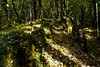
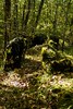
The above images may not be of the site on this page, but were taken nearby. They are loaded from Flickr so please click on them for image credits.
Click here to see more info for this site
Nearby sites
Click here to view sites on an interactive map of the areaKey: Red: member's photo, Blue: 3rd party photo, Yellow: other image, Green: no photo - please go there and take one, Grey: site destroyed
Download sites to:
KML (Google Earth)
GPX (GPS waypoints)
CSV (Garmin/Navman)
CSV (Excel)
To unlock full downloads you need to sign up as a Contributory Member. Otherwise downloads are limited to 50 sites.
Turn off the page maps and other distractions
Nearby sites listing. In the following links * = Image available
568m WSW 246° Allée de Chanteloube* Passage Grave
1.1km SE 136° Menhir de Higaros* Standing Stone (Menhir)
8.3km WSW 256° Allée funéraire de Honrède* Passage Grave
8.6km WSW 254° Menhir de La Honrède* Standing Stone (Menhir)
16.3km ESE 117° Dolmen As Peyrès Burial Chamber or Dolmen
16.8km WSW 255° Allée couverte du Passage de Serbat* Passage Grave
17.3km ESE 120° Menhir Grand Peyro* Standing Stone (Menhir)
20.5km W 270° Allée couverte de Choisy n°2* Passage Grave
20.9km W 270° Pompiey allée couverte* Passage Grave
21.1km NE 37° Menhir de Lastournelles* Standing Stone (Menhir)
22.9km SSE 148° Sempesserre tumulus Chambered Tomb
23.1km NNE 34° Tres Peyres de Ste Colombe de Villeneuve* Burial Chamber or Dolmen
23.6km NE 42° Pierre branlante de Pujols* Natural Stone / Erratic / Other Natural Feature
24.3km WNW 284° Menhir de Roudes* Standing Stone (Menhir)
24.3km WNW 285° Allée Couverte de Cranté* Passage Grave
24.5km WNW 287° Allée couverte de Caubeyres* Passage Grave
24.5km WNW 287° La Pile de Caubeyres* Stone Circle
25.7km NNE 25° Las Tres Peyres d'Allez-et-Cazeneuve* Burial Chamber or Dolmen
28.5km E 87° Menhir de la Croix-du-Diable* Standing Stone (Menhir)
29.2km W 277° Lumé dolmen* Passage Grave
29.8km WSW 251° Cromlech de las Naou-Peyros* Stone Circle
29.8km WSW 256° Allée couverte de Peyre Soule* Passage Grave
29.9km N 354° Menhir du Râle* Standing Stone (Menhir)
30.3km NE 52° Allées funéraires de Grézac* Passage Grave
30.7km NNE 29° Allée couverte des Anglais de Lédat* Burial Chamber or Dolmen
View more nearby sites and additional images


 We would like to know more about this location. Please feel free to add a brief description and any relevant information in your own language.
 Wir möchten mehr über diese Stätte erfahren. Bitte zögern Sie nicht, eine kurze Beschreibung und relevante Informationen in Deutsch hinzuzufügen.
 Nous aimerions en savoir encore un peu sur les lieux. S'il vous plaît n'hesitez pas à ajouter une courte description et tous les renseignements pertinents dans votre propre langue.
 Quisieramos informarnos un poco más de las lugares. No dude en añadir una breve descripción y otros datos relevantes en su propio idioma.