<< Our Photo Pages >> Pueyoril Dolmen - Burial Chamber or Dolmen in Spain in Aragón
Submitted by irundarra on Thursday, 01 October 2009 Page Views: 2219
Neolithic and Bronze AgeSite Name: Pueyoril DolmenCountry: Spain
NOTE: This site is 14.666 km away from the location you searched for.
Region: Aragón Type: Burial Chamber or Dolmen
Nearest Town: Huesa Nearest Village: Las Paúles
Latitude: 42.299424N Longitude: 0.062376E
Condition:
| 5 | Perfect |
| 4 | Almost Perfect |
| 3 | Reasonable but with some damage |
| 2 | Ruined but still recognisable as an ancient site |
| 1 | Pretty much destroyed, possibly visible as crop marks |
| 0 | No data. |
| -1 | Completely destroyed |
| 5 | Superb |
| 4 | Good |
| 3 | Ordinary |
| 2 | Not Good |
| 1 | Awful |
| 0 | No data. |
| 5 | Can be driven to, probably with disabled access |
| 4 | Short walk on a footpath |
| 3 | Requiring a bit more of a walk |
| 2 | A long walk |
| 1 | In the middle of nowhere, a nightmare to find |
| 0 | No data. |
| 5 | co-ordinates taken by GPS or official recorded co-ordinates |
| 4 | co-ordinates scaled from a detailed map |
| 3 | co-ordinates scaled from a bad map |
| 2 | co-ordinates of the nearest village |
| 1 | co-ordinates of the nearest town |
| 0 | no data |
Internal Links:
External Links:
")
You may be viewing yesterday's version of this page. To see the most up to date information please register for a free account.
")
Do not use the above information on other web sites or publications without permission of the contributor.
Nearby Images from Flickr
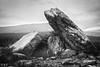

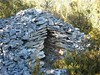
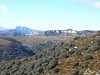
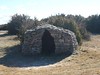
The above images may not be of the site on this page, but were taken nearby. They are loaded from Flickr so please click on them for image credits.
Click here to see more info for this site
Nearby sites
Click here to view sites on an interactive map of the areaKey: Red: member's photo, Blue: 3rd party photo, Yellow: other image, Green: no photo - please go there and take one, Grey: site destroyed
Download sites to:
KML (Google Earth)
GPX (GPS waypoints)
CSV (Garmin/Navman)
CSV (Excel)
To unlock full downloads you need to sign up as a Contributory Member. Otherwise downloads are limited to 50 sites.
Turn off the page maps and other distractions
Nearby sites listing. In the following links * = Image available
1.2km WNW 300° La Capilleta Dolmen* Burial Chamber or Dolmen
1.8km S 185° Caseta de las Balanzas Dolmen* Burial Chamber or Dolmen
11.2km SSW 199° Chimiachas* Cave or Rock Shelter
12.2km SSW 200° Abrigo de Quizans Rock Art
12.5km W 273° Losa Mora Dolmen* Burial Chamber or Dolmen
19.3km WSW 245° Cueva de Chaves Cave or Rock Shelter
22.4km E 94° Dolmen de Perarrúa Burial Chamber or Dolmen
23.8km WSW 253° Articasales Dolmen* Burial Chamber or Dolmen
23.9km WSW 252° Piedrafita Dolmen* Burial Chamber or Dolmen
26.0km WNW 284° Ibirque Dolmen* Burial Chamber or Dolmen
28.2km W 270° Palomar Dolmen Burial Chamber or Dolmen
28.3km SE 139° Remosillo Pinturas Rupestres Rock Art
32.6km NNE 17° Dolmen de Tella* Burial Chamber or Dolmen
33.2km NNE 16° Fandichuerre Dolmen* Burial Chamber or Dolmen
33.7km SE 143° Forau del Cocho Rock Art
34.1km SSW 195° Almerge Castro or Chafurdão
34.2km NE 44° Armeña Túmulo Round Barrow(s)
34.7km ENE 57° Seira Dolmen* Burial Chamber or Dolmen
35.2km E 83° Merli Menhir* Standing Stone (Menhir)
35.3km SE 144° Coveta de l'Engardaixo Cave or Rock Shelter
35.4km NE 36° Collata De Labasar 1-6* Stone Circle
35.4km NE 36° Collata De Labasar 7* Stone Circle
35.4km NE 36° Collado Del Ibón Stone Circle
35.6km S 180° Fornillos Castro or Chafurdão
36.8km N 7° Cromlech de Gurrundué* Stone Circle
View more nearby sites and additional images


 We would like to know more about this location. Please feel free to add a brief description and any relevant information in your own language.
 Wir möchten mehr über diese Stätte erfahren. Bitte zögern Sie nicht, eine kurze Beschreibung und relevante Informationen in Deutsch hinzuzufügen.
 Nous aimerions en savoir encore un peu sur les lieux. S'il vous plaît n'hesitez pas à ajouter une courte description et tous les renseignements pertinents dans votre propre langue.
 Quisieramos informarnos un poco más de las lugares. No dude en añadir una breve descripción y otros datos relevantes en su propio idioma.