<< Other Photo Pages >> Musée Archéologique André-Larroderie - Museum in France in Aquitaine:Lot-et-Garonne (47)
Submitted by TheCaptain on Saturday, 16 April 2005 Page Views: 3467
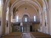
MuseumsSite Name: Musée Archéologique André-LarroderieCountry: France
NOTE: This site is 10.906 km away from the location you searched for.
Département: Aquitaine:Lot-et-Garonne (47) Type: Museum
Nearest Town: Marmande Nearest Village: Sainte-Bazeille
Latitude: 44.528309N Longitude: 0.093935E
Condition:
| 5 | Perfect |
| 4 | Almost Perfect |
| 3 | Reasonable but with some damage |
| 2 | Ruined but still recognisable as an ancient site |
| 1 | Pretty much destroyed, possibly visible as crop marks |
| 0 | No data. |
| -1 | Completely destroyed |
| 5 | Superb |
| 4 | Good |
| 3 | Ordinary |
| 2 | Not Good |
| 1 | Awful |
| 0 | No data. |
| 5 | Can be driven to, probably with disabled access |
| 4 | Short walk on a footpath |
| 3 | Requiring a bit more of a walk |
| 2 | A long walk |
| 1 | In the middle of nowhere, a nightmare to find |
| 0 | No data. |
| 5 | co-ordinates taken by GPS or official recorded co-ordinates |
| 4 | co-ordinates scaled from a detailed map |
| 3 | co-ordinates scaled from a bad map |
| 2 | co-ordinates of the nearest village |
| 1 | co-ordinates of the nearest town |
| 0 | no data |
Internal Links:
External Links:
Museum in Lot-et-Garonne
Address: Place René Sanson, Route des Landes, 47200
Phone: 05 53 94 40 28
You may be viewing yesterday's version of this page. To see the most up to date information please register for a free account.
Do not use the above information on other web sites or publications without permission of the contributor.
davidmorgan has found this location on Google Street View:
Nearby Images from Flickr

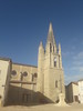
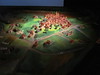
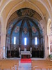
The above images may not be of the site on this page, but were taken nearby. They are loaded from Flickr so please click on them for image credits.
Click here to see more info for this site
Nearby sites
Click here to view sites on an interactive map of the areaKey: Red: member's photo, Blue: 3rd party photo, Yellow: other image, Green: no photo - please go there and take one, Grey: site destroyed
Download sites to:
KML (Google Earth)
GPX (GPS waypoints)
CSV (Garmin/Navman)
CSV (Excel)
To unlock full downloads you need to sign up as a Contributory Member. Otherwise downloads are limited to 50 sites.
Turn off the page maps and other distractions
Nearby sites listing. In the following links * = Image available
26.0km NE 49° Pantoufle du Diable* Rock Art
26.4km NNW 336° Les Grangeottes (Mauriac)* Standing Stone (Menhir)
26.6km NNW 335° Dolmen de la Mouleyre Burial Chamber or Dolmen
27.4km NNW 341° Menhir dit la Gran'Boyne de Balette* Standing Stone (Menhir)
28.3km NW 323° Dolmen les Trois Pierres Burial Chamber or Dolmen
28.4km NNW 327° Menhir Notre Dame de Bonne Nouvelle* Standing Stone (Menhir)
29.2km NW 317° Dolmens de Bignon* Burial Chamber or Dolmen
29.8km NE 53° Eylias Dolmen* Burial Chamber or Dolmen
30.1km ESE 105° Menhir du Râle* Standing Stone (Menhir)
30.5km NW 323° Pontaret Menhir* Standing Stone (Menhir)
30.7km NW 314° Baigneaux tumulus Chambered Tomb
30.9km ENE 57° Allée couverte de Peyrelevade* Passage Grave
31.0km NW 319° Frontenac tumulus Chambered Tomb
31.6km SSE 164° La Pile de Caubeyres* Stone Circle
31.6km NNE 15° Menhir des Goulards* Standing Stone (Menhir)
31.6km SSE 164° Allée couverte de Caubeyres* Passage Grave
31.7km NW 306° Côte de Cayron tumulus Chambered Tomb
31.8km NNE 15° Dolmen de Goulard* Burial Chamber or Dolmen
31.9km NW 321° Gisement de Grand-Moulin Cave or Rock Shelter
32.3km SSE 164° Allée Couverte de Cranté* Passage Grave
32.3km NW 319° Roquefort Settlement Ancient Village or Settlement
32.4km NW 309° La Palanque de Peyre Standing Stone (Menhir)
32.4km NW 320° Roquefort Allée couverte* Passage Grave
32.5km N 358° Abri du Morin Cave or Rock Shelter
32.9km SSE 165° Menhir de Roudes* Standing Stone (Menhir)
View more nearby sites and additional images


 We would like to know more about this location. Please feel free to add a brief description and any relevant information in your own language.
 Wir möchten mehr über diese Stätte erfahren. Bitte zögern Sie nicht, eine kurze Beschreibung und relevante Informationen in Deutsch hinzuzufügen.
 Nous aimerions en savoir encore un peu sur les lieux. S'il vous plaît n'hesitez pas à ajouter une courte description et tous les renseignements pertinents dans votre propre langue.
 Quisieramos informarnos un poco más de las lugares. No dude en añadir una breve descripción y otros datos relevantes en su propio idioma.