<< Text Pages >> Peterson Bison Kill - Natural Stone / Erratic / Other Natural Feature in United States in The Plains
Submitted by bat400 on Saturday, 29 November 2008 Page Views: 14256
Natural PlacesSite Name: Peterson Bison KillCountry: United States
NOTE: This site is 37.551 km away from the location you searched for.
Region: The Plains Type: Natural Stone / Erratic / Other Natural Feature
Nearest Town: Granite Falls, MN
Latitude: 44.810000N Longitude: 95.54W
Condition:
| 5 | Perfect |
| 4 | Almost Perfect |
| 3 | Reasonable but with some damage |
| 2 | Ruined but still recognisable as an ancient site |
| 1 | Pretty much destroyed, possibly visible as crop marks |
| 0 | No data. |
| -1 | Completely destroyed |
| 5 | Superb |
| 4 | Good |
| 3 | Ordinary |
| 2 | Not Good |
| 1 | Awful |
| 0 | No data. |
| 5 | Can be driven to, probably with disabled access |
| 4 | Short walk on a footpath |
| 3 | Requiring a bit more of a walk |
| 2 | A long walk |
| 1 | In the middle of nowhere, a nightmare to find |
| 0 | No data. |
| 5 | co-ordinates taken by GPS or official recorded co-ordinates |
| 4 | co-ordinates scaled from a detailed map |
| 3 | co-ordinates scaled from a bad map |
| 2 | co-ordinates of the nearest village |
| 1 | co-ordinates of the nearest town |
| 0 | no data |
Be the first person to rate this site - see the 'Contribute!' box in the right hand menu.
Internal Links:
External Links:
Natural Stone / Other Natural Feature in Yellow Medicine County, Minnesota.
A natural funnel created by two rock ledges was the site of Archaic hunters' repeated kills of the bison occidentals, a thousand kilo animal with horns spanning a meter or more. Here bones of the extinct animal and stone butchering tools have been found along with a short stone wall that might possibly be connected to guiding animals into the natural trap.
Little excavation has taken place at the site, which only discovered twenty years ago. The site on the property of the Person family does not appear to be open to the public although it is mentioned in some tourist information for the locality. The Peterson Bison Kill Site is a few miles south of Granite Falls, MN. The location given is for the town and does not mark the actual site.
Note: 5000 BC Bison Kill Site eyed by archaeologists to answer questions on Minnesota's archaic history.
You may be viewing yesterday's version of this page. To see the most up to date information please register for a free account.
Do not use the above information on other web sites or publications without permission of the contributor.
Nearby Images from Flickr

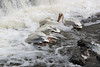
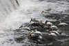

The above images may not be of the site on this page, but were taken nearby. They are loaded from Flickr so please click on them for image credits.
Click here to see more info for this site
Nearby sites
Click here to view sites on an interactive map of the areaKey: Red: member's photo, Blue: 3rd party photo, Yellow: other image, Green: no photo - please go there and take one, Grey: site destroyed
Download sites to:
KML (Google Earth)
GPX (GPS waypoints)
CSV (Garmin/Navman)
CSV (Excel)
To unlock full downloads you need to sign up as a Contributory Member. Otherwise downloads are limited to 50 sites.
Turn off the page maps and other distractions
Nearby sites listing. In the following links * = Image available
88.7km SSE 154° Jeffers Petroglyphs* Rock Art
108.3km SW 215° Pipestone National Monument Ancient Mine, Quarry or other Industry
134.8km SSW 203° Blue Mounds Equinox Stone Alignment Stone Row / Alignment
163.7km ENE 62° Mahnomen Mounds Barrow Cemetery
171.9km SSW 210° Blood Run Rock Art
196.3km E 85° Indian Mounds Regional Park* Artificial Mound
217.6km E 86° Rattlesnake Mound Artificial Mound
229.0km S 180° Sanford Museum* Museum
231.4km WSW 240° Mitchell Site* Ancient Village or Settlement
235.2km S 180° Pilot Rock (Cherokee)* Natural Stone / Erratic / Other Natural Feature
240.2km E 94° Bow and Arrow Rock Art
249.1km ENE 66° Trade Lake Mound* Artificial Mound
266.2km N 5° Itasca Bison Kill* Natural Stone / Erratic / Other Natural Feature
271.7km N 5° Itasca Burial Mounds* Barrow Cemetery
300.5km NW 324° Standing Rock State Historic Site* Artificial Mound
371.8km ESE 112° Fish Farm Mounds State Preserve Artificial Mound
393.7km SSE 155° The Palace Ancient Village or Settlement
395.1km E 101° Fort McCoy Artificial Mound
397.6km ESE 117° Effigy Mounds National Monument* Artificial Mound
399.2km SSE 154° Yellow Banks Park* Artificial Mound
405.3km ESE 115° Larsen Cave, Crawford Co* Rock Art
408.9km ESE 118° Wyalusing Mounds* Artificial Mound
414.1km ESE 111° Tainter Cave Cave or Rock Shelter
435.2km NNE 18° Grand Mound* Artificial Mound
439.2km NNE 19° McKinstry Mounds* Artificial Mound
View more nearby sites and additional images


 We would like to know more about this location. Please feel free to add a brief description and any relevant information in your own language.
 Wir möchten mehr über diese Stätte erfahren. Bitte zögern Sie nicht, eine kurze Beschreibung und relevante Informationen in Deutsch hinzuzufügen.
 Nous aimerions en savoir encore un peu sur les lieux. S'il vous plaît n'hesitez pas à ajouter une courte description et tous les renseignements pertinents dans votre propre langue.
 Quisieramos informarnos un poco más de las lugares. No dude en añadir una breve descripción y otros datos relevantes en su propio idioma.