

<< Other Photo Pages >> Big Eddy - Ancient Mine, Quarry or other Industry in United States in The Plains
Submitted by bat400 on Tuesday, 15 September 2015 Page Views: 15516
Multi-periodSite Name: Big Eddy Alternative Name: Big Eddy SiteCountry: United States Region: The Plains Type: Ancient Mine, Quarry or other Industry
Nearest Town: Springfield, MO Nearest Village: Stockton, MO
Latitude: 37.739300N Longitude: 93.78767W
Condition:
| 5 | Perfect |
| 4 | Almost Perfect |
| 3 | Reasonable but with some damage |
| 2 | Ruined but still recognisable as an ancient site |
| 1 | Pretty much destroyed, possibly visible as crop marks |
| 0 | No data. |
| -1 | Completely destroyed |
| 5 | Superb |
| 4 | Good |
| 3 | Ordinary |
| 2 | Not Good |
| 1 | Awful |
| 0 | No data. |
| 5 | Can be driven to, probably with disabled access |
| 4 | Short walk on a footpath |
| 3 | Requiring a bit more of a walk |
| 2 | A long walk |
| 1 | In the middle of nowhere, a nightmare to find |
| 0 | No data. |
| 5 | co-ordinates taken by GPS or official recorded co-ordinates |
| 4 | co-ordinates scaled from a detailed map |
| 3 | co-ordinates scaled from a bad map |
| 2 | co-ordinates of the nearest village |
| 1 | co-ordinates of the nearest town |
| 0 | no data |
Internal Links:
External Links:
I have visited· I would like to visit
GarrisonC would like to visit
")
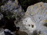
The area would have held attraction for ancient peoples as a source of chert and abundant plants and animals.
Erosion caused by the large volumes of water released from the nearby Stockton Dam for power generation relentlessly eats away the bank. The prime site at the bend in the river will be completely destroyed within 12-15 years.
Additional information from
the University of Missouri and
the Center for the Study of the First Americans.
Note: The Ninth Annual Ozarks Studies Symposium, September 18/19th, West Plains Missouri, features a talk on this important pre-Clovis site
You may be viewing yesterday's version of this page. To see the most up to date information please register for a free account.
")
")
")
Do not use the above information on other web sites or publications without permission of the contributor.
Nearby Images from Flickr

The above images may not be of the site on this page, but were taken nearby. They are loaded from Flickr so please click on them for image credits.
Click here to see more info for this site
Nearby sites
Click here to view sites on an interactive map of the areaKey: Red: member's photo, Blue: 3rd party photo, Yellow: other image, Green: no photo - please go there and take one, Grey: site destroyed
Download sites to:
KML (Google Earth)
GPX (GPS waypoints)
CSV (Garmin/Navman)
CSV (Excel)
To unlock full downloads you need to sign up as a Contributory Member. Otherwise downloads are limited to 50 sites.
Turn off the page maps and other distractions
Nearby sites listing. In the following links * = Image available
70.7km S 182° Horseshoe Fossil Spring Ancient Village or Settlement
171.4km NE 45° BoatHenge, Missouri* Modern Stone Circle etc
173.6km NE 39° Big Moniteau Rock Art
175.1km NNE 15° Old Fort (Miami, MO)* Artificial Mound
178.2km E 82° UMR Stonehenge* Modern Stone Circle etc
182.6km SW 216° Spavinaw Creek Ancient Village or Settlement
217.3km NW 314° Truckhenge* Modern Stone Circle etc
232.5km NE 55° Graham Cave* Cave or Rock Shelter
274.9km E 81° Washington State Park Petroglyphs* Rock Art
275.6km SSW 192° Cavanaugh* Artificial Mound
278.8km SSW 195° Spiro Mounds Archaeological Park* Ancient Village or Settlement
289.8km NNE 20° Thousand Hills Petroglyphs* Rock Art
295.9km ENE 66° Schwendemann Farm Mound Artificial Mound
298.0km WSW 256° Etzanoa* Ancient Village or Settlement
300.8km ENE 69° Blake Mound Artificial Mound
300.8km SSE 165° Petit Jean State Park* Rock Art
306.4km ENE 76° Mastodon State Historic Site* Museum
314.4km ENE 63° Pere Marquette State Park* Artificial Mound
317.7km NE 40° Indian Mounds Park* Artificial Mound
323.4km SSW 193° Heavener Rune Stone* Carving
324.5km ENE 72° Sugarloaf Mound, Missouri* Artificial Mound
328.7km E 83° Modoc Rock Shelter* Cave or Rock Shelter
330.4km ENE 71° Big Mound (St Louis)* Artificial Mound
332.1km E 85° Common Fields* Artificial Mound
333.2km ENE 71° East Saint Louis Mound Center* Ancient Village or Settlement
View more nearby sites and additional images


 We would like to know more about this location. Please feel free to add a brief description and any relevant information in your own language.
 Wir möchten mehr über diese Stätte erfahren. Bitte zögern Sie nicht, eine kurze Beschreibung und relevante Informationen in Deutsch hinzuzufügen.
 Nous aimerions en savoir encore un peu sur les lieux. S'il vous plaît n'hesitez pas à ajouter une courte description et tous les renseignements pertinents dans votre propre langue.
 Quisieramos informarnos un poco más de las lugares. No dude en añadir una breve descripción y otros datos relevantes en su propio idioma.