<< Text Pages >> Kelsey Creek Dam site - Ancient Village or Settlement in United States in The Southwest
Submitted by bat400 on Monday, 04 February 2013 Page Views: 5580
Multi-periodSite Name: Kelsey Creek Dam siteCountry: United States
NOTE: This site is 68.892 km away from the location you searched for.
Region: The Southwest Type: Ancient Village or Settlement
Nearest Town: Dallas, TX Nearest Village: Gilmer, TX
Latitude: 32.763000N Longitude: 94.982W
Condition:
| 5 | Perfect |
| 4 | Almost Perfect |
| 3 | Reasonable but with some damage |
| 2 | Ruined but still recognisable as an ancient site |
| 1 | Pretty much destroyed, possibly visible as crop marks |
| 0 | No data. |
| -1 | Completely destroyed |
| 5 | Superb |
| 4 | Good |
| 3 | Ordinary |
| 2 | Not Good |
| 1 | Awful |
| 0 | No data. |
| 5 | Can be driven to, probably with disabled access |
| 4 | Short walk on a footpath |
| 3 | Requiring a bit more of a walk |
| 2 | A long walk |
| 1 | In the middle of nowhere, a nightmare to find |
| 0 | No data. |
| 5 | co-ordinates taken by GPS or official recorded co-ordinates |
| 4 | co-ordinates scaled from a detailed map |
| 3 | co-ordinates scaled from a bad map |
| 2 | co-ordinates of the nearest village |
| 1 | co-ordinates of the nearest town |
| 0 | no data |
Internal Links:
External Links:
Ancient Village or Settlement in Upshur County, Texas.
One of a cluster of Caddo villages along Kelsey Creek. Excavations in the 1990's prior to the building of a dam and reservoir found house sites, ceramics, stone and bone tools, and some burial locations. The burial locations had been looted at some time in the past.
News articles do not identify the time periods associated with the villages along Kelsey Creek, but the Caddo lived in this area between 700AD and the 1600's, and the people at Kelsey Creek are described as pre-conquest.
Human remains and grave goods have been repatriated to the Caddo Nation (Binger, OK.) The other artifacts will be curated at the Stephen F. Austin State University. A paper, "Mitigation Phase Archaeological Investigations at Lake Gilmer, Upshur County, Texas," by Mark Parsons is pending from the Texas State Historical Commission.
Note: Archaeological investigation of Caddo Indians at Kelsey Creek. See comment.
You may be viewing yesterday's version of this page. To see the most up to date information please register for a free account.
Do not use the above information on other web sites or publications without permission of the contributor.
Nearby Images from Flickr


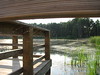
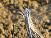
The above images may not be of the site on this page, but were taken nearby. They are loaded from Flickr so please click on them for image credits.
Click here to see more info for this site
Nearby sites
Click here to view sites on an interactive map of the areaKey: Red: member's photo, Blue: 3rd party photo, Yellow: other image, Green: no photo - please go there and take one, Grey: site destroyed
Download sites to:
KML (Google Earth)
GPX (GPS waypoints)
CSV (Garmin/Navman)
CSV (Excel)
To unlock full downloads you need to sign up as a Contributory Member. Otherwise downloads are limited to 50 sites.
Turn off the page maps and other distractions
Nearby sites listing. In the following links * = Image available
130.7km S 187° Caddo Mounds* Ancient Village or Settlement
186.0km NE 39° Ka-Do-Ha* Museum
196.7km W 279° The Flower Mound Natural Stone / Erratic / Other Natural Feature
196.9km W 270° Caelum Moor* Modern Stone Circle etc
218.1km E 92° Hedgepeth Mounds Artificial Mound
237.3km E 89° Scott Place Mounds* Artificial Mound
240.7km N 9° Heavener Rune Stone* Carving
270.8km E 99° Watson Brake* Artificial Mound
274.8km E 99° Filhiol Mound Artificial Mound
285.4km E 100° Landerneau Mounds Artificial Mound
286.0km N 8° Spiro Mounds Archaeological Park* Ancient Village or Settlement
288.3km N 10° Cavanaugh* Artificial Mound
288.4km ESE 105° Wade Landing Mound Artificial Mound
300.0km E 86° Venable Mound Artificial Mound
300.4km E 86° Caney Bayou Mound Artificial Mound
300.7km E 92° Jordan Mounds Site Artificial Mound
311.1km ESE 115° Crooks Mound Artificial Mound
315.4km ESE 108° Alexander Mound Artificial Mound
315.8km ESE 108° Boothe Landing Mound Artificial Mound
316.7km ESE 110° Harrisonburg Mounds Artificial Mound
317.4km ESE 110° McGuffee Mounds Ancient Village or Settlement
319.4km ESE 111° Tew Lake Mounds Artificial Mound
321.1km ESE 111° Routon Mounds Artificial Mound
323.5km ESE 112° Troyville Earthworks* Artificial Mound
324.1km NE 35° Petit Jean State Park* Rock Art
View more nearby sites and additional images


 We would like to know more about this location. Please feel free to add a brief description and any relevant information in your own language.
 Wir möchten mehr über diese Stätte erfahren. Bitte zögern Sie nicht, eine kurze Beschreibung und relevante Informationen in Deutsch hinzuzufügen.
 Nous aimerions en savoir encore un peu sur les lieux. S'il vous plaît n'hesitez pas à ajouter une courte description et tous les renseignements pertinents dans votre propre langue.
 Quisieramos informarnos un poco más de las lugares. No dude en añadir una breve descripción y otros datos relevantes en su propio idioma.