<< Our Photo Pages >> Jeffers Petroglyphs - Rock Art in United States
Submitted by magnusTT on Tuesday, 10 April 2018 Page Views: 2014
Rock ArtSite Name: Jeffers PetroglyphsCountry: United States
NOTE: This site is 101.29 km away from the location you searched for.
Type: Rock Art
Nearest Town: Comfrey, MN
Latitude: 44.092250N Longitude: 95.052722W
Condition:
| 5 | Perfect |
| 4 | Almost Perfect |
| 3 | Reasonable but with some damage |
| 2 | Ruined but still recognisable as an ancient site |
| 1 | Pretty much destroyed, possibly visible as crop marks |
| 0 | No data. |
| -1 | Completely destroyed |
| 5 | Superb |
| 4 | Good |
| 3 | Ordinary |
| 2 | Not Good |
| 1 | Awful |
| 0 | No data. |
| 5 | Can be driven to, probably with disabled access |
| 4 | Short walk on a footpath |
| 3 | Requiring a bit more of a walk |
| 2 | A long walk |
| 1 | In the middle of nowhere, a nightmare to find |
| 0 | No data. |
| 5 | co-ordinates taken by GPS or official recorded co-ordinates |
| 4 | co-ordinates scaled from a detailed map |
| 3 | co-ordinates scaled from a bad map |
| 2 | co-ordinates of the nearest village |
| 1 | co-ordinates of the nearest town |
| 0 | no data |
Internal Links:
External Links:
")
Amid the prairie grasses are islands of uncovered rock, where American Indian ancestors left carvings — petroglyphs — humans, deer, elk, buffalo, turtles, thunderbirds, atlatls, and arrows. They tell a story that spans more than 7,000 years.
The earliest carvings at Jeffers Petroglyphs were created as much as 7,000 years ago. The most recent were made about 250 years ago. This long time span makes Jeffers one of, if not the, oldest continuously used sacred sites in the world.
The site preserves more than 4,000 American Indian images carved into solid horizontal irregularly-shaped Sioux quartzite outcrops. Among the earliest carvings found here are images of buffalo and atlatls, or throwing sticks. Atlatls and darts were used to hunt buffaloes before the bow and arrow were developed 1,200 years ago. These symbols, along with other images carved on the rock, such as thunderbirds and turtles, remain important in American Indian culture. It is interesting to note that the stones do not record bows and arrows. Also "missing" are glyphs representing horses, indicating that the site was no longer used by the late 1700s, although rock art from later times is prevalent.
The carvings of deer, buffalo, turtles, thunderbirds and humans are more than art of mimicry of the natural environment. They are powerful cultural symbols of the complex communities that inhabit the prairies of southwestern Minnesota and still thrive today.
You may be viewing yesterday's version of this page. To see the most up to date information please register for a free account.
Do not use the above information on other web sites or publications without permission of the contributor.
Nearby Images from Flickr
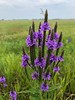
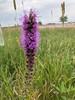
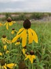
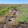
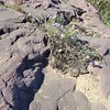
The above images may not be of the site on this page, but were taken nearby. They are loaded from Flickr so please click on them for image credits.
Click here to see more info for this site
Nearby sites
Click here to view sites on an interactive map of the areaKey: Red: member's photo, Blue: 3rd party photo, Yellow: other image, Green: no photo - please go there and take one, Grey: site destroyed
Download sites to:
KML (Google Earth)
GPX (GPS waypoints)
CSV (Garmin/Navman)
CSV (Excel)
To unlock full downloads you need to sign up as a Contributory Member. Otherwise downloads are limited to 50 sites.
Turn off the page maps and other distractions
Nearby sites listing. In the following links * = Image available
88.7km NNW 334° Peterson Bison Kill Natural Stone / Erratic / Other Natural Feature
101.7km WSW 244° Blue Mounds Equinox Stone Alignment Stone Row / Alignment
102.0km W 266° Pipestone National Monument Ancient Mine, Quarry or other Industry
142.5km WSW 241° Blood Run Rock Art
154.5km SSW 195° Sanford Museum* Museum
160.4km SSW 195° Pilot Rock (Cherokee)* Natural Stone / Erratic / Other Natural Feature
184.5km ENE 58° Indian Mounds Regional Park* Artificial Mound
189.4km NE 34° Mahnomen Mounds Barrow Cemetery
201.2km ENE 63° Rattlesnake Mound Artificial Mound
209.8km ENE 73° Bow and Arrow Rock Art
241.9km W 262° Mitchell Site* Ancient Village or Settlement
261.2km NE 47° Trade Lake Mound* Artificial Mound
305.1km SSE 156° The Palace Ancient Village or Settlement
310.6km SSE 155° Yellow Banks Park* Artificial Mound
311.1km ESE 102° Fish Farm Mounds State Preserve Artificial Mound
330.8km ESE 108° Effigy Mounds National Monument* Artificial Mound
340.6km ESE 106° Larsen Cave, Crawford Co* Rock Art
340.8km ESE 110° Wyalusing Mounds* Artificial Mound
345.2km N 358° Itasca Bison Kill* Natural Stone / Erratic / Other Natural Feature
348.8km E 90° Fort McCoy Artificial Mound
350.5km N 358° Itasca Burial Mounds* Barrow Cemetery
354.5km ESE 101° Tainter Cave Cave or Rock Shelter
388.3km NNW 327° Standing Rock State Historic Site* Artificial Mound
398.3km E 87° Cranberry Creek Mound Group Artificial Mound
398.5km ESE 115° Dunleith Mounds* Artificial Mound
View more nearby sites and additional images


 We would like to know more about this location. Please feel free to add a brief description and any relevant information in your own language.
 Wir möchten mehr über diese Stätte erfahren. Bitte zögern Sie nicht, eine kurze Beschreibung und relevante Informationen in Deutsch hinzuzufügen.
 Nous aimerions en savoir encore un peu sur les lieux. S'il vous plaît n'hesitez pas à ajouter une courte description et tous les renseignements pertinents dans votre propre langue.
 Quisieramos informarnos un poco más de las lugares. No dude en añadir una breve descripción y otros datos relevantes en su propio idioma.