Featured: Explore Scotland (and everywhere else) with our Megalithic Portal iPhone app

Explore Scotland (and everywhere else) with our Megalithic Portal iPhone app

Singing Up the Country: The Songlines of Avebury and Beyond

Singing Up the Country: The Songlines of Avebury and Beyond

Who's Online

There are currently, 335 guests and 0 members online.

You are a guest. To join in, please register for free by clicking here

Sponsors

<< Our Photo Pages >> Parkin - Ancient Village or Settlement in United States in The South

Submitted by bat400 on Saturday, 16 March 2024  Page Views: 6600

Multi-periodSite Name: Parkin Alternative Name: Casqui, Parkin site on the St. Francis River, Parkin Archeological State Park
Country: United States Region: The South Type: Ancient Village or Settlement
 Nearest Village: Parkin
Latitude: 35.277500N  Longitude: 90.5575W
Condition:
5Perfect
4Almost Perfect
3Reasonable but with some damage
2Ruined but still recognisable as an ancient site
1Pretty much destroyed, possibly visible as crop marks
0No data.
-1Completely destroyed
4 Ambience:
5Superb
4Good
3Ordinary
2Not Good
1Awful
0No data.
4 Access:
5Can be driven to, probably with disabled access
4Short walk on a footpath
3Requiring a bit more of a walk
2A long walk
1In the middle of nowhere, a nightmare to find
0No data.
5 Accuracy:
5co-ordinates taken by GPS or official recorded co-ordinates
4co-ordinates scaled from a detailed map
3co-ordinates scaled from a bad map
2co-ordinates of the nearest village
1co-ordinates of the nearest town
0no data
4

Internal Links:
External Links:

I have visited· I would like to visit

stonetracker visited on 1st Feb 2024 - their rating: Cond: 4 Amb: 4 Access: 5 Well preserved Late Mississippian village and mound site with a nice museum. A paved trail provides good access to and interpretation of all cultural features at the site, including historic features. Appears to be fully accessible to disabled visitors.
Parkin
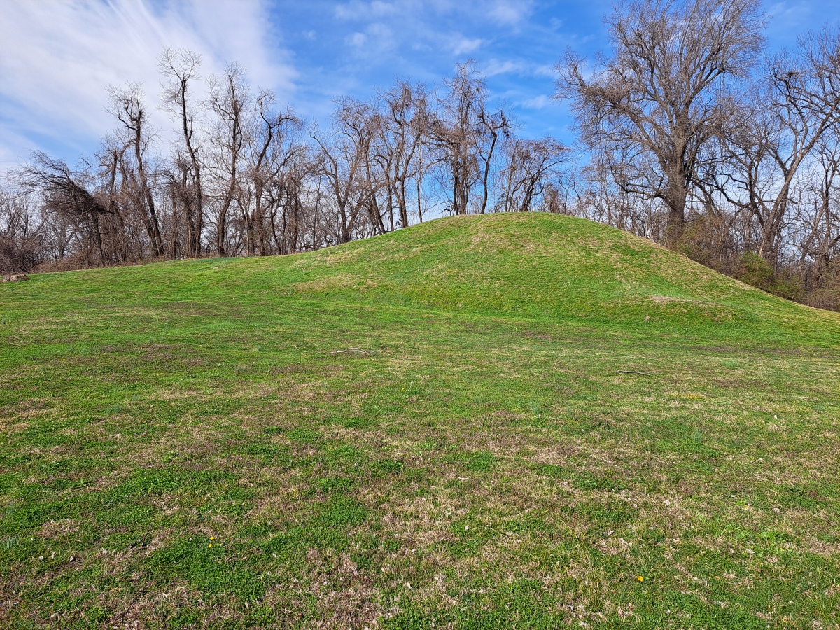
Parkin submitted by stonetracker : Another view of the platform mound. Note the two tiers. The top was likely the domain of the ruling chieftain, while subordinate leaders' houses were located on the lower level apron to the left. (Vote or comment on this photo)
This Mississippian era village site in Cross County is an Arkansas State Park. The site includes a platform mound close on the river. Interpretation is provided by a museum and visitor center (see photos). It is highly likely that this is the village Hernando de Soto visited in 1541 and was described by his party as "Casqui".

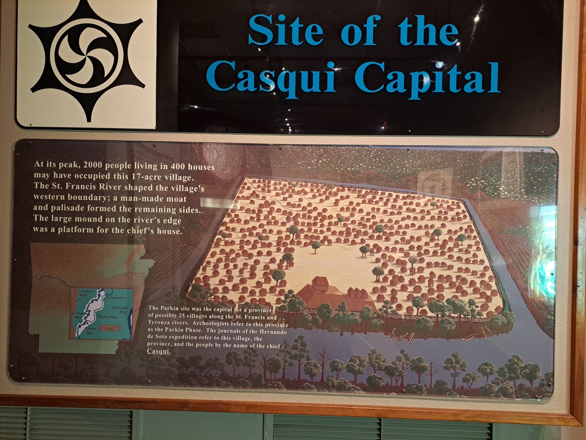
The site was originally 17 acres enclosed by a palisade and a ditch connected to the St. Francis River. The ditch appears to have been partially natural and was extended by the inhabitants to provide protection in addition to their stockade.

For information on operating hours see the park website.


Note: Videos from Stonetracker's visit linked from the comments on our page
You may be viewing yesterday's version of this page. To see the most up to date information please register for a free account.

Parkin
Parkin submitted by stonetracker : This panel depicts the source of trade goods used by the Parkin people to create weapons, tools, and artwork. Most of the materials were not native to the Delta region. (Vote or comment on this photo)

Parkin
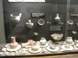
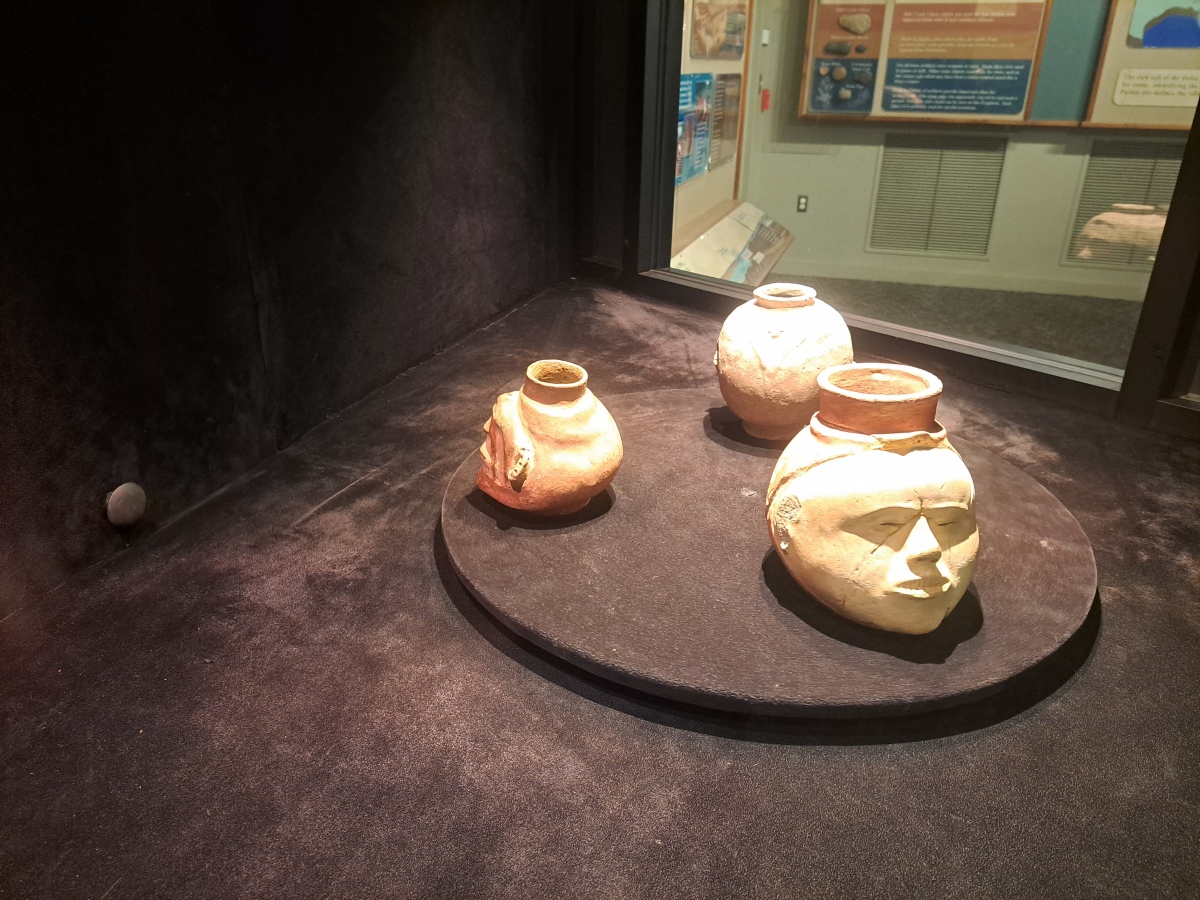
Parkin submitted by stonetracker : Some examples of Parkin phase "head" pottery (Vote or comment on this photo)

Parkin
Parkin submitted by stonetracker : Some early photos of the site (Vote or comment on this photo)

Parkin
Parkin submitted by stonetracker : Artist's conception of Parkin at its peak: 2000 people living in 400 homes. (Vote or comment on this photo)

Parkin
Parkin submitted by stonetracker : Sign about the excavated habitation site.

Parkin
Parkin submitted by stonetracker : Site of a wooden post that was excavated. The post was part of a habitation that likely pre-dated the moat. This was located outside the palisade wall.

Parkin
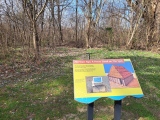
Parkin submitted by stonetracker : Kiosk describing main paved trail through the site

Parkin
Parkin submitted by stonetracker : The visitor's center

Parkin
Parkin submitted by AKFisher : Odd effigy pottery vessel excavated from a mound a couple miles from the Parkin, Arkansas mound complex by C. B. Moore in the early 1900s. Photo courtesy Dr Greg Little, author of the Illustrated Encyclopedia of Native American Indian Mounds & Earthworks (2016). 

Parkin
Parkin submitted by AKFisher : In the early 1540s Hernando de Soto marched through the southeast. His chroniclers related that they passed through large towns and villages continually. One of the places they went to was the Parkin site in Arkansas. Along the St. Francis River and its tributaries there were mound-dominated towns spaced evenly every 1.5-2 miles. This is a map by Herb Roe [wiki] showing some of the sites close t...

Parkin
Parkin submitted by AKFisher : Photo courtesy Dr Greg Little, author of the Illustrated Encyclopedia of Native American Indian Mounds & Earthworks (2016). Page from unpublished book in progress on the Parkin, Arkansas mound complex.

Parkin
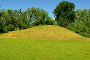
Parkin submitted by Flickr : Mound at Parkin Archeological State Park. Parkin Arkansas www.arkansasstateparks.com/parkinarcheological/ Image copyright: LordWalt Thanks for 5.9 million views, hosted on Flickr and displayed under the terms of their API.

Parkin
Parkin submitted by Flickr : Museum at the Parkin Archaelogical State Park in Parkin Arkansas. They are excavating the remains of a Native American village which is believed to have been visited by Hernando De Soto in 1541. Image copyright: mdsilverhawke, hosted on Flickr and displayed under the terms of their API.

Parkin
Parkin submitted by Flickr : Mound at Parkin Archeological State Park, April 20, 2010 Image copyright: exit78 (Mike Goad), hosted on Flickr and displayed under the terms of their API.

Parkin
Parkin submitted by Flickr : Visitor Center Image copyright: Adventurer Dustin Holmes (Dustin Holmes), hosted on Flickr and displayed under the terms of their API.

Parkin
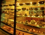
Parkin submitted by Flickr : More pottery at Parkin Archeological State Park. Parkin Arkansas www.arkansasstateparks.com/parkinarcheological/ Image copyright: LordWalt Thanks for 5.9 million views, hosted on Flickr and displayed under the terms of their API.

Parkin
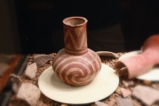
Parkin submitted by Flickr : Pottery at Parkin Archeological State Park. Parkin Arkansas www.arkansasstateparks.com/parkinarcheological/ Image copyright: LordWalt Thanks for 5.9 million views, hosted on Flickr and displayed under the terms of their API.

Parkin
Parkin submitted by Flickr : Parkin Archeological State Park, April 20, 2010 Image copyright: exit78 (Mike Goad), hosted on Flickr and displayed under the terms of their API.

Parkin
Parkin submitted by Flickr

Parkin
Parkin submitted by Flickr

Parkin
Parkin submitted by Flickr

Parkin
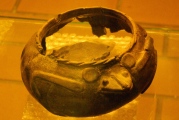
Parkin submitted by Flickr : Reconstructed bowl at Parkin Archeological State Park. Parkin Arkansas www.arkansasstateparks.com/parkinarcheological/ Image copyright: LordWalt Thanks for 5.9 million views, hosted on Flickr and displayed under the terms of their API.

Parkin
Parkin submitted by Flickr : Image copyright: jball359 (Jonathan Ball), hosted on Flickr and displayed under the terms of their API.

Parkin
Parkin submitted by Flickr

These are just the first 25 photos of Parkin. If you log in with a free user account you will be able to see our entire collection.

Do not use the above information on other web sites or publications without permission of the contributor.
Click here to see more info for this site

Nearby sites

Click here to view sites on an interactive map of the area

Key: Red: member's photo, Blue: 3rd party photo, Yellow: other image, Green: no photo - please go there and take one, Grey: site destroyed

Download sites to:
KML (Google Earth)
GPX (GPS waypoints)
CSV (Garmin/Navman)
CSV (Excel)

To unlock full downloads you need to sign up as a Contributory Member. Otherwise downloads are limited to 50 sites.


Turn off the page maps and other distractions

Nearby sites listing. In the following links * = Image available
 8.5km ENE 75° Berry Cemetery Mound* Artificial Mound
 12.4km ENE 57° Richard's Bridge Ancient Village or Settlement
 44.5km SE 135° Edgefield Mounds* Artificial Mound
 45.7km ESE 121° Chucalissa Prehistoric Indian Village* Museum
 47.2km ESE 111° Chickasaw Heritage Park* Artificial Mound
 48.9km SE 135° Cheatham Mound* Artificial Mound
 53.3km SSE 163° Commerce Mounds* Artificial Mound
 57.1km NE 55° Hampson* Museum
 58.3km SSE 163° Hollywood Mounds* Artificial Mound
 62.2km SSE 164° Johnson Cemetery Mound* Artificial Mound
 63.7km NE 55° Nodena Site* Ancient Village or Settlement
 72.6km SSE 168° Evansville Mounds* Artificial Mound
 73.7km SSE 168° Beaverdam Mounds* Artificial Mound
 81.7km S 175° West Mounds* Artificial Mound
 92.3km NE 38° Chickasawba Mound* Artificial Mound
 94.7km S 175° Barbee Mound* Artificial Mound
 100.3km S 176° Salomon Mounds* Artificial Mound
 108.8km S 176° Alcorn Cemetery Mound* Artificial Mound
 109.8km S 186° Carson Mounds* Artificial Mound
 118.3km S 176° Dunn Mounds* Artificial Mound
 118.6km SSE 151° Batesville Mounds* Artificial Mound
 151.2km SSW 204° Menard-Hodges Site* Artificial Mound
 154.1km WSW 243° Toltec Mounds* Misc. Earthwork
 154.1km WSW 243° Toltec Mounds - Embankment* Misc. Earthwork
 154.3km WSW 243° Toltec Mounds - Mound B* Pyramid / Mastaba
View more nearby sites and additional images

<< Le Ro de Jacques

Menhir de Peyregrosse >>

Please add your thoughts on this site

Lines on the Landscape, Circles from the Sky: Monuments of Neolithic Orkney

Lines on the Landscape, Circles from the Sky: Monuments of Neolithic Orkney

Sponsors

Auto-Translation (Google)

Translate from English into:

"Parkin" | Login/Create an Account | 4 News and Comments
  
Go back to top of page    Comments are owned by the poster. We aren't responsible for their content.
Re: Parkin by stonetracker on Saturday, 16 March 2024
(User Info | Send a Message)
Comments on the one extant mound remaining:

photos.app.goo.gl/zyGbBSRFEGATTKSz9

[ Reply to This ]

Re: Parkin by stonetracker on Saturday, 16 March 2024
(User Info | Send a Message)
Subordinate mounds:

photos.app.goo.gl/DpVzLWsth8xPKawTA
[ Reply to This ]

Re: Parkin by stonetracker on Saturday, 16 March 2024
(User Info | Send a Message)
Overall site commentary (Part 2):

photos.app.goo.gl/fh2Uv2aDSh8SUmSBA
[ Reply to This ]

Re: Parkin by stonetracker on Saturday, 16 March 2024
(User Info | Send a Message)
Overall site commentary:

photos.app.goo.gl/86gNMLZnsauzqMf8A
[ Reply to This ]

Your Name: Anonymous [ Register Now ]
Subject:


Add your comment or contribution to this page. Spam or offensive posts are deleted immediately, don't even bother

<<< What is five plus one as a number? (Please type the answer to this question in the little box on the left)
You can also embed videos and other things. For Youtube please copy and paste the 'embed code'.
For Google Street View please include Street View in the text.
Create a web link like this: <a href="https://www.megalithic.co.uk">This is a link</a>  

Allowed HTML is:
<p> <b> <i> <a> <img> <em> <br> <strong> <blockquote> <tt> <li> <ol> <ul> <object> <param> <embed> <iframe>

We would like to know more about this location. Please feel free to add a brief description and any relevant information in your own language.
Wir möchten mehr über diese Stätte erfahren. Bitte zögern Sie nicht, eine kurze Beschreibung und relevante Informationen in Deutsch hinzuzufügen.
Nous aimerions en savoir encore un peu sur les lieux. S'il vous plaît n'hesitez pas à ajouter une courte description et tous les renseignements pertinents dans votre propre langue.
Quisieramos informarnos un poco más de las lugares. No dude en añadir una breve descripción y otros datos relevantes en su propio idioma.