<< Text Pages >> Cloondaff Court Tomb - Cairn in Ireland (Republic of) in Co. Mayo
Submitted by Sunny100 on Tuesday, 05 April 2011 Page Views: 5033
Neolithic and Bronze AgeSite Name: Cloondaff Court Tomb Alternative Name: Cloondaff Court CairnCountry: Ireland (Republic of)
NOTE: This site is 11.197 km away from the location you searched for.
County: Co. Mayo Type: Cairn
Nearest Town: Newport Nearest Village: Glenhest
Map Ref: M071997
Latitude: 53.938403N Longitude: 9.41533W
Condition:
| 5 | Perfect |
| 4 | Almost Perfect |
| 3 | Reasonable but with some damage |
| 2 | Ruined but still recognisable as an ancient site |
| 1 | Pretty much destroyed, possibly visible as crop marks |
| 0 | No data. |
| -1 | Completely destroyed |
| 5 | Superb |
| 4 | Good |
| 3 | Ordinary |
| 2 | Not Good |
| 1 | Awful |
| 0 | No data. |
| 5 | Can be driven to, probably with disabled access |
| 4 | Short walk on a footpath |
| 3 | Requiring a bit more of a walk |
| 2 | A long walk |
| 1 | In the middle of nowhere, a nightmare to find |
| 0 | No data. |
| 5 | co-ordinates taken by GPS or official recorded co-ordinates |
| 4 | co-ordinates scaled from a detailed map |
| 3 | co-ordinates scaled from a bad map |
| 2 | co-ordinates of the nearest village |
| 1 | co-ordinates of the nearest town |
| 0 | no data |
Internal Links:
External Links:
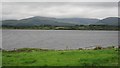
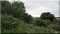
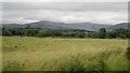
The Cloondaff Court tomb is located near the north-west corner of Lough Beltra about a quarter of a mile west of the shoreline in the Glenhest Valley. The ancient monument stands at the south-eastern edge of a low ridge at the top end of a farmer's field. It is often partly covered in scrub, so it might be a bit difficult to spot it when walking along the footpath that runs along the western side.
It is a former court tomb/cairn that originally had a large mound covering it but this has long gone. Today the tomb is in a ruinous condition, but it's gallery is some 4.5 metres in length and orientated ESE to WSW and is divided into two chambers. At the eastern side of the tomb by the entrance/portal a court-stone is still visible today.
This ancient monument, dating back some 5,000 years, was discovered in the 19th century by a local priest, Father Gillespie, who cleared the site of bushes and recognised that the monument was of great, prehistoric significance.
You may be viewing yesterday's version of this page. To see the most up to date information please register for a free account.
Do not use the above information on other web sites or publications without permission of the contributor.
Nearby Images from Geograph Britain and Ireland:
©2013(licence)
©2016(licence)
©2012(licence)
©2012(licence)
©2012(licence)
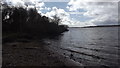
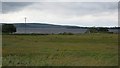
The above images may not be of the site on this page, they are loaded from Geograph.
Please Submit an Image of this site or go out and take one for us!
Click here to see more info for this site
Nearby sites
Click here to view sites on an interactive map of the areaKey: Red: member's photo, Blue: 3rd party photo, Yellow: other image, Green: no photo - please go there and take one, Grey: site destroyed
Download sites to:
KML (Google Earth)
GPX (GPS waypoints)
CSV (Garmin/Navman)
CSV (Excel)
To unlock full downloads you need to sign up as a Contributory Member. Otherwise downloads are limited to 50 sites.
Turn off the page maps and other distractions
Nearby sites listing. In the following links * = Image available
9.6km N 7° Derryhillagh* Standing Stones (G085092)
17.5km SSW 204° Sandy Hill Mound* Misc. Earthwork
19.3km N 352° Eskeragh* Stone Row / Alignment (G048189)
19.5km NNW 347° Dooleeg More* Stone Row / Alignment (G031188)
20.1km SE 139° Belcarra Standing Stone* Standing Stone (Menhir)
21.3km SW 215° Killadangan* Stone Row / Alignment
23.1km SSW 203° Boheh* Rock Art (L97517866)
23.8km E 80° Lough Muck Stone Row* Stone Row / Alignment
24.8km NE 41° Dolmen Of The Four Maols* Burial Chamber or Dolmen
29.3km NE 55° Carrowcrom* Wedge Tomb
29.5km SW 221° Glenbaun Dun II Stone Fort or Dun
29.8km SW 223° Glenbaun Dun I Stone Fort or Dun
33.7km NNE 16° Mullaghmore (Co. Mayo) Stone Circle (G170320)
33.9km W 269° Kildavnet Churchyard Crosses Ancient Cross (L731997)
34.7km NNE 17° Carbad More* Court Tomb (G181327)
35.4km NNE 17° Rathfranpark Stone Circle (G184333)
35.4km NNE 17° Rathfranpark Wedge Tomb* Wedge Tomb
35.6km SW 230° Knockeen Tomb Burial Chamber or Dolmen
35.8km NNE 17° Breastagh* Standing Stone (Menhir) (G183337)
35.8km SW 231° Formoyle Tomb Burial Chamber or Dolmen
35.8km NNE 19° Rathfran Stone Circles Stone Circle
35.9km SW 228° Knockeen Stone* Standing Stone (Menhir) (L7986876200)
36.3km NNE 18° Summerhill House Stone Circle (G190340)
36.9km SW 223° Derryheeagh* Standing Stone (Menhir) (L8138073151)
37.3km SW 226° Srahwee* Wedge Tomb (L7953074462)
View more nearby sites and additional images


 We would like to know more about this location. Please feel free to add a brief description and any relevant information in your own language.
 Wir möchten mehr über diese Stätte erfahren. Bitte zögern Sie nicht, eine kurze Beschreibung und relevante Informationen in Deutsch hinzuzufügen.
 Nous aimerions en savoir encore un peu sur les lieux. S'il vous plaît n'hesitez pas à ajouter une courte description et tous les renseignements pertinents dans votre propre langue.
 Quisieramos informarnos un poco más de las lugares. No dude en añadir una breve descripción y otros datos relevantes en su propio idioma.