<< Text Pages >> Castro da Illa do Mar - Castro or Chafurdão in Spain in Galicia
Submitted by TheCaptain on Wednesday, 08 September 2010 Page Views: 2497
Iron Age and Later PrehistorySite Name: Castro da Illa do MarCountry: Spain Region: Galicia Type: Castro or Chafurdão
Nearest Town: La Coruña Nearest Village: Porto do Son
Latitude: 42.661752N Longitude: 9.042842W
Condition:
| 5 | Perfect |
| 4 | Almost Perfect |
| 3 | Reasonable but with some damage |
| 2 | Ruined but still recognisable as an ancient site |
| 1 | Pretty much destroyed, possibly visible as crop marks |
| 0 | No data. |
| -1 | Completely destroyed |
| 5 | Superb |
| 4 | Good |
| 3 | Ordinary |
| 2 | Not Good |
| 1 | Awful |
| 0 | No data. |
| 5 | Can be driven to, probably with disabled access |
| 4 | Short walk on a footpath |
| 3 | Requiring a bit more of a walk |
| 2 | A long walk |
| 1 | In the middle of nowhere, a nightmare to find |
| 0 | No data. |
| 5 | co-ordinates taken by GPS or official recorded co-ordinates |
| 4 | co-ordinates scaled from a detailed map |
| 3 | co-ordinates scaled from a bad map |
| 2 | co-ordinates of the nearest village |
| 1 | co-ordinates of the nearest town |
| 0 | no data |
Be the first person to rate this site - see the 'Contribute!' box in the right hand menu.
Internal Links:
External Links:
Castro in Galicia
Castro da Illa do Mar is a Castro in the community of Porto do Son, Province of La Coruña, region of Galicia
You may be viewing yesterday's version of this page. To see the most up to date information please register for a free account.
Do not use the above information on other web sites or publications without permission of the contributor.
Nearby Images from Flickr

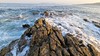
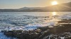


The above images may not be of the site on this page, but were taken nearby. They are loaded from Flickr so please click on them for image credits.
Click here to see more info for this site
Nearby sites
Click here to view sites on an interactive map of the areaKey: Red: member's photo, Blue: 3rd party photo, Yellow: other image, Green: no photo - please go there and take one, Grey: site destroyed
Download sites to:
KML (Google Earth)
GPX (GPS waypoints)
CSV (Garmin/Navman)
CSV (Excel)
To unlock full downloads you need to sign up as a Contributory Member. Otherwise downloads are limited to 50 sites.
Turn off the page maps and other distractions
Nearby sites listing. In the following links * = Image available
868m NNE 14° Castro de Porto Nadelas Castro or Chafurdão
2.1km ENE 74° Castro da Lagoa (Porto do Son) Castro or Chafurdão
3.8km NNE 14° Castro de Baroña* Castro or Chafurdão
5.1km NNE 29° Monte da Gurita Petroglifo* Rock Art
6.4km S 182° Castro do Taúme Castro or Chafurdão
6.6km NE 45° Castro de Enxa Castro or Chafurdão
7.2km SSE 163° Dolmen de Axeitos* Burial Chamber or Dolmen
7.9km E 87° Casarota do Fusiño Dolmen* Burial Chamber or Dolmen
8.0km SE 128° Necrópole megalítica de Moldes Barrow Cemetery
8.2km SE 138° Necrópole de Moldes* Rock Outcrop
8.3km E 91° Túmulo da Portela Round Barrow(s)
8.3km E 87° Túmulo de Outeiro dos Corvos Round Barrow(s)
8.5km ENE 72° Arca do Barbanza 2 Round Barrow(s)
8.6km S 175° Menhir de Cristal Standing Stone (Menhir)
8.6km ENE 72° Arca do Barbanza 1* Burial Chamber or Dolmen
8.8km ENE 69° Petroglifo do Rio Barbanza Rock Art
9.1km ENE 70° Túmulo de Outeiriño Redondo* Round Barrow(s)
9.1km ENE 67° Túmulo Porto Traveso 1 Round Barrow(s)
9.2km ENE 66° Túmulo Porto Traveso 2 Round Barrow(s)
9.2km ENE 66° Túmulo Porto Traveso 3 Round Barrow(s)
9.5km ENE 66° Túmulo de Cavada 3 Round Barrow(s)
9.5km ENE 71° Túmulo de Sabuceda 1 Round Barrow(s)
9.6km ENE 71° Túmulo de Sabuceda 2 Round Barrow(s)
9.6km ENE 66° Dolmen de Cavada 2* Burial Chamber or Dolmen
9.6km ENE 66° Túmulo de Cavada 4 Round Barrow(s)
View more nearby sites and additional images


 We would like to know more about this location. Please feel free to add a brief description and any relevant information in your own language.
 Wir möchten mehr über diese Stätte erfahren. Bitte zögern Sie nicht, eine kurze Beschreibung und relevante Informationen in Deutsch hinzuzufügen.
 Nous aimerions en savoir encore un peu sur les lieux. S'il vous plaît n'hesitez pas à ajouter une courte description et tous les renseignements pertinents dans votre propre langue.
 Quisieramos informarnos un poco más de las lugares. No dude en añadir una breve descripción y otros datos relevantes en su propio idioma.