<< Image Pages >> Triangle Island Mound, Isle Royale - Artificial Mound in United States in Great Lakes Midwest
Submitted by durhamnature on Thursday, 21 February 2013 Page Views: 6578
Pre-ColumbianSite Name: Triangle Island Mound, Isle RoyaleCountry: United States
NOTE: This site is 92.84 km away from the location you searched for.
Region: Great Lakes Midwest Type: Artificial Mound
Latitude: 47.864227N Longitude: 89.276276W
Condition:
| 5 | Perfect |
| 4 | Almost Perfect |
| 3 | Reasonable but with some damage |
| 2 | Ruined but still recognisable as an ancient site |
| 1 | Pretty much destroyed, possibly visible as crop marks |
| 0 | No data. |
| -1 | Completely destroyed |
| 5 | Superb |
| 4 | Good |
| 3 | Ordinary |
| 2 | Not Good |
| 1 | Awful |
| 0 | No data. |
| 5 | Can be driven to, probably with disabled access |
| 4 | Short walk on a footpath |
| 3 | Requiring a bit more of a walk |
| 2 | A long walk |
| 1 | In the middle of nowhere, a nightmare to find |
| 0 | No data. |
| 5 | co-ordinates taken by GPS or official recorded co-ordinates |
| 4 | co-ordinates scaled from a detailed map |
| 3 | co-ordinates scaled from a bad map |
| 2 | co-ordinates of the nearest village |
| 1 | co-ordinates of the nearest town |
| 0 | no data |
Internal Links:
External Links:
")
Small island west of Washington Island, Lake Superior, named as "North Rock" on some maps, "Triangle Island" on others. There are several mounds and settlement remains, which have been excavated around 1900.
You may be viewing yesterday's version of this page. To see the most up to date information please register for a free account.
")
Do not use the above information on other web sites or publications without permission of the contributor.
Nearby Images from Flickr
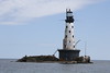

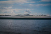
The above images may not be of the site on this page, but were taken nearby. They are loaded from Flickr so please click on them for image credits.
Click here to see more info for this site
Nearby sites
Click here to view sites on an interactive map of the areaKey: Red: member's photo, Blue: 3rd party photo, Yellow: other image, Green: no photo - please go there and take one, Grey: site destroyed
Download sites to:
KML (Google Earth)
GPX (GPS waypoints)
CSV (Garmin/Navman)
CSV (Excel)
To unlock full downloads you need to sign up as a Contributory Member. Otherwise downloads are limited to 50 sites.
Turn off the page maps and other distractions
Nearby sites listing. In the following links * = Image available
244.3km WNW 284° Backcountry cache Ancient Mine, Quarry or other Industry
251.3km SE 127° Grand Island Ancient Village or Settlement
326.9km WNW 285° McKinstry Mounds* Artificial Mound
332.4km SSE 153° Chambers Island Mounds* Artificial Mound
336.3km WNW 284° Grand Mound* Artificial Mound
351.2km SW 227° Trade Lake Mound* Artificial Mound
367.1km WNW 286° Manitou Mounds* Barrow Cemetery
370.3km SE 128° Beaver Island Mound* Artificial Mound
371.1km SE 130° Beaver Island Stone Circle Stone Circle
415.4km ESE 122° Old Fort Mackinac Mounds* Artificial Mound
415.8km S 189° Cranberry Creek Mound Group Artificial Mound
425.4km SW 220° Rattlesnake Mound Artificial Mound
427.5km SW 234° Mahnomen Mounds Barrow Cemetery
435.0km SW 223° Indian Mounds Regional Park* Artificial Mound
439.5km SW 216° Bow and Arrow Rock Art
441.1km SSW 195° Fort McCoy Artificial Mound
443.5km SE 139° Underwater Stone Circle nr Traverse City Stone Circle
450.1km W 263° Itasca Burial Mounds* Barrow Cemetery
453.1km W 263° Itasca Bison Kill* Natural Stone / Erratic / Other Natural Feature
476.4km ESE 122° Ocquecoc River Mound* Artificial Mound
487.5km S 184° Man Mound Park* Artificial Mound
490.3km S 175° Nitschke Mounds State Park Artificial Mound
495.9km S 184° Devil's Lake Mounds* Artificial Mound
497.2km S 169° Lizard Mound State Park* Artificial Mound
511.8km SSW 193° Tainter Cave Cave or Rock Shelter
View more nearby sites and additional images


 We would like to know more about this location. Please feel free to add a brief description and any relevant information in your own language.
 Wir möchten mehr über diese Stätte erfahren. Bitte zögern Sie nicht, eine kurze Beschreibung und relevante Informationen in Deutsch hinzuzufügen.
 Nous aimerions en savoir encore un peu sur les lieux. S'il vous plaît n'hesitez pas à ajouter une courte description et tous les renseignements pertinents dans votre propre langue.
 Quisieramos informarnos un poco más de las lugares. No dude en añadir una breve descripción y otros datos relevantes en su propio idioma.