

<< Other Photo Pages >> Dunbar Mound - Barrow Cemetery in United States in Mid Atlantic
Submitted by bat400 on Monday, 27 February 2017 Page Views: 1710
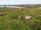
Neolithic and Bronze AgeSite Name: Dunbar Mound Alternative Name: Poorhouse Mound, Fairgrounds MoundCountry: United States
NOTE: This site is 5.125 km away from the location you searched for.
Region: Mid Atlantic Type: Barrow Cemetery
Nearest Town: Dunbar, WV
Latitude: 38.378000N Longitude: 81.761W
Condition:
| 5 | Perfect |
| 4 | Almost Perfect |
| 3 | Reasonable but with some damage |
| 2 | Ruined but still recognisable as an ancient site |
| 1 | Pretty much destroyed, possibly visible as crop marks |
| 0 | No data. |
| -1 | Completely destroyed |
| 5 | Superb |
| 4 | Good |
| 3 | Ordinary |
| 2 | Not Good |
| 1 | Awful |
| 0 | No data. |
| 5 | Can be driven to, probably with disabled access |
| 4 | Short walk on a footpath |
| 3 | Requiring a bit more of a walk |
| 2 | A long walk |
| 1 | In the middle of nowhere, a nightmare to find |
| 0 | No data. |
| 5 | co-ordinates taken by GPS or official recorded co-ordinates |
| 4 | co-ordinates scaled from a detailed map |
| 3 | co-ordinates scaled from a bad map |
| 2 | co-ordinates of the nearest village |
| 1 | co-ordinates of the nearest town |
| 0 | no data |
Internal Links:
External Links:
I have visited· I would like to visit
rrmoser would like to visit
")
Located in what is now Shawnee Region Park (a public golf course.)
You may be viewing yesterday's version of this page. To see the most up to date information please register for a free account.
")
")
")
Do not use the above information on other web sites or publications without permission of the contributor.
Nearby Images from Flickr


The above images may not be of the site on this page, but were taken nearby. They are loaded from Flickr so please click on them for image credits.
Click here to see more info for this site
Nearby sites
Click here to view sites on an interactive map of the areaKey: Red: member's photo, Blue: 3rd party photo, Yellow: other image, Green: no photo - please go there and take one, Grey: site destroyed
Download sites to:
KML (Google Earth)
GPX (GPS waypoints)
CSV (Garmin/Navman)
CSV (Excel)
To unlock full downloads you need to sign up as a Contributory Member. Otherwise downloads are limited to 50 sites.
Turn off the page maps and other distractions
Nearby sites listing. In the following links * = Image available
4.1km SE 126° Sunset Mound Artificial Mound
5.7km E 100° Criel Mound* Barrow Cemetery
50.6km SE 128° Armstrong Mountain* Artificial Mound
54.6km NW 318° May Moore Mound* Misc. Earthwork
73.3km W 268° Stone Serpent Mound* Hill Figure or Geoglyph
113.3km WNW 291° Portsmouth Earthworks* Misc. Earthwork
116.1km NNW 344° Wolf Plains Group* Artificial Mound
118.4km WNW 294° Tremper* Barrow Cemetery
118.9km NNE 13° Campus Martius* Museum
118.9km NNE 12° Marietta Earthworks* Misc. Earthwork
119.0km NNE 13° Marietta Earthworks - Conus* Artificial Mound
119.3km NNE 13° Marietta Earthworks - Capitolium* Artificial Mound
119.3km NNE 12° Marietta Earthworks - Quadranaou* Pyramid / Mastaba
126.0km NNE 23° Reynolds Mound* Artificial Mound
132.4km NW 305° Piketon Mounds* Artificial Mound
137.7km NW 316° Liberty Earthworks* Artificial Mound
142.4km NW 316° High Bank Works* Misc. Earthwork
145.4km NW 326° Karshner Mound Artificial Mound
150.5km NW 314° Junction Earthworks* Misc. Earthwork
151.6km NW 315° Story Mound (Chillicothe)* Artificial Mound
152.1km NW 314° Steel Earthworks* Misc. Earthwork
153.3km NW 316° Adena Mound* Artificial Mound
153.9km NW 317° Hopeton Earthworks* Artificial Mound
154.7km NW 316° Hopewell Culture National Historic Site* Misc. Earthwork
155.0km NW 318° Cedar Banks Works* Ancient Village or Settlement
View more nearby sites and additional images


 We would like to know more about this location. Please feel free to add a brief description and any relevant information in your own language.
 Wir möchten mehr über diese Stätte erfahren. Bitte zögern Sie nicht, eine kurze Beschreibung und relevante Informationen in Deutsch hinzuzufügen.
 Nous aimerions en savoir encore un peu sur les lieux. S'il vous plaît n'hesitez pas à ajouter une courte description et tous les renseignements pertinents dans votre propre langue.
 Quisieramos informarnos un poco más de las lugares. No dude en añadir una breve descripción y otros datos relevantes en su propio idioma.