


<< Other Photo Pages >> Windover (Florida) - Barrow Cemetery in United States in The South
Submitted by bat400 on Thursday, 09 January 2014 Page Views: 9386
Neolithic and Bronze AgeSite Name: Windover (Florida) Alternative Name: 8BR246Country: United States Region: The South Type: Barrow Cemetery
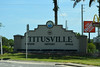
Nearest Town: Titusville, FL
Latitude: 28.540000N Longitude: 80.843W
Condition:
| 5 | Perfect |
| 4 | Almost Perfect |
| 3 | Reasonable but with some damage |
| 2 | Ruined but still recognisable as an ancient site |
| 1 | Pretty much destroyed, possibly visible as crop marks |
| 0 | No data. |
| -1 | Completely destroyed |
| 5 | Superb |
| 4 | Good |
| 3 | Ordinary |
| 2 | Not Good |
| 1 | Awful |
| 0 | No data. |
| 5 | Can be driven to, probably with disabled access |
| 4 | Short walk on a footpath |
| 3 | Requiring a bit more of a walk |
| 2 | A long walk |
| 1 | In the middle of nowhere, a nightmare to find |
| 0 | No data. |
| 5 | co-ordinates taken by GPS or official recorded co-ordinates |
| 4 | co-ordinates scaled from a detailed map |
| 3 | co-ordinates scaled from a bad map |
| 2 | co-ordinates of the nearest village |
| 1 | co-ordinates of the nearest town |
| 0 | no data |
Internal Links:
External Links:
I have visited· I would like to visit
bat400 couldn't find on 1st Sep 2009 I drove passed this site multiple times without knowing it (while hunting for it!) Despite the pond's location directly along a paved road through a housing estate, there is no place to stop and look at the pond without walking through a private home's back garden or "bushwacking" through Florida underbrush. As described in the site listing, you are better off visiting the Brevard County History and Science Museum and asking them if any visits to the site are planned.
")
A National Register of Historic Places site. Although the Windover Bog is on private land, the site in under county management. However, there is no interpretive information and no immediate access to the site. With no parking, and surrounded by private homes, the casual visitor is possibly better off waiting for a rare visit to the site organized by the Brevard County History and Science Museum which has an exhibit describing the many finds from the Windover site.
The North Brevard Business Directory also includes a webpage on the site.
The Archaeology Conservancy has purchased a buffer zone of land surrounding the existing pond in other to better protect the site and prevent encroachment of housing development.
Note: Archaeology Conservancy buys land surrounding 7000 year old Florida burial pond. See comments.
You may be viewing yesterday's version of this page. To see the most up to date information please register for a free account.
 (PID:116120)")
Do not use the above information on other web sites or publications without permission of the contributor.
Nearby Images from Flickr
The above images may not be of the site on this page, but were taken nearby. They are loaded from Flickr so please click on them for image credits.
Click here to see more info for this site
Nearby sites
Click here to view sites on an interactive map of the areaKey: Red: member's photo, Blue: 3rd party photo, Yellow: other image, Green: no photo - please go there and take one, Grey: site destroyed
Download sites to:
KML (Google Earth)
GPX (GPS waypoints)
CSV (Garmin/Navman)
CSV (Excel)
To unlock full downloads you need to sign up as a Contributory Member. Otherwise downloads are limited to 50 sites.
Turn off the page maps and other distractions
Nearby sites listing. In the following links * = Image available
18.8km SSE 154° Brevard Museum of History and Natural Sciences* Museum
36.7km N 1° Snyder's Mound* Ancient Mine, Quarry or other Industry
39.5km N 5° Castle Windy Artificial Mound
43.5km N 2° Turtle Mound* Artificial Mound
46.6km NW 309° Indian Mound Village Site* Artificial Mound
54.7km N 352° Old Fort Mound Artificial Mound
62.9km S 172° Three Forks Marsh Artificial Mound
64.8km N 351° Green Mound Artificial Mound
69.8km NW 314° Hontoon Island State Park* Artificial Mound
84.8km NNW 346° Ormond Burial Mound* Barrow Cemetery
91.8km NNW 345° Strickland Mound Complex Barrow Cemetery
93.7km NNW 345° Nocoroco* Ancient Village or Settlement
109.4km SSE 156° Vero Beach* Ancient Village or Settlement
127.5km NW 322° Mount Royal Site* Artificial Mound
177.2km S 178° Lake Okeechobee* Ancient Village or Settlement
177.2km WNW 284° Crystal River Archaeological State Park* Barrow Cemetery
178.6km SW 231° Portavant Mound Site Artificial Mound
178.8km S 190° Fort Center Archaeological Site* Artificial Mound
187.2km W 261° Oelsner Indian Mound* Artificial Mound
188.5km S 169° Big Mound City Misc. Earthwork
189.1km WSW 252° Safety Harbor Mound* Artificial Mound
189.3km WSW 246° Weedon Island Preserve* Barrow Cemetery
193.0km SSE 157° Jupiter Inlet Mound* Artificial Mound
196.4km SSW 193° Ortona Prehistoric Village Artificial Mound
203.0km WSW 238° Madira Bickel Mound State Archaeological Site* Artificial Mound
View more nearby sites and additional images


 We would like to know more about this location. Please feel free to add a brief description and any relevant information in your own language.
 Wir möchten mehr über diese Stätte erfahren. Bitte zögern Sie nicht, eine kurze Beschreibung und relevante Informationen in Deutsch hinzuzufügen.
 Nous aimerions en savoir encore un peu sur les lieux. S'il vous plaît n'hesitez pas à ajouter une courte description et tous les renseignements pertinents dans votre propre langue.
 Quisieramos informarnos un poco más de las lugares. No dude en añadir una breve descripción y otros datos relevantes en su propio idioma.