<< Other Photo Pages >> Armstrong Mountain - Artificial Mound in United States in The South
Submitted by AKFisher on Friday, 28 July 2023 Page Views: 791
Pre-ColumbianSite Name: Armstrong Mountain Alternative Name: Mount Armstrong, WVCountry: United States
NOTE: This site is 87.743 km away from the location you searched for.
Region: The South Type: Artificial Mound
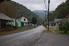
Nearest Town: Mt. Carbon
Latitude: 38.098883N Longitude: 81.3032W
Condition:
| 5 | Perfect |
| 4 | Almost Perfect |
| 3 | Reasonable but with some damage |
| 2 | Ruined but still recognisable as an ancient site |
| 1 | Pretty much destroyed, possibly visible as crop marks |
| 0 | No data. |
| -1 | Completely destroyed |
| 5 | Superb |
| 4 | Good |
| 3 | Ordinary |
| 2 | Not Good |
| 1 | Awful |
| 0 | No data. |
| 5 | Can be driven to, probably with disabled access |
| 4 | Short walk on a footpath |
| 3 | Requiring a bit more of a walk |
| 2 | A long walk |
| 1 | In the middle of nowhere, a nightmare to find |
| 0 | No data. |
| 5 | co-ordinates taken by GPS or official recorded co-ordinates |
| 4 | co-ordinates scaled from a detailed map |
| 3 | co-ordinates scaled from a bad map |
| 2 | co-ordinates of the nearest village |
| 1 | co-ordinates of the nearest town |
| 0 | no data |
Internal Links:
External Links:
")
From the Historical Marker on site: "Ancient Works ~ On a ridge between Armstrong and Loop Creeks across the river are extensive pre-historic stone ruins whose walls are several miles long, and enclose a large area. Many of these stones are from the valley below the old wall."
(Olafson, Inghram, and McMichael 1958)
"The northernmost limit of the site is about one mile south of the mouth of Armstrong Creek, and from this point, it extends southward for an airline distance of about three miles, or five miles if the meanders of the ridge top are followed. The principal feature of the site, is, of course, the “stone walls”. Actually windrows would be more appropriate in that these are not laid-up walls but rather crude rows of loosely piled rock...
"Beginning on the north, the first encountered (See Map 2). has been designated Wall 1. This is a U-shaped windrow of loosely piled rocks crossing the ridge as it slopes down to the Kanawha, just east of the mouth of Armstrong Creek. It is about one-half mile south of the river, but it lies 1,200 feet above the river level or 1,790 feet above sea level. This structure rests on a fairly level bench or shelf where it crosses the ridge and is well preserved. It is about two feet high and about 20 feet wide."
Further reading and information:
https://wvexplorer.com/2022/02/05/ancient-walls-on-armstrong-mountain-old-timers-tale/
https://wvexplorer.com/attractions/prehistoric/mount-carbon-stone-walls/
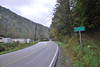
Directions: Mt. Carbon, WV ~ Via Armstrong Creek Rd. and Cooper St ~ 5.5 mi south
You may be viewing yesterday's version of this page. To see the most up to date information please register for a free account.
")
")
Do not use the above information on other web sites or publications without permission of the contributor.
Nearby Images from Flickr


The above images may not be of the site on this page, but were taken nearby. They are loaded from Flickr so please click on them for image credits.
Click here to see more info for this site
Nearby sites
Click here to view sites on an interactive map of the areaKey: Red: member's photo, Blue: 3rd party photo, Yellow: other image, Green: no photo - please go there and take one, Grey: site destroyed
Download sites to:
KML (Google Earth)
GPX (GPS waypoints)
CSV (Garmin/Navman)
CSV (Excel)
To unlock full downloads you need to sign up as a Contributory Member. Otherwise downloads are limited to 50 sites.
Turn off the page maps and other distractions
Nearby sites listing. In the following links * = Image available
45.7km NW 311° Criel Mound* Barrow Cemetery
46.5km NW 308° Sunset Mound Artificial Mound
50.6km NW 308° Dunbar Mound* Barrow Cemetery
104.8km NW 313° May Moore Mound* Misc. Earthwork
116.8km WNW 284° Stone Serpent Mound* Hill Figure or Geoglyph
118.6km SSE 153° Fort Bragg Misc. Earthwork
147.1km N 4° Reynolds Mound* Artificial Mound
147.5km N 355° Marietta Earthworks - Conus* Artificial Mound
147.7km N 355° Campus Martius* Museum
147.8km N 355° Marietta Earthworks* Misc. Earthwork
148.0km N 355° Marietta Earthworks - Capitolium* Artificial Mound
148.1km N 355° Marietta Earthworks - Quadranaou* Pyramid / Mastaba
159.9km NNW 333° Wolf Plains Group* Artificial Mound
162.5km WNW 297° Portsmouth Earthworks* Misc. Earthwork
162.8km ESE 108° Foamhenge (Natural Bridge)* Modern Stone Circle etc
167.9km WNW 298° Tremper* Barrow Cemetery
173.1km SSW 199° Cornelius Ancient Village or Settlement
183.0km NW 306° Piketon Mounds* Artificial Mound
187.9km NW 314° Liberty Earthworks* Artificial Mound
192.7km NW 314° High Bank Works* Misc. Earthwork
194.2km NW 321° Karshner Mound Artificial Mound
200.9km NW 313° Junction Earthworks* Misc. Earthwork
201.9km NW 314° Story Mound (Chillicothe)* Artificial Mound
202.3km SSE 158° Pilot Mountain* Natural Stone / Erratic / Other Natural Feature
202.5km NW 313° Steel Earthworks* Misc. Earthwork
View more nearby sites and additional images


 We would like to know more about this location. Please feel free to add a brief description and any relevant information in your own language.
 Wir möchten mehr über diese Stätte erfahren. Bitte zögern Sie nicht, eine kurze Beschreibung und relevante Informationen in Deutsch hinzuzufügen.
 Nous aimerions en savoir encore un peu sur les lieux. S'il vous plaît n'hesitez pas à ajouter une courte description et tous les renseignements pertinents dans votre propre langue.
 Quisieramos informarnos un poco más de las lugares. No dude en añadir una breve descripción y otros datos relevantes en su propio idioma.