<< Image Pages >> Old Fort Mackinac Mounds - Artificial Mound in United States in Great Lakes Midwest
Submitted by durhamnature on Monday, 25 February 2013 Page Views: 3481
Pre-ColumbianSite Name: Old Fort Mackinac MoundsCountry: United States
NOTE: This site is 695.929 km away from the location you searched for.
Region: Great Lakes Midwest Type: Artificial Mound
Latitude: 45.785633N Longitude: 84.7378W
Condition:
| 5 | Perfect |
| 4 | Almost Perfect |
| 3 | Reasonable but with some damage |
| 2 | Ruined but still recognisable as an ancient site |
| 1 | Pretty much destroyed, possibly visible as crop marks |
| 0 | No data. |
| -1 | Completely destroyed |
| 5 | Superb |
| 4 | Good |
| 3 | Ordinary |
| 2 | Not Good |
| 1 | Awful |
| 0 | No data. |
| 5 | Can be driven to, probably with disabled access |
| 4 | Short walk on a footpath |
| 3 | Requiring a bit more of a walk |
| 2 | A long walk |
| 1 | In the middle of nowhere, a nightmare to find |
| 0 | No data. |
| 5 | co-ordinates taken by GPS or official recorded co-ordinates |
| 4 | co-ordinates scaled from a detailed map |
| 3 | co-ordinates scaled from a bad map |
| 2 | co-ordinates of the nearest village |
| 1 | co-ordinates of the nearest town |
| 0 | no data |
Be the first person to rate this site - see the 'Contribute!' box in the right hand menu.
Internal Links:
External Links:
")
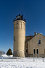
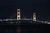
Group of six Indian mounds along the shore of the Straits of Mackinac, in Michigan. The location plan shows an additional mound at Point La Barbe, on the opposite side of the strait. The strait has been bridged since the plan was drawn, but the mounds appear not to be affected.
You may be viewing yesterday's version of this page. To see the most up to date information please register for a free account.
Do not use the above information on other web sites or publications without permission of the contributor.
Nearby Images from Flickr


The above images may not be of the site on this page, but were taken nearby. They are loaded from Flickr so please click on them for image credits.
Click here to see more info for this site
Nearby sites
Click here to view sites on an interactive map of the areaKey: Red: member's photo, Blue: 3rd party photo, Yellow: other image, Green: no photo - please go there and take one, Grey: site destroyed
Download sites to:
KML (Google Earth)
GPX (GPS waypoints)
CSV (Garmin/Navman)
CSV (Excel)
To unlock full downloads you need to sign up as a Contributory Member. Otherwise downloads are limited to 50 sites.
Turn off the page maps and other distractions
Nearby sites listing. In the following links * = Image available
60.6km W 266° Beaver Island Mound* Artificial Mound
61.1km ESE 122° Ocquecoc River Mound* Artificial Mound
67.2km W 260° Beaver Island Stone Circle Stone Circle
131.9km SSW 212° Underwater Stone Circle nr Traverse City Stone Circle
166.4km WNW 298° Grand Island Ancient Village or Settlement
198.3km SSE 149° Ottawa Point Mound* Artificial Mound
214.7km WSW 253° Chambers Island Mounds* Artificial Mound
233.0km SE 129° Alpena-Amberley Ridge Game Drives* Ancient Mine, Quarry or other Industry
273.7km SSE 150° Sanilac Petroglyphs Historic State Park* Rock Art
326.5km SSW 194° Norton Mounds Barrow Cemetery
358.8km SSE 148° Mound at Head of St Clair River* Artificial Mound
363.0km SE 141° Davidson Ancient Village or Settlement
372.9km SW 227° Lizard Mound State Park* Artificial Mound
380.2km SSE 156° Riviere Au Vase Artificial Mound
405.1km SW 232° Nitschke Mounds State Park Artificial Mound
405.9km SSE 159° The Manitou Idol Sculptured Stone
409.2km SSE 161° Fort Wayne Mound Site Artificial Mound
409.3km SSE 161° Great Mound, River Rouge* Artificial Mound
415.2km SW 223° Cutler Mound Group* Artificial Mound
415.4km NW 305° Triangle Island Mound, Isle Royale* Artificial Mound
419.6km SW 217° Mound Cemetery (Racine) Barrow Cemetery
445.8km SW 229° Aztalan State Park* Ancient Village or Settlement
448.7km ESE 102° Lewiston Mound State Park* Artificial Mound
455.9km WSW 249° Cranberry Creek Mound Group Artificial Mound
462.1km SW 227° The Finch Site Ancient Village or Settlement
View more nearby sites and additional images


 We would like to know more about this location. Please feel free to add a brief description and any relevant information in your own language.
 Wir möchten mehr über diese Stätte erfahren. Bitte zögern Sie nicht, eine kurze Beschreibung und relevante Informationen in Deutsch hinzuzufügen.
 Nous aimerions en savoir encore un peu sur les lieux. S'il vous plaît n'hesitez pas à ajouter une courte description et tous les renseignements pertinents dans votre propre langue.
 Quisieramos informarnos un poco más de las lugares. No dude en añadir una breve descripción y otros datos relevantes en su propio idioma.