<< Other Photo Pages >> Artificial Mound in Great Lakes Midwest - Artificial Mound in United States in Great Lakes Midwest
Submitted by gizmoenlightenment on Monday, 12 October 2020 Page Views: 1611
Multi-periodSite Name: Artificial Mound in Great Lakes MidwestCountry: United States
NOTE: This site is 20.165 km away from the location you searched for.
Region: Great Lakes Midwest Type: Artificial Mound
Nearest Town: East Palestine Nearest Village: Negley
Latitude: 40.472400N Longitude: 80.322W
Condition:
| 5 | Perfect |
| 4 | Almost Perfect |
| 3 | Reasonable but with some damage |
| 2 | Ruined but still recognisable as an ancient site |
| 1 | Pretty much destroyed, possibly visible as crop marks |
| 0 | No data. |
| -1 | Completely destroyed |
| 5 | Superb |
| 4 | Good |
| 3 | Ordinary |
| 2 | Not Good |
| 1 | Awful |
| 0 | No data. |
| 5 | Can be driven to, probably with disabled access |
| 4 | Short walk on a footpath |
| 3 | Requiring a bit more of a walk |
| 2 | A long walk |
| 1 | In the middle of nowhere, a nightmare to find |
| 0 | No data. |
| 5 | co-ordinates taken by GPS or official recorded co-ordinates |
| 4 | co-ordinates scaled from a detailed map |
| 3 | co-ordinates scaled from a bad map |
| 2 | co-ordinates of the nearest village |
| 1 | co-ordinates of the nearest town |
| 0 | no data |
Internal Links:
External Links:
")
You may be viewing yesterday's version of this page. To see the most up to date information please register for a free account.
")
")
Do not use the above information on other web sites or publications without permission of the contributor.
Nearby Images from Flickr
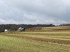
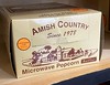

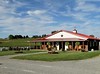
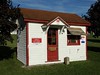

The above images may not be of the site on this page, but were taken nearby. They are loaded from Flickr so please click on them for image credits.
Click here to see more info for this site
Nearby sites
Click here to view sites on an interactive map of the areaKey: Red: member's photo, Blue: 3rd party photo, Yellow: other image, Green: no photo - please go there and take one, Grey: site destroyed
Download sites to:
KML (Google Earth)
GPX (GPS waypoints)
CSV (Garmin/Navman)
CSV (Excel)
To unlock full downloads you need to sign up as a Contributory Member. Otherwise downloads are limited to 50 sites.
Turn off the page maps and other distractions
Nearby sites listing. In the following links * = Image available
23.0km E 90° McKees Rocks Mound* Artificial Mound
25.3km SW 215° Meadowcroft Rockshelter* Cave or Rock Shelter
45.8km SW 224° Hodgen's Cemetery Mound* Artificial Mound
71.4km SSW 210° Grave Creek Mound* Artificial Mound
90.3km SW 234° Barnesville Rock Art* Rock Art
104.1km NNE 24° Indian God Rock Rock Art
106.7km WNW 294° Nobles Pond* Ancient Village or Settlement
133.6km W 259° Porteus Mound* Artificial Mound
138.1km WNW 302° Paleo Crossing Ancient Village or Settlement
138.3km SSW 212° Reynolds Mound* Artificial Mound
151.5km SW 220° Marietta Earthworks - Conus* Artificial Mound
151.5km SW 220° Marietta Earthworks - Capitolium* Artificial Mound
151.6km SW 220° Marietta Earthworks - Quadranaou* Pyramid / Mastaba
152.0km SW 220° Campus Martius* Museum
152.1km SW 220° Marietta Earthworks* Misc. Earthwork
173.3km WSW 253° Flint Ridge* Ancient Mine, Quarry or other Industry
180.8km WSW 253° Tippett Mound Artificial Mound
182.2km WSW 249° Glenford Fort* Hillfort
183.3km W 268° McLaughlin Mound* Artificial Mound
183.6km WSW 256° Upham* Artificial Mound
184.2km WSW 253° Fairmount* Artificial Mound
184.5km WSW 256° Newark Earthworks - Wright* Misc. Earthwork
185.3km WSW 256° Newark Earthworks - Great Circle* Misc. Earthwork
185.4km WSW 257° Ferris Owen* Artificial Mound
186.2km WSW 256° Newark Earthworks - Octagon* Misc. Earthwork
View more nearby sites and additional images


 We would like to know more about this location. Please feel free to add a brief description and any relevant information in your own language.
 Wir möchten mehr über diese Stätte erfahren. Bitte zögern Sie nicht, eine kurze Beschreibung und relevante Informationen in Deutsch hinzuzufügen.
 Nous aimerions en savoir encore un peu sur les lieux. S'il vous plaît n'hesitez pas à ajouter une courte description et tous les renseignements pertinents dans votre propre langue.
 Quisieramos informarnos un poco más de las lugares. No dude en añadir una breve descripción y otros datos relevantes en su propio idioma.