<< Text Pages >> Castro do Campo dos Bufos - Castro or Chafurdão in Spain in Galicia
Submitted by TheCaptain on Wednesday, 08 September 2010 Page Views: 1752
Iron Age and Later PrehistorySite Name: Castro do Campo dos BufosCountry: Spain
NOTE: This site is 1.752 km away from the location you searched for.
Region: Galicia Type: Castro or Chafurdão
Nearest Town: Pontevedra Nearest Village: A Illa de Arousa
Latitude: 42.554000N Longitude: 8.864W
Condition:
| 5 | Perfect |
| 4 | Almost Perfect |
| 3 | Reasonable but with some damage |
| 2 | Ruined but still recognisable as an ancient site |
| 1 | Pretty much destroyed, possibly visible as crop marks |
| 0 | No data. |
| -1 | Completely destroyed |
| 5 | Superb |
| 4 | Good |
| 3 | Ordinary |
| 2 | Not Good |
| 1 | Awful |
| 0 | No data. |
| 5 | Can be driven to, probably with disabled access |
| 4 | Short walk on a footpath |
| 3 | Requiring a bit more of a walk |
| 2 | A long walk |
| 1 | In the middle of nowhere, a nightmare to find |
| 0 | No data. |
| 5 | co-ordinates taken by GPS or official recorded co-ordinates |
| 4 | co-ordinates scaled from a detailed map |
| 3 | co-ordinates scaled from a bad map |
| 2 | co-ordinates of the nearest village |
| 1 | co-ordinates of the nearest town |
| 0 | no data |
Be the first person to rate this site - see the 'Contribute!' box in the right hand menu.
Internal Links:
External Links:
Castro in Galicia
Castro do Campo dos Bufos is a Castro in the community of A Illa de Arousa, Province of Pontevedra, region of Galicia
You may be viewing yesterday's version of this page. To see the most up to date information please register for a free account.
Do not use the above information on other web sites or publications without permission of the contributor.
Nearby Images from Flickr

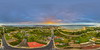

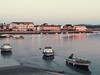
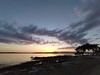

The above images may not be of the site on this page, but were taken nearby. They are loaded from Flickr so please click on them for image credits.
Click here to see more info for this site
Nearby sites
Click here to view sites on an interactive map of the areaKey: Red: member's photo, Blue: 3rd party photo, Yellow: other image, Green: no photo - please go there and take one, Grey: site destroyed
Download sites to:
KML (Google Earth)
GPX (GPS waypoints)
CSV (Garmin/Navman)
CSV (Excel)
To unlock full downloads you need to sign up as a Contributory Member. Otherwise downloads are limited to 50 sites.
Turn off the page maps and other distractions
Nearby sites listing. In the following links * = Image available
3.2km WSW 245° Cistas do Xacemento de Tarais Cist
3.3km ENE 64° Castro de Vilanova de Arousa Castro or Chafurdão
6.3km SE 146° Castro e Torre de San Sadurniño Castro or Chafurdão
6.3km ESE 122° Castro de Pinal do Rei Castro or Chafurdão
6.6km SE 135° Castro da Pastora Castro or Chafurdão
6.7km NW 311° Castro de Punta Ostreira Castro or Chafurdão
6.8km NNW 344° Castro do Achadizo* Castro or Chafurdão
7.4km ESE 116° Castro das Sete Pías Castro or Chafurdão
7.5km ESE 116° Petroglifo das Sete Pías Rock Art
7.6km NW 312° Castro de Cabío Castro or Chafurdão
7.7km NW 312° Castro de Postmarcos Castro or Chafurdão
7.7km N 355° Castro de O Castriño Castro or Chafurdão
8.7km SSE 156° Castro de A Revolta (Lourido) Castro or Chafurdão
8.8km ENE 61° Castro de Alobre* Castro or Chafurdão
9.0km WNW 282° Coroso Dolmen Burial Chamber or Dolmen
9.2km SSE 151° Castro de Castrelo Castro or Chafurdão
10.1km SSE 157° Petroglifo do Monte Castelo (Sartaxes) Rock Art
10.1km SSW 213° Adro Vello Área Arqueológica Ancient Village or Settlement
10.2km WNW 284° Pedra das Cabras* Rock Art
10.2km SW 216° Castro de Carreiro Castro or Chafurdão
10.6km NNE 30° Castro de Brión (Rianxo) Castro or Chafurdão
10.7km ESE 108° Castro de Monte de O Castro* Castro or Chafurdão
10.9km NW 311° Necrópole megalítica de Moldes Barrow Cemetery
10.9km WNW 302° Necrópole de Moldes* Rock Outcrop
11.1km NE 46° Petróglifos dos Ballotes* Rock Art
View more nearby sites and additional images


 We would like to know more about this location. Please feel free to add a brief description and any relevant information in your own language.
 Wir möchten mehr über diese Stätte erfahren. Bitte zögern Sie nicht, eine kurze Beschreibung und relevante Informationen in Deutsch hinzuzufügen.
 Nous aimerions en savoir encore un peu sur les lieux. S'il vous plaît n'hesitez pas à ajouter une courte description et tous les renseignements pertinents dans votre propre langue.
 Quisieramos informarnos un poco más de las lugares. No dude en añadir una breve descripción y otros datos relevantes en su propio idioma.