


<< Our Photo Pages >> Kilmovee Ogham Stone - Sculptured Stone in Ireland (Republic of) in Co. Mayo
Submitted by LaurenHermit on Sunday, 06 August 2023 Page Views: 659
Early Medieval (Dark Age)Site Name: Kilmovee Ogham StoneCountry: Ireland (Republic of)
NOTE: This site is 9.04 km away from the location you searched for.
County: Co. Mayo Type: Sculptured Stone
Nearest Village: Kilmovee
Latitude: 53.899790N Longitude: 8.68177W
Condition:
| 5 | Perfect |
| 4 | Almost Perfect |
| 3 | Reasonable but with some damage |
| 2 | Ruined but still recognisable as an ancient site |
| 1 | Pretty much destroyed, possibly visible as crop marks |
| 0 | No data. |
| -1 | Completely destroyed |
| 5 | Superb |
| 4 | Good |
| 3 | Ordinary |
| 2 | Not Good |
| 1 | Awful |
| 0 | No data. |
| 5 | Can be driven to, probably with disabled access |
| 4 | Short walk on a footpath |
| 3 | Requiring a bit more of a walk |
| 2 | A long walk |
| 1 | In the middle of nowhere, a nightmare to find |
| 0 | No data. |
| 5 | co-ordinates taken by GPS or official recorded co-ordinates |
| 4 | co-ordinates scaled from a detailed map |
| 3 | co-ordinates scaled from a bad map |
| 2 | co-ordinates of the nearest village |
| 1 | co-ordinates of the nearest town |
| 0 | no data |
Internal Links:
External Links:
")
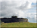
According to the Celtic Inscribed Stones Project, the inscription is somewhat damaged but it reads ”ALATTOS MAQI BR[–”. This ogham stone is located beside ”The Three Wells”, also known as ”The Crozier Wells or ”Tobar na Bachaille”. Ogham was the old Irish alphabet containing 20 letters which were formed using a series of short strokes, Ireland’s first writing.
You may be viewing yesterday's version of this page. To see the most up to date information please register for a free account.
")
Do not use the above information on other web sites or publications without permission of the contributor.
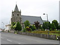
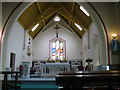
Nearby Images from Geograph Britain and Ireland:
©2014(licence)
©2014(licence)
©2008(licence)
The above images may not be of the site on this page, they are loaded from Geograph.
Please Submit an Image of this site or go out and take one for us!
Click here to see more info for this site
Nearby sites
Click here to view sites on an interactive map of the areaKey: Red: member's photo, Blue: 3rd party photo, Yellow: other image, Green: no photo - please go there and take one, Grey: site destroyed
Download sites to:
KML (Google Earth)
GPX (GPS waypoints)
CSV (Garmin/Navman)
CSV (Excel)
To unlock full downloads you need to sign up as a Contributory Member. Otherwise downloads are limited to 50 sites.
Turn off the page maps and other distractions
Nearby sites listing. In the following links * = Image available
1.8km S 177° Kilcashel Stone Fort* Stone Fort or Dun
16.0km SSW 209° Bracklaghboy* Standing Stone (Menhir) (M474807)
17.1km ENE 56° Ballynakill (LoughRea) Stone Circle* Stone Circle (G696040)
20.7km ESE 111° Kilcorkey Stone* Standing Stone (Menhir)
21.7km ESE 109° Drummin Stones* Standing Stones
22.6km ESE 110° Standing stone near Rathcroghan* Standing Stone (Menhir)
22.8km ENE 70° Ballynanultagh* Portal Tomb (G76800237)
24.0km NE 41° Kesh Corran Chambered Cairn (G7127812622)
25.6km NE 48° Carrowkeel B* Passage Grave (G7446711598)
25.7km NE 49° Carrowkeel F* Passage Grave (G749114)
25.9km WNW 289° Lough Muck Stone Row* Stone Row / Alignment
25.9km NE 49° Carrowkeel Cairn E* Court Tomb (G7492711606)
26.1km NE 48° Carrowkeel D Passage Grave (G748121)
26.1km NE 48° Carrowkeel Cairn C Passage Grave (G748121)
26.2km NE 50° Carrowkeel M Passage Grave (G755114)
26.2km NE 50° Carrowkeel N Passage Grave (G756113)
26.2km NE 49° Carrowkeel L* Passage Grave (G753117)
26.3km NE 49° Carrowkeel Cairn K* Chambered Cairn (G7533511726)
26.3km ESE 112° Ráth Mór* Artificial Mound
26.4km NE 49° Carrowkeel H* Passage Grave (G7530211863)
26.4km NE 49° Carrowkeel Cairn X* Cairn (G75251196)
26.4km NE 49° Carrowkeel Cairn G* Chambered Cairn (G7531111933)
26.4km NE 48° Carrowkeel* Passage Grave (G75231206)
26.5km ESE 114° Rath na tDarbh* Round Barrow(s)
26.7km NE 50° Carrowkeel O Passage Grave (G759117)
View more nearby sites and additional images


 We would like to know more about this location. Please feel free to add a brief description and any relevant information in your own language.
 Wir möchten mehr über diese Stätte erfahren. Bitte zögern Sie nicht, eine kurze Beschreibung und relevante Informationen in Deutsch hinzuzufügen.
 Nous aimerions en savoir encore un peu sur les lieux. S'il vous plaît n'hesitez pas à ajouter une courte description et tous les renseignements pertinents dans votre propre langue.
 Quisieramos informarnos un poco más de las lugares. No dude en añadir una breve descripción y otros datos relevantes en su propio idioma.