


<< Text Pages >> Revash - Burial Chamber or Dolmen in Peru
Submitted by bat400 on Saturday, 18 September 2010 Page Views: 4341
Neolithic and Bronze AgeSite Name: RevashCountry: Peru
NOTE: This site is 44.308 km away from the location you searched for.
Type: Burial Chamber or Dolmen
Nearest Town: Chachapoyas Nearest Village: Santo Tomas de Quillay
Latitude: 6.4598S Longitude: 77.8758W
Condition:
| 5 | Perfect |
| 4 | Almost Perfect |
| 3 | Reasonable but with some damage |
| 2 | Ruined but still recognisable as an ancient site |
| 1 | Pretty much destroyed, possibly visible as crop marks |
| 0 | No data. |
| -1 | Completely destroyed |
| 5 | Superb |
| 4 | Good |
| 3 | Ordinary |
| 2 | Not Good |
| 1 | Awful |
| 0 | No data. |
| 5 | Can be driven to, probably with disabled access |
| 4 | Short walk on a footpath |
| 3 | Requiring a bit more of a walk |
| 2 | A long walk |
| 1 | In the middle of nowhere, a nightmare to find |
| 0 | No data. |
| 5 | co-ordinates taken by GPS or official recorded co-ordinates |
| 4 | co-ordinates scaled from a detailed map |
| 3 | co-ordinates scaled from a bad map |
| 2 | co-ordinates of the nearest village |
| 1 | co-ordinates of the nearest town |
| 0 | no data |
Internal Links:
External Links:
Burial Chamber in Amazonas Department, Peru.Burial chambers set in a cliffside wall of a canyon above the Utcubamba River. Although the burials inside the chambers have been destroyed by looters and rodents, the buildings themselves have been protected. They are made from small stones and a mud mortar, plastered with the same mud and painted white and red. The cliff overhang has protected them for over 600 years.
The structures resemble a village of cottages set into the cliff. The Revash tombs can be viewed from the valley floor and guided tours are offered from nearby villages and as part of multi-site tours of the Chachapoyas area.
You may be viewing yesterday's version of this page. To see the most up to date information please register for a free account.
Do not use the above information on other web sites or publications without permission of the contributor.
Nearby Images from Flickr
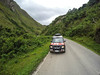
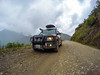
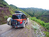
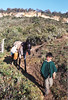
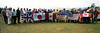
The above images may not be of the site on this page, but were taken nearby. They are loaded from Flickr so please click on them for image credits.
Click here to see more info for this site
Nearby sites
Click here to view sites on an interactive map of the areaKey: Red: member's photo, Blue: 3rd party photo, Yellow: other image, Green: no photo - please go there and take one, Grey: site destroyed
Download sites to:
KML (Google Earth)
GPX (GPS waypoints)
CSV (Garmin/Navman)
CSV (Excel)
To unlock full downloads you need to sign up as a Contributory Member. Otherwise downloads are limited to 50 sites.
Turn off the page maps and other distractions
Nearby sites listing. In the following links * = Image available
3.5km NW 309° Atumpucro Ancient Village or Settlement
7.0km NW 311° Kuelap Citadel* Ancient Village or Settlement
25.2km N 1° Huaca la Puertenciaria de la Meseta Ancient Village or Settlement
35.9km WNW 296° Gran Vilaya / Rabantu* Ancient Village or Settlement
38.7km NNW 333° Karajia Burial Chamber or Dolmen
42.5km N 0° Iyacyecuj Cave Cave or Rock Shelter
98.1km SW 221° Ventanillas de Otuzco Rock Cut Tomb
107.3km NNW 340° Cordillera de Colan Citadel Hillfort
112.5km SW 224° Cumbemayo Rock Art
126.8km W 276° Pacopampa Ancient Temple
130.4km SW 235° Kuntur Wasi* Ancient Temple
130.9km NW 309° Jaén Temples* Ancient Temple
131.0km NW 310° San Isidro Ancient Temple
149.2km S 189° Marcahuamachuco* Ancient Village or Settlement
159.2km SSE 154° Rio Abiseo National Park Ancient Village or Settlement
160.8km WSW 250° Nanchoc Ancient Village or Settlement
188.0km W 278° El Gallo Tombs Burial Chamber or Dolmen
194.4km WSW 259° Huaca Rajada Pyramid / Mastaba
194.6km W 274° Cerro Cerrillos Natural Stone / Erratic / Other Natural Feature
197.8km W 261° Cerro Pátapo Ancient Village or Settlement
202.8km WSW 253° Huaca el Pueblo Pyramid / Mastaba
207.2km SW 225° Mocollope Ancient Village or Settlement
211.6km W 259° Ventarron - Temple of the Captured Deer Ancient Temple
211.9km W 270° Pomac Forest Ancient Village or Settlement
212.2km SSW 212° Caballo Muerto Ancient Village or Settlement
View more nearby sites and additional images


 We would like to know more about this location. Please feel free to add a brief description and any relevant information in your own language.
 Wir möchten mehr über diese Stätte erfahren. Bitte zögern Sie nicht, eine kurze Beschreibung und relevante Informationen in Deutsch hinzuzufügen.
 Nous aimerions en savoir encore un peu sur les lieux. S'il vous plaît n'hesitez pas à ajouter une courte description et tous les renseignements pertinents dans votre propre langue.
 Quisieramos informarnos un poco más de las lugares. No dude en añadir una breve descripción y otros datos relevantes en su propio idioma.