
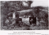

<< Our Photo Pages >> Forest ct Stones - Modern Stone Circle etc in United States in New England
Submitted by haitzulotar on Monday, 08 June 2020 Page Views: 1155
Modern SitesSite Name: Forest ct StonesCountry: United States Region: New England Type: Modern Stone Circle etc
Nearest Town: Carmel Hamlet Nearest Village: Kent
Latitude: 41.479447N Longitude: 73.778614W
Condition:
| 5 | Perfect |
| 4 | Almost Perfect |
| 3 | Reasonable but with some damage |
| 2 | Ruined but still recognisable as an ancient site |
| 1 | Pretty much destroyed, possibly visible as crop marks |
| 0 | No data. |
| -1 | Completely destroyed |
| 5 | Superb |
| 4 | Good |
| 3 | Ordinary |
| 2 | Not Good |
| 1 | Awful |
| 0 | No data. |
| 5 | Can be driven to, probably with disabled access |
| 4 | Short walk on a footpath |
| 3 | Requiring a bit more of a walk |
| 2 | A long walk |
| 1 | In the middle of nowhere, a nightmare to find |
| 0 | No data. |
| 5 | co-ordinates taken by GPS or official recorded co-ordinates |
| 4 | co-ordinates scaled from a detailed map |
| 3 | co-ordinates scaled from a bad map |
| 2 | co-ordinates of the nearest village |
| 1 | co-ordinates of the nearest town |
| 0 | no data |
Internal Links:
External Links:
")
You may be viewing yesterday's version of this page. To see the most up to date information please register for a free account.
")
Do not use the above information on other web sites or publications without permission of the contributor.
Nearby Images from Flickr

The above images may not be of the site on this page, but were taken nearby. They are loaded from Flickr so please click on them for image credits.
Click here to see more info for this site
Nearby sites
Click here to view sites on an interactive map of the areaKey: Red: member's photo, Blue: 3rd party photo, Yellow: other image, Green: no photo - please go there and take one, Grey: site destroyed
Download sites to:
KML (Google Earth)
GPX (GPS waypoints)
CSV (Garmin/Navman)
CSV (Excel)
To unlock full downloads you need to sign up as a Contributory Member. Otherwise downloads are limited to 50 sites.
Turn off the page maps and other distractions
Nearby sites listing. In the following links * = Image available
4.7km NNE 17° Stormville Structure* Modern Stone Circle etc
9.3km ENE 75° Ludingtonville stones* Modern Stone Circle etc
23.6km SE 133° North Salem Dolmen* Natural Stone / Erratic / Other Natural Feature
41.6km S 187° Glacial Erratic, Rockefeller State Park Preserve* Natural Stone / Erratic / Other Natural Feature
56.8km NNW 342° The King Stones Stone Circle
63.7km NNE 30° Giant's Thumb and mound* Standing Stone (Menhir)
73.7km ESE 104° Connecticut Seid* Natural Stone / Erratic / Other Natural Feature
77.6km SW 221° Tripod Rock* Natural Stone / Erratic / Other Natural Feature
79.4km SSW 191° Metropolitan Museum of Art* Museum
79.4km SSW 191° New York Cleopatra's Needle* Standing Stone (Menhir)
79.5km SSW 192° American Museum of Natural History (New York)* Museum
80.4km S 190° Noguchi Humming Stone (Summstein) Modern Stone Circle etc
88.4km SSW 193° National Museum of the American Indian* Museum
112.1km SW 232° Hackettstown Ceremonial Stone Landscape* Cairn
114.5km NNE 19° EarthGate Circle Modern Stone Circle etc
121.8km NNE 20° Balance Stone Lanesborough Natural Stone / Erratic / Other Natural Feature
131.8km ENE 74° Connecticut Archaeology Center* Museum
134.0km WSW 243° Columcille Megalith Park* Modern Stone Circle etc
134.1km NE 36° Balanced rock Goshen* Natural Stone / Erratic / Other Natural Feature
134.5km NE 44° Early Archaic Settlement Site on North King Street* Ancient Village or Settlement
134.5km NE 44° Potential Grinding Stone at Northampton Site Polissoir
136.9km WSW 250° Scotrun* Round Cairn
137.2km E 88° Montville Chamber* Souterrain (Fogou, Earth House)
140.9km SW 224° Quakertown Bedrock Mortar Museum
143.8km E 92° Gungywamp* Standing Stones
View more nearby sites and additional images


 We would like to know more about this location. Please feel free to add a brief description and any relevant information in your own language.
 Wir möchten mehr über diese Stätte erfahren. Bitte zögern Sie nicht, eine kurze Beschreibung und relevante Informationen in Deutsch hinzuzufügen.
 Nous aimerions en savoir encore un peu sur les lieux. S'il vous plaît n'hesitez pas à ajouter une courte description et tous les renseignements pertinents dans votre propre langue.
 Quisieramos informarnos un poco más de las lugares. No dude en añadir una breve descripción y otros datos relevantes en su propio idioma.