


<< Text Pages >> Anta do Chao do Padorno - Burial Chamber or Dolmen in Spain in Galicia
Submitted by holger_rix on Wednesday, 09 December 2015 Page Views: 525
Neolithic and Bronze AgeSite Name: Anta do Chao do Padorno Alternative Name: Dolmen de San Tome I, Dólmen de Santo ToméCountry: Spain Region: Galicia Type: Burial Chamber or Dolmen
Latitude: 43.536400N Longitude: 7.486636W
Condition:
| 5 | Perfect |
| 4 | Almost Perfect |
| 3 | Reasonable but with some damage |
| 2 | Ruined but still recognisable as an ancient site |
| 1 | Pretty much destroyed, possibly visible as crop marks |
| 0 | No data. |
| -1 | Completely destroyed |
| 5 | Superb |
| 4 | Good |
| 3 | Ordinary |
| 2 | Not Good |
| 1 | Awful |
| 0 | No data. |
| 5 | Can be driven to, probably with disabled access |
| 4 | Short walk on a footpath |
| 3 | Requiring a bit more of a walk |
| 2 | A long walk |
| 1 | In the middle of nowhere, a nightmare to find |
| 0 | No data. |
| 5 | co-ordinates taken by GPS or official recorded co-ordinates |
| 4 | co-ordinates scaled from a detailed map |
| 3 | co-ordinates scaled from a bad map |
| 2 | co-ordinates of the nearest village |
| 1 | co-ordinates of the nearest town |
| 0 | no data |
Be the first person to rate this site - see the 'Contribute!' box in the right hand menu.
Internal Links:
External Links:
Burial Chamber (Dolmen) in Galicia
You may be viewing yesterday's version of this page. To see the most up to date information please register for a free account.
Do not use the above information on other web sites or publications without permission of the contributor.
Nearby Images from Flickr
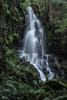

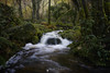
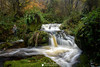
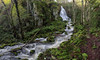
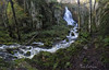
The above images may not be of the site on this page, but were taken nearby. They are loaded from Flickr so please click on them for image credits.
Click here to see more info for this site
Nearby sites
Click here to view sites on an interactive map of the areaKey: Red: member's photo, Blue: 3rd party photo, Yellow: other image, Green: no photo - please go there and take one, Grey: site destroyed
Download sites to:
KML (Google Earth)
GPX (GPS waypoints)
CSV (Garmin/Navman)
CSV (Excel)
To unlock full downloads you need to sign up as a Contributory Member. Otherwise downloads are limited to 50 sites.
Turn off the page maps and other distractions
Nearby sites listing. In the following links * = Image available
1.3km WSW 238° Círculo Lítico do Prado das Chantas* Stone Circle
4.0km WSW 251° Círculo Lítico das Pedragosas Stone Circle
4.4km W 278° Arcas de Sinás Burial Chamber or Dolmen
10.0km N 354° Castro de Penas Agudas Castro or Chafurdão
12.3km N 355° Castro do Torrillón Castro or Chafurdão
14.2km SE 132° Castro da Recadeira Castro or Chafurdão
14.3km SSE 149° Castro de Zoñán Castro or Chafurdão
14.7km ESE 110° Castro de Picote (Santo André) Castro or Chafurdão
15.6km NW 312° Pedrafita de Catarou Standing Stone (Menhir)
15.7km S 173° Castro de Arriba* Castro or Chafurdão
16.2km NE 50° Castro de Punta dos Castros (Cangas) Castro or Chafurdão
16.4km E 85° Castro de Vilaronte Castro or Chafurdão
16.5km N 11° Castro de Castelo Castro or Chafurdão
16.6km ENE 60° Castro de Nois Castro or Chafurdão
16.7km ENE 57° Castro do Curveiro (Nois) Castro or Chafurdão
16.8km ENE 64° Castro de Fazouro* Castro or Chafurdão
17.3km E 81° Castro do Río Castro or Chafurdão
17.5km N 8° Castro da Atalaia (Lieiro) Castro or Chafurdão
17.7km NNE 23° Castro de Rueta Castro or Chafurdão
17.8km W 270° Castro do Carrusco Castro or Chafurdão
18.0km ESE 106° Castro de Vilamar Castro or Chafurdão
18.1km NE 35° Castro de Burela Castro or Chafurdão
18.1km ESE 122° Castro de Chantado Castro or Chafurdão
18.4km ENE 78° Castro do Pico do Castro (Foz) Castro or Chafurdão
18.4km WNW 292° Mámoas do Cristo dos Callós Barrow Cemetery
View more nearby sites and additional images


 We would like to know more about this location. Please feel free to add a brief description and any relevant information in your own language.
 Wir möchten mehr über diese Stätte erfahren. Bitte zögern Sie nicht, eine kurze Beschreibung und relevante Informationen in Deutsch hinzuzufügen.
 Nous aimerions en savoir encore un peu sur les lieux. S'il vous plaît n'hesitez pas à ajouter une courte description et tous les renseignements pertinents dans votre propre langue.
 Quisieramos informarnos un poco más de las lugares. No dude en añadir una breve descripción y otros datos relevantes en su propio idioma.