

<< Text Pages >> Castro da Moura - Castro or Chafurdão in Spain in Galicia
Submitted by johnstone on Friday, 24 January 2020 Page Views: 378
Iron Age and Later PrehistorySite Name: Castro da MouraCountry: Spain
NOTE: This site is 1.725 km away from the location you searched for.
Region: Galicia Type: Castro or Chafurdão
Nearest Town: Lugo Nearest Village: Sarria
Latitude: 42.682508N Longitude: 7.25571W
Condition:
| 5 | Perfect |
| 4 | Almost Perfect |
| 3 | Reasonable but with some damage |
| 2 | Ruined but still recognisable as an ancient site |
| 1 | Pretty much destroyed, possibly visible as crop marks |
| 0 | No data. |
| -1 | Completely destroyed |
| 5 | Superb |
| 4 | Good |
| 3 | Ordinary |
| 2 | Not Good |
| 1 | Awful |
| 0 | No data. |
| 5 | Can be driven to, probably with disabled access |
| 4 | Short walk on a footpath |
| 3 | Requiring a bit more of a walk |
| 2 | A long walk |
| 1 | In the middle of nowhere, a nightmare to find |
| 0 | No data. |
| 5 | co-ordinates taken by GPS or official recorded co-ordinates |
| 4 | co-ordinates scaled from a detailed map |
| 3 | co-ordinates scaled from a bad map |
| 2 | co-ordinates of the nearest village |
| 1 | co-ordinates of the nearest town |
| 0 | no data |
Be the first person to rate this site - see the 'Contribute!' box in the right hand menu.
Internal Links:
External Links:
Castro in Galicia
Can you send us a photo or more information about this site?
You may be viewing yesterday's version of this page. To see the most up to date information please register for a free account.
Do not use the above information on other web sites or publications without permission of the contributor.
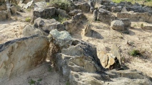
Nearby Images from Flickr
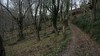
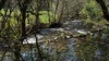
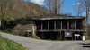
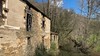
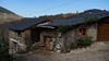
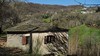
The above images may not be of the site on this page, but were taken nearby. They are loaded from Flickr so please click on them for image credits.
Click here to see more info for this site
Nearby sites
Click here to view sites on an interactive map of the areaKey: Red: member's photo, Blue: 3rd party photo, Yellow: other image, Green: no photo - please go there and take one, Grey: site destroyed
Download sites to:
KML (Google Earth)
GPX (GPS waypoints)
CSV (Garmin/Navman)
CSV (Excel)
To unlock full downloads you need to sign up as a Contributory Member. Otherwise downloads are limited to 50 sites.
Turn off the page maps and other distractions
Nearby sites listing. In the following links * = Image available
4.4km WNW 303° Castro de Valbón Castro or Chafurdão
5.0km NW 324° Castro de Escanlar Castro or Chafurdão
6.7km NNW 327° Castro de Moura Castro or Chafurdão
7.1km WSW 239° Castro de Santa Cristina Castro or Chafurdão
7.3km ESE 108° Castro de Miraz* Castro or Chafurdão
7.8km ESE 118° Castro de Brigo Castro or Chafurdão
8.0km WNW 296° Necrópole Megalítica do Campo de Valentín Barrow Cemetery
8.2km WNW 295° Serra do Edramo Dolmen Burial Chamber or Dolmen
8.4km ESE 106° Castro de Meiraos Castro or Chafurdão
8.4km WNW 288° Castro de Formigueiros* Castro or Chafurdão
9.2km SE 141° Castro da Torre* Castro or Chafurdão
9.3km ESE 115° Castro de Santo Estevo Castro or Chafurdão
9.7km W 281° Necrópole Megalítica de Santa Mariña Barrow Cemetery
10.1km ESE 114° Castro de Piñeira Castro or Chafurdão
10.2km E 98° Castro de Vilela (Folgoso) Castro or Chafurdão
10.4km SE 141° Castro de A Torre Castro or Chafurdão
10.8km ESE 114° Castro da Devesa do Rei Castro or Chafurdão
11.5km SSE 155° Castro de Torexe Castro or Chafurdão
11.5km WNW 289° Castro de Cima da Ribeira Castro or Chafurdão
11.9km ESE 118° Necrópolis Pena do Cuco Barrow Cemetery
12.0km S 172° Castro de Vilamor Castro or Chafurdão
12.2km ESE 117° Castro de Monte Cido Castro or Chafurdão
12.7km E 99° Castro da Escrita ou Tralocastro Castro or Chafurdão
13.5km NE 47° Castro da Coroa (Sinllán) Castro or Chafurdão
14.0km S 173° Castro de Vilar* Castro or Chafurdão
View more nearby sites and additional images


 We would like to know more about this location. Please feel free to add a brief description and any relevant information in your own language.
 Wir möchten mehr über diese Stätte erfahren. Bitte zögern Sie nicht, eine kurze Beschreibung und relevante Informationen in Deutsch hinzuzufügen.
 Nous aimerions en savoir encore un peu sur les lieux. S'il vous plaît n'hesitez pas à ajouter une courte description et tous les renseignements pertinents dans votre propre langue.
 Quisieramos informarnos un poco más de las lugares. No dude en añadir una breve descripción y otros datos relevantes en su propio idioma.