<< Text Pages >> Castro de Cerracín - Castro or Chafurdão in Spain in Galicia
Submitted by holger_rix on Sunday, 20 December 2015 Page Views: 808
Iron Age and Later PrehistorySite Name: Castro de CerracínCountry: Spain
NOTE: This site is 8.395 km away from the location you searched for.
Region: Galicia Type: Castro or Chafurdão
Nearest Town: Lugo Nearest Village: Becerreá
Latitude: 42.662879N Longitude: 7.056313W
Condition:
| 5 | Perfect |
| 4 | Almost Perfect |
| 3 | Reasonable but with some damage |
| 2 | Ruined but still recognisable as an ancient site |
| 1 | Pretty much destroyed, possibly visible as crop marks |
| 0 | No data. |
| -1 | Completely destroyed |
| 5 | Superb |
| 4 | Good |
| 3 | Ordinary |
| 2 | Not Good |
| 1 | Awful |
| 0 | No data. |
| 5 | Can be driven to, probably with disabled access |
| 4 | Short walk on a footpath |
| 3 | Requiring a bit more of a walk |
| 2 | A long walk |
| 1 | In the middle of nowhere, a nightmare to find |
| 0 | No data. |
| 5 | co-ordinates taken by GPS or official recorded co-ordinates |
| 4 | co-ordinates scaled from a detailed map |
| 3 | co-ordinates scaled from a bad map |
| 2 | co-ordinates of the nearest village |
| 1 | co-ordinates of the nearest town |
| 0 | no data |
Be the first person to rate this site - see the 'Contribute!' box in the right hand menu.
Internal Links:
External Links:
Castro in Galicia
You may be viewing yesterday's version of this page. To see the most up to date information please register for a free account.
Do not use the above information on other web sites or publications without permission of the contributor.
Nearby Images from Flickr
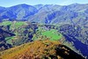


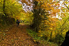

The above images may not be of the site on this page, but were taken nearby. They are loaded from Flickr so please click on them for image credits.
Click here to see more info for this site
Nearby sites
Click here to view sites on an interactive map of the areaKey: Red: member's photo, Blue: 3rd party photo, Yellow: other image, Green: no photo - please go there and take one, Grey: site destroyed
Download sites to:
KML (Google Earth)
GPX (GPS waypoints)
CSV (Garmin/Navman)
CSV (Excel)
To unlock full downloads you need to sign up as a Contributory Member. Otherwise downloads are limited to 50 sites.
Turn off the page maps and other distractions
Nearby sites listing. In the following links * = Image available
3.8km W 273° Castro da Escrita ou Tralocastro Castro or Chafurdão
6.2km W 277° Castro de Vilela (Folgoso) Castro or Chafurdão
6.3km WSW 239° Castro de Monte Cido Castro or Chafurdão
6.8km WSW 239° Necrópolis Pena do Cuco Barrow Cemetery
6.8km WSW 251° Castro da Devesa do Rei Castro or Chafurdão
7.4km WSW 255° Castro de Piñeira Castro or Chafurdão
8.1km WSW 258° Castro de Santo Estevo Castro or Chafurdão
8.2km W 269° Castro de Meiraos Castro or Chafurdão
9.4km W 270° Castro de Miraz* Castro or Chafurdão
9.5km W 261° Castro de Brigo Castro or Chafurdão
11.4km WSW 239° Castro de A Torre Castro or Chafurdão
11.6km WSW 245° Castro da Torre* Castro or Chafurdão
13.0km NNW 331° Castro da Coroa (Sinllán) Castro or Chafurdão
14.1km SW 235° Castro de Torexe Castro or Chafurdão
14.4km NNW 333° Castro de Vilaesteva Castro or Chafurdão
16.4km W 278° Castro da Moura Castro or Chafurdão
16.6km NNE 33° Castro Río de Cereixedo Castro or Chafurdão
16.9km N 350° Castro da Fonte do Cando Castro or Chafurdão
16.9km NNW 327° Castro Monte do Castro (Nogais) Castro or Chafurdão
17.6km WSW 237° Castro de Vilamor Castro or Chafurdão
17.7km N 358° Castro de Pena Tallada Castro or Chafurdão
18.8km SW 231° Castro de Vilar* Castro or Chafurdão
20.2km WNW 288° Castro de Escanlar Castro or Chafurdão
20.5km WNW 283° Castro de Valbón Castro or Chafurdão
20.9km NW 323° Castro de Guilfrei Castro or Chafurdão
View more nearby sites and additional images


 We would like to know more about this location. Please feel free to add a brief description and any relevant information in your own language.
 Wir möchten mehr über diese Stätte erfahren. Bitte zögern Sie nicht, eine kurze Beschreibung und relevante Informationen in Deutsch hinzuzufügen.
 Nous aimerions en savoir encore un peu sur les lieux. S'il vous plaît n'hesitez pas à ajouter une courte description et tous les renseignements pertinents dans votre propre langue.
 Quisieramos informarnos un poco más de las lugares. No dude en añadir una breve descripción y otros datos relevantes en su propio idioma.