<< Other Photo Pages >> Los petroglifos Tilama - Rock Art in Chile
Submitted by KaiHofmann on Monday, 24 January 2011 Page Views: 5290
Rock ArtSite Name: Los petroglifos TilamaCountry: Chile
NOTE: This site is 79.594 km away from the location you searched for.
Type: Rock Art
Nearest Town: Pichidangui Nearest Village: Tilama
Latitude: 32.097252S Longitude: 71.171123W
Condition:
| 5 | Perfect |
| 4 | Almost Perfect |
| 3 | Reasonable but with some damage |
| 2 | Ruined but still recognisable as an ancient site |
| 1 | Pretty much destroyed, possibly visible as crop marks |
| 0 | No data. |
| -1 | Completely destroyed |
| 5 | Superb |
| 4 | Good |
| 3 | Ordinary |
| 2 | Not Good |
| 1 | Awful |
| 0 | No data. |
| 5 | Can be driven to, probably with disabled access |
| 4 | Short walk on a footpath |
| 3 | Requiring a bit more of a walk |
| 2 | A long walk |
| 1 | In the middle of nowhere, a nightmare to find |
| 0 | No data. |
| 5 | co-ordinates taken by GPS or official recorded co-ordinates |
| 4 | co-ordinates scaled from a detailed map |
| 3 | co-ordinates scaled from a bad map |
| 2 | co-ordinates of the nearest village |
| 1 | co-ordinates of the nearest town |
| 0 | no data |
Internal Links:
External Links:
")
You may be viewing yesterday's version of this page. To see the most up to date information please register for a free account.
Do not use the above information on other web sites or publications without permission of the contributor.
Nearby Images from Flickr
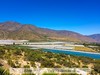
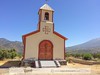
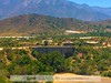
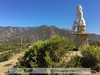
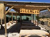
The above images may not be of the site on this page, but were taken nearby. They are loaded from Flickr so please click on them for image credits.
Click here to see more info for this site
Nearby sites
Click here to view sites on an interactive map of the areaKey: Red: member's photo, Blue: 3rd party photo, Yellow: other image, Green: no photo - please go there and take one, Grey: site destroyed
Download sites to:
KML (Google Earth)
GPX (GPS waypoints)
CSV (Garmin/Navman)
CSV (Excel)
To unlock full downloads you need to sign up as a Contributory Member. Otherwise downloads are limited to 50 sites.
Turn off the page maps and other distractions
Nearby sites listing. In the following links * = Image available
156.2km N 353° Valle del Encanto* Rock Art
156.4km SSE 163° Museo Nacional de Historia Natural, MNHN* Museum
156.9km SSE 162° Museo Chileno de Arte Precolombino de Santiago de Chile* Museum
158.2km SSE 162° Parque Almagro* Modern Stone Circle etc
188.2km N 7° Petroglifos de las Tinajas* Rock Art
191.6km N 8° Stone house Pichasca* Ancient Village or Settlement
244.1km N 358° Archaeological Museum of La Serena* Museum
317.8km N 8° Los petroglifos del Cerro La Silla Rock Art
623.3km NE 39° El Shincal Ancient Village or Settlement
770.3km N 11° San Ramon 15 Ancient Mine, Quarry or other Industry
779.6km NE 44° Tafi del Valle* Sculptured Stone
780.3km NE 41° Fuerte Quemado* Ancient Village or Settlement
796.2km NE 41° Museo Pachamama* Museum
799.9km NE 40° Los Quilmes* Ancient Village or Settlement
861.3km NNE 18° Llullaillaco Vault Chambered Tomb
916.9km NNE 33° Archaeological Museum Pío Pablo Díaz* Museum
917.5km NNE 33° Mariscal Ancient Village or Settlement
918.5km NNE 33° Bogatta Ancient Village or Settlement
950.8km NNE 33° Potrero de Payogasta* Ancient Village or Settlement
957.9km S 190° Pilauco Ancient Village or Settlement
988.3km NE 36° MAAM* Museum
1055.3km NNE 17° Tulor Ancient Village or Settlement
1061.5km S 189° Monte Verde* Ancient Village or Settlement
1062.9km NNE 17° R. P. Gustavo Le Paige Archaeological Museum* Museum
1063.2km NNE 17° Pucara de Quitor* Stone Fort or Dun
View more nearby sites and additional images


 We would like to know more about this location. Please feel free to add a brief description and any relevant information in your own language.
 Wir möchten mehr über diese Stätte erfahren. Bitte zögern Sie nicht, eine kurze Beschreibung und relevante Informationen in Deutsch hinzuzufügen.
 Nous aimerions en savoir encore un peu sur les lieux. S'il vous plaît n'hesitez pas à ajouter une courte description et tous les renseignements pertinents dans votre propre langue.
 Quisieramos informarnos un poco más de las lugares. No dude en añadir una breve descripción y otros datos relevantes en su propio idioma.