<< Our Photo Pages >> Tiwanaku - Akapana Pyramid - Pyramid / Mastaba in Bolivia
Submitted by bat400 on Wednesday, 21 October 2009 Page Views: 16923
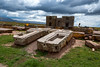
Multi-periodSite Name: Tiwanaku - Akapana PyramidCountry: Bolivia
NOTE: This site is 126.05 km away from the location you searched for.
Type: Pyramid / Mastaba
Nearest Village: Tiwanaku
Latitude: 16.55631S Longitude: 68.67283W
Condition:
| 5 | Perfect |
| 4 | Almost Perfect |
| 3 | Reasonable but with some damage |
| 2 | Ruined but still recognisable as an ancient site |
| 1 | Pretty much destroyed, possibly visible as crop marks |
| 0 | No data. |
| -1 | Completely destroyed |
| 5 | Superb |
| 4 | Good |
| 3 | Ordinary |
| 2 | Not Good |
| 1 | Awful |
| 0 | No data. |
| 5 | Can be driven to, probably with disabled access |
| 4 | Short walk on a footpath |
| 3 | Requiring a bit more of a walk |
| 2 | A long walk |
| 1 | In the middle of nowhere, a nightmare to find |
| 0 | No data. |
| 5 | co-ordinates taken by GPS or official recorded co-ordinates |
| 4 | co-ordinates scaled from a detailed map |
| 3 | co-ordinates scaled from a bad map |
| 2 | co-ordinates of the nearest village |
| 1 | co-ordinates of the nearest town |
| 0 | no data |
Internal Links:
External Links:
I have visited· I would like to visit
Ogham has visited here
")
Built around 1200 BC and is described by experts as one of the biggest pre-Columbian constructions in South America (45 feet high.)
The pyramid is dramatically damaged by looting and quarrying that began with the Spanish Conquest and has continued through the 20th Century. A large "looter's hole" can be seen in the center of the pyramid's top surface.
Note: Renovations to attract tourists to Akapana pyramid may end in building being removed from UN list of archaeological treasures
You may be viewing yesterday's version of this page. To see the most up to date information please register for a free account.
Do not use the above information on other web sites or publications without permission of the contributor.
Nearby Images from Flickr
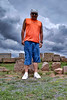
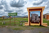
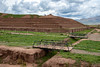
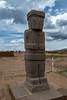

The above images may not be of the site on this page, but were taken nearby. They are loaded from Flickr so please click on them for image credits.
Click here to see more info for this site
Nearby sites
Click here to view sites on an interactive map of the areaKey: Red: member's photo, Blue: 3rd party photo, Yellow: other image, Green: no photo - please go there and take one, Grey: site destroyed
Download sites to:
KML (Google Earth)
GPX (GPS waypoints)
CSV (Garmin/Navman)
CSV (Excel)
To unlock full downloads you need to sign up as a Contributory Member. Otherwise downloads are limited to 50 sites.
Turn off the page maps and other distractions
Nearby sites listing. In the following links * = Image available
180m NNW 340° Tiwanaku* Ancient Village or Settlement
965m SW 232° Pumapunku* Ancient Temple
29.7km NNW 341° Suriki Island* Ancient Mine, Quarry or other Industry
61.8km NW 314° Copacabana Ceremonial Center Ancient Temple
75.0km W 268° Cuncaicha Natural Stone / Erratic / Other Natural Feature
76.6km NW 319° La Fuente del Inca* Holy Well or Sacred Spring
102.1km WNW 295° Aramu Muru* Sculptured Stone
123.9km WNW 288° Jiskairumoko Ancient Village or Settlement
149.3km WNW 299° Puno Fertility Sanctuary* Ancient Temple
183.9km WNW 300° Sillustani necropolis* Ancient Temple
187.1km WNW 302° Lake Titicaca Raised Fields Ancient Village or Settlement
240.7km WSW 255° Cerro Baul Ancient Village or Settlement
266.5km SW 218° Lluta Valley Geoglyphs* Hill Figure or Geoglyph
270.3km SW 216° San Miguel de Azapa Archaeological Museum* Museum
270.8km SW 215° Azapa Valley Geoglyphs* Hill Figure or Geoglyph
274.2km SW 217° Cerro Sagrado Geoglyphs Hill Figure or Geoglyph
274.4km SW 217° La Tropilla Geoglyphs* Hill Figure or Geoglyph
292.9km WNW 282° Sumbay Rock Art
300.3km WSW 246° Museo Chiribaya Museum
302.7km WSW 246° Chiribaya Alta Ancient Village or Settlement
326.7km SSW 205° Chiza Geoglyphs* Hill Figure or Geoglyph
359.8km SSW 202° Tiliviche Geoglyphs* Hill Figure or Geoglyph
383.0km SSW 193° Tarapacá geoglyphs Hill Figure or Geoglyph
390.7km SSW 195° Atacama Giant* Hill Figure or Geoglyph
392.2km NW 312° Raqchi* Ancient Temple
View more nearby sites and additional images


 We would like to know more about this location. Please feel free to add a brief description and any relevant information in your own language.
 Wir möchten mehr über diese Stätte erfahren. Bitte zögern Sie nicht, eine kurze Beschreibung und relevante Informationen in Deutsch hinzuzufügen.
 Nous aimerions en savoir encore un peu sur les lieux. S'il vous plaît n'hesitez pas à ajouter une courte description et tous les renseignements pertinents dans votre propre langue.
 Quisieramos informarnos un poco más de las lugares. No dude en añadir una breve descripción y otros datos relevantes en su propio idioma.