<< Text Pages >> Augustine Mound - Round Barrow(s) in Canada
Submitted by Andy B on Friday, 24 November 2017 Page Views: 4853
Neolithic and Bronze AgeSite Name: Augustine Mound Alternative Name: Metepenagiag Mound, Oxbow Archaeological Site (nearby)Country: Canada Type: Round Barrow(s)
Latitude: 46.957150N Longitude: 65.8377W
Condition:
| 5 | Perfect |
| 4 | Almost Perfect |
| 3 | Reasonable but with some damage |
| 2 | Ruined but still recognisable as an ancient site |
| 1 | Pretty much destroyed, possibly visible as crop marks |
| 0 | No data. |
| -1 | Completely destroyed |
| 5 | Superb |
| 4 | Good |
| 3 | Ordinary |
| 2 | Not Good |
| 1 | Awful |
| 0 | No data. |
| 5 | Can be driven to, probably with disabled access |
| 4 | Short walk on a footpath |
| 3 | Requiring a bit more of a walk |
| 2 | A long walk |
| 1 | In the middle of nowhere, a nightmare to find |
| 0 | No data. |
| 5 | co-ordinates taken by GPS or official recorded co-ordinates |
| 4 | co-ordinates scaled from a detailed map |
| 3 | co-ordinates scaled from a bad map |
| 2 | co-ordinates of the nearest village |
| 1 | co-ordinates of the nearest town |
| 0 | no data |
Be the first person to rate this site - see the 'Contribute!' box in the right hand menu.
Internal Links:
External Links:
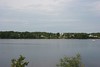
Augustine Mound National Historic Site is an archaeological site located within the reserve land of the Metepenagiag Mi’kmaq Nation, New Brunswick, on the north side of the Little Southwest Miramichi River across from the present Mi’kmaq community. It includes a circular ritual site surrounding a slightly elevated burial mound that sits on low terrace near the junction of the Northwest and Little Southwest Miramichi Rivers.
Augustine Mound National Historic Site of Canada is located 700 metres east of the Oxbow National Historic Site of Canada.
Augustine Mound was designated a National Historic Site of Canada in 1975 because
- this site is an exceptional and enduring expression of Mi’kmaw spirituality, exhibiting burial rituals and artifacts directly connected to Adena traditions in eastern North America 2500 years ago.
Source: Canada's Historic Places, see also Wikipedia
You may be viewing yesterday's version of this page. To see the most up to date information please register for a free account.
Do not use the above information on other web sites or publications without permission of the contributor.
Nearby Images from Flickr

The above images may not be of the site on this page, but were taken nearby. They are loaded from Flickr so please click on them for image credits.
Click here to see more info for this site
Nearby sites
Click here to view sites on an interactive map of the areaKey: Red: member's photo, Blue: 3rd party photo, Yellow: other image, Green: no photo - please go there and take one, Grey: site destroyed
Download sites to:
KML (Google Earth)
GPX (GPS waypoints)
CSV (Garmin/Navman)
CSV (Excel)
To unlock full downloads you need to sign up as a Contributory Member. Otherwise downloads are limited to 50 sites.
Turn off the page maps and other distractions
Nearby sites listing. In the following links * = Image available
278.5km SSW 205° Machias Bay Petroglyphs Rock Art
296.7km SE 142° Sibley Rock Burial Chamber or Dolmen
297.3km SSE 156° Stone Arrangements on Oak Island Modern Stone Circle etc
300.9km SE 145° Admirals Park Dolmen Burial Chamber or Dolmen
313.5km SE 146° Kidston Lake Dolmen Burial Chamber or Dolmen
315.3km SE 146° Roachs Pond Dolmen Burial Chamber or Dolmen
405.3km E 101° Big Hill Dolmen Burial Chamber or Dolmen
408.6km W 270° Quebec ice dolmen* Modern Stone Circle etc
424.0km ESE 106° Loch Lomond Circle Modern Stone Circle etc
564.7km WSW 248° Balancing Stone Westfield Natural Stone / Erratic / Other Natural Feature
586.1km WSW 245° Elmore Balancing Rock* Natural Stone / Erratic / Other Natural Feature
598.6km SW 226° Pawtuckaway Balancing Rock* Natural Stone / Erratic / Other Natural Feature
614.9km WSW 258° Charles De Gaulle Obelisk* Modern Stone Circle etc
621.4km SW 231° Mount Kearsarge Indian Museum Museum
621.5km WSW 237° Humming Stone Norwich (Summstein) Modern Stone Circle etc
622.9km SW 225° America's Stonehenge* Ancient Village or Settlement
645.3km WSW 237° Calendar II* Artificial Mound
647.2km WSW 251° Earthwood Modern Stone Circle Modern Stone Circle etc
658.2km SSW 211° Fort Hill Sharpening Stone* Polissoir
670.2km SW 233° Bellows Falls Petroglyphs* Rock Art
670.4km SW 220° Mary Caroline Herter Public Garden Modern Stone Circle etc
676.8km WSW 253° Earthwood new stone circle Modern Stone Circle etc
688.2km SW 226° Wachusett Stone* Natural Stone / Erratic / Other Natural Feature
694.4km SW 220° Foxborough Prayer Seat (3)* Cairn
694.4km SW 220° Foxborough Stone Pile* Cairn
View more nearby sites and additional images


 We would like to know more about this location. Please feel free to add a brief description and any relevant information in your own language.
 Wir möchten mehr über diese Stätte erfahren. Bitte zögern Sie nicht, eine kurze Beschreibung und relevante Informationen in Deutsch hinzuzufügen.
 Nous aimerions en savoir encore un peu sur les lieux. S'il vous plaît n'hesitez pas à ajouter une courte description et tous les renseignements pertinents dans votre propre langue.
 Quisieramos informarnos un poco más de las lugares. No dude en añadir una breve descripción y otros datos relevantes en su propio idioma.