


<< Our Photo Pages >> Rock Art near Victoria, Grenada - Rock Art in Caribbean Islands
Submitted by MikeShort on Saturday, 03 July 2010 Page Views: 5554
Rock ArtSite Name: Rock Art near Victoria, GrenadaCountry: Caribbean Islands
NOTE: This site is 296.503 km away from the location you searched for.
Type: Rock Art
Nearest Town: Victoria
Latitude: 12.194080N Longitude: 61.70934W
Condition:
| 5 | Perfect |
| 4 | Almost Perfect |
| 3 | Reasonable but with some damage |
| 2 | Ruined but still recognisable as an ancient site |
| 1 | Pretty much destroyed, possibly visible as crop marks |
| 0 | No data. |
| -1 | Completely destroyed |
| 5 | Superb |
| 4 | Good |
| 3 | Ordinary |
| 2 | Not Good |
| 1 | Awful |
| 0 | No data. |
| 5 | Can be driven to, probably with disabled access |
| 4 | Short walk on a footpath |
| 3 | Requiring a bit more of a walk |
| 2 | A long walk |
| 1 | In the middle of nowhere, a nightmare to find |
| 0 | No data. |
| 5 | co-ordinates taken by GPS or official recorded co-ordinates |
| 4 | co-ordinates scaled from a detailed map |
| 3 | co-ordinates scaled from a bad map |
| 2 | co-ordinates of the nearest village |
| 1 | co-ordinates of the nearest town |
| 0 | no data |
Internal Links:
External Links:
")
Boulder with two carvings from the Pre-Contact (Pre-Columbian) period. Dating is the subject of much debate but said to correspond to the Late Troumassoid / Suazoid period (ceramaic dating periods) approximately 900-1100AD, but possibly earlier. This is despite the fact that imagery on ceramics of those periods significantly differ from imagery on rock art but the theory has recently been advanced by Henry Petitjean Roget that ceramic art was executed by women and rock art by men.
About 50m further South on the opposite side of the road, there is said to be a further carving in a small cave high above the road. The cutting of the soft rock face during road widening and subsequent slippage has made access impossible except with a very long ladder.
May 2010
You may be viewing yesterday's version of this page. To see the most up to date information please register for a free account.
")
")
Do not use the above information on other web sites or publications without permission of the contributor.
Nearby Images from Flickr
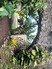
The above images may not be of the site on this page, but were taken nearby. They are loaded from Flickr so please click on them for image credits.
Click here to see more info for this site
Nearby sites
Click here to view sites on an interactive map of the areaKey: Red: member's photo, Blue: 3rd party photo, Yellow: other image, Green: no photo - please go there and take one, Grey: site destroyed
Download sites to:
KML (Google Earth)
GPX (GPS waypoints)
CSV (Garmin/Navman)
CSV (Excel)
To unlock full downloads you need to sign up as a Contributory Member. Otherwise downloads are limited to 50 sites.
Turn off the page maps and other distractions
Nearby sites listing. In the following links * = Image available
1.6km NE 44° Rock Art near Waltham, Victoria, Grenada* Rock Art
3.2km ENE 69° Duquense Bay Petroglyphs, Grenada (Caribbean)* Rock Art
4.4km ENE 70° Man-Face petroglyph (Union, Grenada)* Rock Art
7.4km E 94° Mt Rich Grenada (Caribbean)* Rock Art
121.2km NNE 23° St Vincent, Buccament* Rock Art
124.3km NNE 29° St Vincent - Yambou Pass* Rock Art
124.9km NNE 22° St Vincent - Borrouallie* Rock Art
132.3km NNE 28° St Vincent, Colonarie* Rock Art
161.8km SSE 164° Blanchisseuse Ancient Village or Settlement
420.0km N 1° Trois Rivières Rock Carvings Rock Art
535.5km N 360° Indian Creek Ancient Village or Settlement
557.7km SSE 151° Wyva Creek Shell Mound Artificial Mound
786.8km W 271° Curaçao Hato Caves Rock Art
833.8km NW 321° Ponce Plaza (Puerto Rico) Rock Art
869.5km NW 322° Caguana* Standing Stones
877.5km NW 324° La Cueva del Indio (Puerto Rico)* Rock Art
1121.3km NW 310° Padre Nuestro Caves (Dominican Republic) Rock Art
1182.6km NW 311° Raul de Monteclaro (Dominican Rep) Rock Art
1194.4km WSW 248° El Porvenir Not Known (by us)
1282.2km NW 305° Las Caritas de Los Indios* Rock Art
1336.6km W 266° Ciudad Perdida* Ancient Village or Settlement
1339.2km W 267° El Pueblito Ancient Village or Settlement
1412.6km SE 127° Mont d'Argent rock art* Rock Art
1490.7km WSW 242° El Infiernito* Standing Stones
1599.8km WSW 239° Museo del Oro (Bogota)* Museum
View more nearby sites and additional images


 We would like to know more about this location. Please feel free to add a brief description and any relevant information in your own language.
 Wir möchten mehr über diese Stätte erfahren. Bitte zögern Sie nicht, eine kurze Beschreibung und relevante Informationen in Deutsch hinzuzufügen.
 Nous aimerions en savoir encore un peu sur les lieux. S'il vous plaît n'hesitez pas à ajouter une courte description et tous les renseignements pertinents dans votre propre langue.
 Quisieramos informarnos un poco más de las lugares. No dude en añadir una breve descripción y otros datos relevantes en su propio idioma.