<< Our Photo Pages >> Mina del Chiflón - Ancient Mine, Quarry or other Industry in Spain in Andalucía
Submitted by Maatje on Sunday, 12 February 2023 Page Views: 265
Multi-periodSite Name: Mina del Chiflón Alternative Name: Chiflón Mine El PozueloCountry: Spain
NOTE: This site is 1.008 km away from the location you searched for.
Region: Andalucía Type: Ancient Mine, Quarry or other Industry
Nearest Town: Huelva Nearest Village: El Pozuelo
Latitude: 37.362367N Longitude: 6.382555W
Condition:
| 5 | Perfect |
| 4 | Almost Perfect |
| 3 | Reasonable but with some damage |
| 2 | Ruined but still recognisable as an ancient site |
| 1 | Pretty much destroyed, possibly visible as crop marks |
| 0 | No data. |
| -1 | Completely destroyed |
| 5 | Superb |
| 4 | Good |
| 3 | Ordinary |
| 2 | Not Good |
| 1 | Awful |
| 0 | No data. |
| 5 | Can be driven to, probably with disabled access |
| 4 | Short walk on a footpath |
| 3 | Requiring a bit more of a walk |
| 2 | A long walk |
| 1 | In the middle of nowhere, a nightmare to find |
| 0 | No data. |
| 5 | co-ordinates taken by GPS or official recorded co-ordinates |
| 4 | co-ordinates scaled from a detailed map |
| 3 | co-ordinates scaled from a bad map |
| 2 | co-ordinates of the nearest village |
| 1 | co-ordinates of the nearest town |
| 0 | no data |
Internal Links:
External Links:
")
This mine of Chiflón is found in a region close to many Dolmen of El Pozuelo. It is said to be in use since the Bronzeage.
You may be viewing yesterday's version of this page. To see the most up to date information please register for a free account.
")
")
Do not use the above information on other web sites or publications without permission of the contributor.
Nearby Images from Flickr

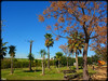
The above images may not be of the site on this page, but were taken nearby. They are loaded from Flickr so please click on them for image credits.
Click here to see more info for this site
Nearby sites
Click here to view sites on an interactive map of the areaKey: Red: member's photo, Blue: 3rd party photo, Yellow: other image, Green: no photo - please go there and take one, Grey: site destroyed
Download sites to:
KML (Google Earth)
GPX (GPS waypoints)
CSV (Garmin/Navman)
CSV (Excel)
To unlock full downloads you need to sign up as a Contributory Member. Otherwise downloads are limited to 50 sites.
Turn off the page maps and other distractions
Nearby sites listing. In the following links * = Image available
25.1km NW 308° De La Hueca Dolmen 2 Burial Chamber or Dolmen
25.1km NW 307° De La Hueca Dolmen 1 Burial Chamber or Dolmen
28.0km NNW 327° Mascotejo Dolmen Burial Chamber or Dolmen
28.1km E 80° Matarrubilla Dolmen* Burial Chamber or Dolmen
28.3km NNW 336° Casullo Dolmen Burial Chamber or Dolmen
28.7km ENE 79° La Pastora Dolmen* Chambered Tomb
29.1km E 79° Dolmen de Montelirio* Burial Chamber or Dolmen
31.0km NNW 334° Dolmen Puerto Huertos Burial Chamber or Dolmen
31.0km ENE 73° Itálica Santiponce Ancient Village or Settlement
32.6km W 268° Dolmen de Soto* Chambered Tomb
33.7km WNW 290° Cabezo de la Sepultura Dolmen Burial Chamber or Dolmen
34.9km NW 320° El Pozuelo Dolmen 1* Chambered Cairn
34.9km NW 320° El Pozuelo Dolmen 2* Chambered Cairn
35.0km E 88° Museo Arqueológico de Sevilla* Museum
35.0km NW 320° El Pozuelo Dolmen 3* Chambered Cairn
35.0km NW 320° El Pozuelo Dolmen 4* Chambered Cairn
36.0km NW 318° El Pozuelo Dolmen 5* Chambered Cairn
36.2km NW 307° Gabrieles Dolmen 6* Burial Chamber or Dolmen
36.3km NW 318° El Pozuelo Dolmen 8* Chambered Cairn
36.3km NW 307° Gabrieles Dolmen 5 Burial Chamber or Dolmen
36.3km NW 307° Gabrieles Dolmen 4* Burial Chamber or Dolmen
36.4km NW 307° Gabrieles Dolmen 3* Burial Chamber or Dolmen
36.4km NNW 338° La Lancha Dolmen Burial Chamber or Dolmen
36.4km NW 318° El Pozuelo Dolmen 6* Chambered Cairn
36.5km WNW 289° El Labradillo Dolmen 1* Burial Chamber or Dolmen
View more nearby sites and additional images


 We would like to know more about this location. Please feel free to add a brief description and any relevant information in your own language.
 Wir möchten mehr über diese Stätte erfahren. Bitte zögern Sie nicht, eine kurze Beschreibung und relevante Informationen in Deutsch hinzuzufügen.
 Nous aimerions en savoir encore un peu sur les lieux. S'il vous plaît n'hesitez pas à ajouter une courte description et tous les renseignements pertinents dans votre propre langue.
 Quisieramos informarnos un poco más de las lugares. No dude en añadir una breve descripción y otros datos relevantes en su propio idioma.