

<< Our Photo Pages >> Dun Merkadale - Stone Fort or Dun in Scotland in Isle of Skye
Submitted by Andy B on Tuesday, 19 October 2010 Page Views: 5414
Multi-periodSite Name: Dun MerkadaleCountry: Scotland
NOTE: This site is 1.009 km away from the location you searched for.
County: Isle of Skye Type: Stone Fort or Dun
Map Ref: NG38983061
Latitude: 57.291250N Longitude: 6.333898W
Condition:
| 5 | Perfect |
| 4 | Almost Perfect |
| 3 | Reasonable but with some damage |
| 2 | Ruined but still recognisable as an ancient site |
| 1 | Pretty much destroyed, possibly visible as crop marks |
| 0 | No data. |
| -1 | Completely destroyed |
| 5 | Superb |
| 4 | Good |
| 3 | Ordinary |
| 2 | Not Good |
| 1 | Awful |
| 0 | No data. |
| 5 | Can be driven to, probably with disabled access |
| 4 | Short walk on a footpath |
| 3 | Requiring a bit more of a walk |
| 2 | A long walk |
| 1 | In the middle of nowhere, a nightmare to find |
| 0 | No data. |
| 5 | co-ordinates taken by GPS or official recorded co-ordinates |
| 4 | co-ordinates scaled from a detailed map |
| 3 | co-ordinates scaled from a bad map |
| 2 | co-ordinates of the nearest village |
| 1 | co-ordinates of the nearest town |
| 0 | no data |
Be the first person to rate this site - see the 'Contribute!' box in the right hand menu.
Internal Links:
External Links:
")
Dun Merkadale, a dun sub-oval on plan, and measuring internally some 36ft NNW-SSE and about 30ft in width. The wall, built on the edge of a plateau, has disappeared round the flanks and S end, and even the section built across the plateau at the N end shows only as a shapeless mass of stone and earth 9ft wide and 4ft high. The entrance has been at the NW and is indicated by a few stones remaining in position on the left side. The roadway approaching the entrance slopes up the W side.
Source: Canmore
You may be viewing yesterday's version of this page. To see the most up to date information please register for a free account.
Do not use the above information on other web sites or publications without permission of the contributor.
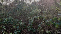
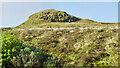
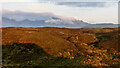
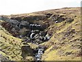
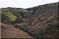
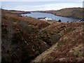
Nearby Images from Geograph Britain and Ireland:
©2023(licence)
©2023(licence)
©2006(licence)
©2019(licence)
©2009(licence)
The above images may not be of the site on this page, they are loaded from Geograph.
Please Submit an Image of this site or go out and take one for us!
Click here to see more info for this site
Nearby sites
Key: Red: member's photo, Blue: 3rd party photo, Yellow: other image, Green: no photo - please go there and take one, Grey: site destroyed
Download sites to:
KML (Google Earth)
GPX (GPS waypoints)
CSV (Garmin/Navman)
CSV (Excel)
To unlock full downloads you need to sign up as a Contributory Member. Otherwise downloads are limited to 50 sites.
Turn off the page maps and other distractions
Nearby sites listing. In the following links * = Image available
5.9km NW 307° Crois Mic Jamain Standing Stones (NG345345)
6.5km NNW 332° Dun Taimh* Stone Fort or Dun (NG363366)
6.8km WSW 254° Dun Sleadale* Broch or Nuraghe (NG323292)
7.5km NW 310° Dun Ardtreck* Broch or Nuraghe (NG335358)
8.0km SSW 202° Kraiknish* Stone Fort or Dun (NG35462340)
8.3km NNW 331° Dun Diarmaid* Broch or Nuraghe (NG35453816)
8.7km NNW 337° Dun Garsin* Broch or Nuraghe (NG361388)
8.7km NW 319° Struanmore* Chambered Cairn (NG337376)
8.9km W 280° Cave of the Speckled Horses Cave or Rock Shelter (NG30283264)
9.4km NW 324° Dun Beag (Struan)* Broch or Nuraghe (NG3395438630)
9.6km N 5° Tungadal* Souterrain (Fogou, Earth House) (NG404401)
9.6km NW 321° Ullinish Souterrain Souterrain (Fogou, Earth House) (NG334385)
9.7km NW 326° Dun Mor (Struan)* Stone Fort or Dun (NG340390)
9.8km NW 314° Ullinish Lodge* Chambered Cairn (NG323378)
11.3km ESE 107° River Sligachan Stone Circle (NG49582662)
12.6km NNW 338° Dun Arkaig* Broch or Nuraghe (NG350426)
14.2km S 175° Rubh' an Dunain Cairn* Chambered Cairn (NG39341636)
14.3km NW 322° Dun Abhuinn Bhaile Mheadhonaich* Stone Fort or Dun (NG309425)
14.6km S 174° Rubh' an Dunain Broch* Broch or Nuraghe (NG39581597)
14.8km NW 319° Dun Feorlig* Broch or Nuraghe (NG299423)
14.8km NW 309° Dun Neill* Stone Fort or Dun (NG28114073)
15.1km ENE 67° Dunan An Aisilidh* Stone Fort or Dun (NG53203571)
16.2km NW 322° Vatten* Cairn (NG2983843987)
16.8km ENE 65° Raasay* Class II Pictish Symbol Stone (NG54673677)
17.1km NNE 34° Dun Torvaig* Stone Fort or Dun (NG49374422)
View more nearby sites and additional images


 We would like to know more about this location. Please feel free to add a brief description and any relevant information in your own language.
 Wir möchten mehr über diese Stätte erfahren. Bitte zögern Sie nicht, eine kurze Beschreibung und relevante Informationen in Deutsch hinzuzufügen.
 Nous aimerions en savoir encore un peu sur les lieux. S'il vous plaît n'hesitez pas à ajouter une courte description et tous les renseignements pertinents dans votre propre langue.
 Quisieramos informarnos un poco más de las lugares. No dude en añadir una breve descripción y otros datos relevantes en su propio idioma.