 with our Megalithic Portal iPhone app")


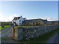
<< Text Pages >> Kintra (Islay) - Standing Stone (Menhir) in Scotland in Isle of Islay
Submitted by nicoladidsbury on Tuesday, 14 September 2004 Page Views: 4889
Neolithic and Bronze AgeSite Name: Kintra (Islay)Country: Scotland
NOTE: This site is 3.136 km away from the location you searched for.
County: Isle of Islay Type: Standing Stone (Menhir)
Map Ref: NR319483 Landranger Map Number: 60
Latitude: 55.654015N Longitude: 6.263573W
Condition:
| 5 | Perfect |
| 4 | Almost Perfect |
| 3 | Reasonable but with some damage |
| 2 | Ruined but still recognisable as an ancient site |
| 1 | Pretty much destroyed, possibly visible as crop marks |
| 0 | No data. |
| -1 | Completely destroyed |
| 5 | Superb |
| 4 | Good |
| 3 | Ordinary |
| 2 | Not Good |
| 1 | Awful |
| 0 | No data. |
| 5 | Can be driven to, probably with disabled access |
| 4 | Short walk on a footpath |
| 3 | Requiring a bit more of a walk |
| 2 | A long walk |
| 1 | In the middle of nowhere, a nightmare to find |
| 0 | No data. |
| 5 | co-ordinates taken by GPS or official recorded co-ordinates |
| 4 | co-ordinates scaled from a detailed map |
| 3 | co-ordinates scaled from a bad map |
| 2 | co-ordinates of the nearest village |
| 1 | co-ordinates of the nearest town |
| 0 | no data |
Be the first person to rate this site - see the 'Contribute!' box in the right hand menu.
Internal Links:
External Links:
Standing Stone in Islay. This unworked portable stone lies beside a tumbled wall. It has a flat-bottomed bowl with no evidence of a drain hole and is most probably a mortar-stone of no special significance.
You may be viewing yesterday's version of this page. To see the most up to date information please register for a free account.
Do not use the above information on other web sites or publications without permission of the contributor.
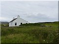
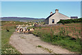
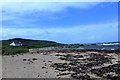
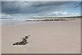
Nearby Images from Geograph Britain and Ireland:
©2011(licence)
©2009(licence)
©2016(licence)
©2016(licence)
©2014(licence)
The above images may not be of the site on this page, they are loaded from Geograph.
Please Submit an Image of this site or go out and take one for us!
Click here to see more info for this site
Nearby sites
Key: Red: member's photo, Blue: 3rd party photo, Yellow: other image, Green: no photo - please go there and take one, Grey: site destroyed
Download sites to:
KML (Google Earth)
GPX (GPS waypoints)
CSV (Garmin/Navman)
CSV (Excel)
To unlock full downloads you need to sign up as a Contributory Member. Otherwise downloads are limited to 50 sites.
![]()
Turn off the page maps and other distractions
Nearby sites listing. In the following links * = Image available
714m WSW 238° Dun A'chail* Stone Fort or Dun (NR31274796)
1.0km ESE 114° Carragh Bhan* Standing Stone (Menhir) (NR32834781)
1.4km SSW 213° Coille A'chnoic Mhoir* Standing Stone (Menhir) (NR31094721)
1.6km SSW 208° Frachdale* Chambered Cairn (NR31054693)
2.4km SSE 159° Cornabus Standing Stone (Menhir) (NR32644600)
3.3km SSE 158° Cragabus* Chambered Cairn (NR3292445189)
3.7km WSW 238° Gleann Bun An Easa* Misc. Earthwork (NR2863146542)
3.8km SSE 165° Upper Cragabus* Cairn (NR32654459)
5.6km SSW 199° Glac A` Charraigh* Standing Stone (Menhir) (NR2975443158)
5.7km ESE 110° Branhunisary* Standing Stone (Menhir) (NR37134603)
5.9km ESE 114° Port Ellen* Standing Stone (Menhir) (NR372456)
6.7km ESE 101° Kilbride* Standing Stone (Menhir) (NR38384657)
6.8km ESE 107° Torradale Standing Stone* Chambered Tomb (NR383459)
7.4km ESE 104° Achnancarranan* Stone Row / Alignment (NR38954606)
7.4km E 101° Ballynaughton* Chambered Cairn (NR39074646)
7.5km ESE 111° Laphroaig (Druim Mor) Standing Stone (Menhir) (NR388452)
7.9km ESE 102° Lagavulin N* Stone Row / Alignment (NR39544621)
7.9km ESE 103° Druim Mor Guide Stone* Marker Stone (NR3953346040)
8.1km ESE 103° Druim Mor (Lagavulin)* Cairn (NR39714592)
9.2km E 97° Dun Dearg Stone Fort or Dun (NR41004664)
11.5km E 85° Cnoc Rhaonastil Standing Stone (Menhir) (NR434485)
11.7km NW 319° Port Charlotte* Chambered Cairn (NR2482957613)
11.7km E 86° Clachan Cean Ile* Standing Stones (NR43684832)
12.3km E 82° Ardilistry* Stone Circle (NR44264919)
12.9km NNE 15° Neriby (Bridgend) Standing Stone (Menhir) (NR35956053)
View more nearby sites and additional images


 We would like to know more about this location. Please feel free to add a brief description and any relevant information in your own language.
 Wir möchten mehr über diese Stätte erfahren. Bitte zögern Sie nicht, eine kurze Beschreibung und relevante Informationen in Deutsch hinzuzufügen.
 Nous aimerions en savoir encore un peu sur les lieux. S'il vous plaît n'hesitez pas à ajouter une courte description et tous les renseignements pertinents dans votre propre langue.
 Quisieramos informarnos un poco más de las lugares. No dude en añadir una breve descripción y otros datos relevantes en su propio idioma.