


<< Our Photo Pages >> Higher Botallack Enclosure - Ancient Village or Settlement in England in Cornwall
Submitted by coldrum on Sunday, 27 July 2008 Page Views: 4666
Multi-periodSite Name: Higher Botallack EnclosureCountry: England
NOTE: This site is 0.824 km away from the location you searched for.
County: Cornwall Type: Ancient Village or Settlement
Nearest Town: Botallack
Map Ref: SW377327
Latitude: 50.136241N Longitude: 5.672047W
Condition:
| 5 | Perfect |
| 4 | Almost Perfect |
| 3 | Reasonable but with some damage |
| 2 | Ruined but still recognisable as an ancient site |
| 1 | Pretty much destroyed, possibly visible as crop marks |
| 0 | No data. |
| -1 | Completely destroyed |
| 5 | Superb |
| 4 | Good |
| 3 | Ordinary |
| 2 | Not Good |
| 1 | Awful |
| 0 | No data. |
| 5 | Can be driven to, probably with disabled access |
| 4 | Short walk on a footpath |
| 3 | Requiring a bit more of a walk |
| 2 | A long walk |
| 1 | In the middle of nowhere, a nightmare to find |
| 0 | No data. |
| 5 | co-ordinates taken by GPS or official recorded co-ordinates |
| 4 | co-ordinates scaled from a detailed map |
| 3 | co-ordinates scaled from a bad map |
| 2 | co-ordinates of the nearest village |
| 1 | co-ordinates of the nearest town |
| 0 | no data |
Internal Links:
External Links:
")
Enclosure.
You may be viewing yesterday's version of this page. To see the most up to date information please register for a free account.
")
")
")
Do not use the above information on other web sites or publications without permission of the contributor.
Nearby Images from Geograph Britain and Ireland:
©2015(licence)
©2009(licence)
©2017(licence)
©2009(licence)
©2005(licence)
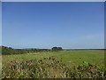
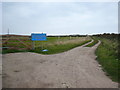
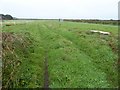
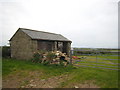
The above images may not be of the site on this page, they are loaded from Geograph.
Please Submit an Image of this site or go out and take one for us!
Click here to see more info for this site
Nearby sites
Key: Red: member's photo, Blue: 3rd party photo, Yellow: other image, Green: no photo - please go there and take one, Grey: site destroyed
Download sites to:
KML (Google Earth)
GPX (GPS waypoints)
CSV (Garmin/Navman)
CSV (Excel)
To unlock full downloads you need to sign up as a Contributory Member. Otherwise downloads are limited to 50 sites.
Turn off the page maps and other distractions
Nearby sites listing. In the following links * = Image available
329m ENE 73° Camyorth Field System Misc. Earthwork (SW38023278)
382m E 95° No Go By Hill Field System* Misc. Earthwork (SW38083265)
496m ESE 102° Truthwall Barrow* Round Barrow(s) (SW38183257)
654m SE 146° Tregeseal Barrow* Chambered Tomb (SW38043214)
718m NE 49° Carnbean Barrows* Round Barrow(s) (SW38273314)
778m E 89° Truthwall Commom Ancient Village or Settlement (SW38483267)
902m ESE 107° Tregeseal W Stone Circle (SW38553239)
961m ESE 107° Tregeseal C* Stone Circle (SW38613238)
1.0km ESE 106° Tregeseal East* Stone Circle (SW38663237)
1.0km SE 124° Carn Vres* Round Barrow(s) (SW38523209)
1.0km SE 129° Lower Bostraze Misc. Earthwork (SW38473201)
1.1km SSW 198° Venton East* Holy Well or Sacred Spring (SW3732931708)
1.1km ENE 73° Carn Kenidjack propped stone* Natural Stone / Erratic / Other Natural Feature (SW38793297)
1.1km ENE 72° Carn Kenidjack* Rock Outcrop (SW388330)
1.2km E 94° Truthwall Common barrows* Round Barrow(s) (SW38893256)
1.2km NNE 30° Carn Eanes Standing stone* Modern Stone Circle etc (SW38373375)
1.3km E 91° Kenidjack Common holed stones* Stone Row / Alignment (SW39013262)
1.3km SSW 204° The Selus Stone* Early Christian Sculptured Stone (SW371315)
1.4km E 87° Carn Kenidjack Hut Circle and Enclosure Ancient Village or Settlement (SW391327)
1.4km E 79° Carnyorth Circles Ancient Village or Settlement (SW39103289)
1.4km NNE 25° Carn Eanes Cairn* Cairn (SW38373397)
1.5km ENE 66° Portheras Barrow* Round Barrow(s) (SW39143326)
1.6km ENE 75° Boslow Cross* Ancient Cross (SW39253304)
1.6km NNE 18° Pendeen Cross* Ancient Cross (SW38273423)
1.7km NE 34° Higher Boscaswell Well* Holy Well or Sacred Spring (SW3869434032)
View more nearby sites and additional images


 We would like to know more about this location. Please feel free to add a brief description and any relevant information in your own language.
 Wir möchten mehr über diese Stätte erfahren. Bitte zögern Sie nicht, eine kurze Beschreibung und relevante Informationen in Deutsch hinzuzufügen.
 Nous aimerions en savoir encore un peu sur les lieux. S'il vous plaît n'hesitez pas à ajouter une courte description et tous les renseignements pertinents dans votre propre langue.
 Quisieramos informarnos un poco más de las lugares. No dude en añadir una breve descripción y otros datos relevantes en su propio idioma.