

<< Our Photo Pages >> Necrópolis Romana de Carmona - Barrow Cemetery in Spain in Andalucía
Submitted by Maatje on Wednesday, 08 February 2023 Page Views: 1864
Roman, Greek and ClassicalSite Name: Necrópolis Romana de CarmonaCountry: Spain
NOTE: This site is 19.061 km away from the location you searched for.
Region: Andalucía Type: Barrow Cemetery
Nearest Town: Sevilla Nearest Village: Carmona
Latitude: 37.287062N Longitude: 5.393222W
Condition:
| 5 | Perfect |
| 4 | Almost Perfect |
| 3 | Reasonable but with some damage |
| 2 | Ruined but still recognisable as an ancient site |
| 1 | Pretty much destroyed, possibly visible as crop marks |
| 0 | No data. |
| -1 | Completely destroyed |
| 5 | Superb |
| 4 | Good |
| 3 | Ordinary |
| 2 | Not Good |
| 1 | Awful |
| 0 | No data. |
| 5 | Can be driven to, probably with disabled access |
| 4 | Short walk on a footpath |
| 3 | Requiring a bit more of a walk |
| 2 | A long walk |
| 1 | In the middle of nowhere, a nightmare to find |
| 0 | No data. |
| 5 | co-ordinates taken by GPS or official recorded co-ordinates |
| 4 | co-ordinates scaled from a detailed map |
| 3 | co-ordinates scaled from a bad map |
| 2 | co-ordinates of the nearest village |
| 1 | co-ordinates of the nearest town |
| 0 | no data |
Internal Links:
External Links:
")
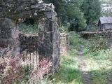
There is an exhibition in the Museum what had been found in the graves; eg. the statue of an Elephant. The excevation was photographed so you can see how the excevation took place and how they sorted all out. Very well done.
On the other side of the large hill you can see remains of the Roman Amfitheater. This was closed. Also you can see small round hilltops in the area next to the necrópolis that have not been excavated.
Carmona has been occupied by humans from 100.000 years ago.It was a very imported town in Roman times and in the old city you can still find many small artefacts in the streets.
You may be viewing yesterday's version of this page. To see the most up to date information please register for a free account.
")
")
")
")
")
Do not use the above information on other web sites or publications without permission of the contributor.
Click here to see more info for this site
Nearby sites
Click here to view sites on an interactive map of the areaKey: Red: member's photo, Blue: 3rd party photo, Yellow: other image, Green: no photo - please go there and take one, Grey: site destroyed
Download sites to:
KML (Google Earth)
GPX (GPS waypoints)
CSV (Garmin/Navman)
CSV (Excel)
To unlock full downloads you need to sign up as a Contributory Member. Otherwise downloads are limited to 50 sites.
Turn off the page maps and other distractions
Nearby sites listing. In the following links * = Image available
29.9km NW 314° City Museum de Carmona* Museum
30.0km NW 313° El Acebuchal Castro or Chafurdão
34.1km W 281° El Término Chambered Tomb
34.7km W 281° El Vaquero Chambered Tomb
34.8km W 281° Las Canteras Ancient Village or Settlement
44.3km SSE 149° Dólmen de los Tomillos 1* Burial Chamber or Dolmen
44.3km SSE 149° Dólmen de los Tomillos 2* Burial Chamber or Dolmen
44.4km SSE 149° Dólmen de los Tomillos 3* Chambered Tomb
49.4km S 173° El Charcón II* Burial Chamber or Dolmen
49.6km S 173° Dolmen El Charcón* Burial Chamber or Dolmen
52.4km SSE 165° Acinipo* Ancient Village or Settlement
53.2km SE 134° Dólmenes del Guadalteba Burial Chamber or Dolmen
53.3km W 280° Museo Arqueológico de Sevilla* Museum
56.5km NNW 327° Mulva-Munigua Ruinas Romanas Ancient Village or Settlement
56.7km SSW 202° Alberite Dolmen* Chambered Tomb
57.0km S 169° Ronda Dolmen* Burial Chamber or Dolmen
58.7km S 178° Caldaza Medieval Trackway* Ancient Trackway
59.3km SSW 202° Menhir de La Lancha* Standing Stone (Menhir)
60.2km WNW 287° Itálica Santiponce Ancient Village or Settlement
60.4km WNW 283° Dolmen de Montelirio* Burial Chamber or Dolmen
60.8km ENE 76° Villa Romana de Fuente Álamo Ancient Village or Settlement
61.0km WNW 284° La Pastora Dolmen* Chambered Tomb
61.2km WNW 283° Matarrubilla Dolmen* Burial Chamber or Dolmen
63.4km SE 127° Necrópolis de las Aguilillas* Rock Cut Tomb
64.2km SSE 161° Water Mine / Fortress Ronda* Ancient Mine, Quarry or other Industry
View more nearby sites and additional images


 We would like to know more about this location. Please feel free to add a brief description and any relevant information in your own language.
 Wir möchten mehr über diese Stätte erfahren. Bitte zögern Sie nicht, eine kurze Beschreibung und relevante Informationen in Deutsch hinzuzufügen.
 Nous aimerions en savoir encore un peu sur les lieux. S'il vous plaît n'hesitez pas à ajouter une courte description et tous les renseignements pertinents dans votre propre langue.
 Quisieramos informarnos un poco más de las lugares. No dude en añadir una breve descripción y otros datos relevantes en su propio idioma.