<< Text Pages >> Trewithen Round - Ancient Village or Settlement in England in Cornwall
Submitted by Bladup on Tuesday, 19 March 2024 Page Views: 67
Multi-periodSite Name: Trewithen RoundCountry: England
NOTE: This site is 0.615 km away from the location you searched for.
County: Cornwall Type: Ancient Village or Settlement
Map Ref: SW72833802
Latitude: 50.198511N Longitude: 5.18447W
Condition:
| 5 | Perfect |
| 4 | Almost Perfect |
| 3 | Reasonable but with some damage |
| 2 | Ruined but still recognisable as an ancient site |
| 1 | Pretty much destroyed, possibly visible as crop marks |
| 0 | No data. |
| -1 | Completely destroyed |
| 5 | Superb |
| 4 | Good |
| 3 | Ordinary |
| 2 | Not Good |
| 1 | Awful |
| 0 | No data. |
| 5 | Can be driven to, probably with disabled access |
| 4 | Short walk on a footpath |
| 3 | Requiring a bit more of a walk |
| 2 | A long walk |
| 1 | In the middle of nowhere, a nightmare to find |
| 0 | No data. |
| 5 | co-ordinates taken by GPS or official recorded co-ordinates |
| 4 | co-ordinates scaled from a detailed map |
| 3 | co-ordinates scaled from a bad map |
| 2 | co-ordinates of the nearest village |
| 1 | co-ordinates of the nearest town |
| 0 | no data |
Internal Links:
External Links:
Ancient Village or Settlement in Cornwall
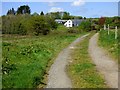
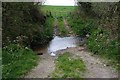
Trewithen Round and associated field system was found by Geophysical Survey at SW72833802 before the Solar farm was built over it, Strangely the sign to the site (See Photo) is/was found by the entrance to Pencoose Farm a 1000m to the East of the round at SW73683795
You may be viewing yesterday's version of this page. To see the most up to date information please register for a free account.
")
Do not use the above information on other web sites or publications without permission of the contributor.
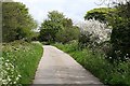
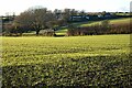
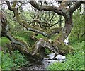
Nearby Images from Geograph Britain and Ireland:
©2006(licence)
©2022(licence)
©2006(licence)
©2019(licence)
©2006(licence)
The above images may not be of the site on this page, they are loaded from Geograph.
Please Submit an Image of this site or go out and take one for us!
Click here to see more info for this site
Nearby sites
Key: Red: member's photo, Blue: 3rd party photo, Yellow: other image, Green: no photo - please go there and take one, Grey: site destroyed
Download sites to:
KML (Google Earth)
GPX (GPS waypoints)
CSV (Garmin/Navman)
CSV (Excel)
To unlock full downloads you need to sign up as a Contributory Member. Otherwise downloads are limited to 50 sites.
Turn off the page maps and other distractions
Nearby sites listing. In the following links * = Image available
725m N 5° Trebowland Round* Ancient Village or Settlement (SW72923874)
895m SSE 161° Stithians Vicarage Garden Cross* Ancient Cross (SW73083716)
924m ESE 104° Seaureaugh standing Stone* Standing Stone (Menhir) (SW73723776)
935m SSE 160° St Stithians Churchyard Cross* Ancient Cross (SW73123713)
1.8km W 267° Penhalvean Cross* Ancient Cross (SW71003799)
1.9km S 175° Tretheague Ancient Cross* Ancient Cross (SW729361)
2.2km ESE 101° Lady Holy Well* Holy Well or Sacred Spring (SW7492937503)
2.2km SE 144° Trevales Farm Wayside Cross* Ancient Cross (SW74073614)
2.4km ESE 120° Laity Moor (Tremenheere)* Standing Stone (Menhir) (SW7485136749)
2.6km SW 220° Colvennor Standing Stone* Modern Stone Circle etc (SW71073610)
2.6km NNE 27° St Gwennap's Well Holy Well or Sacred Spring (SW741403)
2.7km SE 141° Trevales House Cross* Ancient Cross (SW74443582)
2.9km SSW 200° Stithians Cupmarked Stones* Rock Art (SW71713536)
2.9km NNW 330° Figgy Dowdy's Well* Holy Well or Sacred Spring (SW7146740637)
3.4km SSW 211° Mt Wise Farm* Standing Stone (Menhir) (SW7092535175)
3.5km SW 225° Carnmenellis Crosses* Ancient Cross (SW70233567)
3.5km WSW 246° Carnmenellis Outcrop* Rock Outcrop (SW69533669)
3.6km W 275° Gregwartha Tumuli* Barrow Cemetery (SW693385)
3.6km WSW 244° Carnmenellis Tor cairn* Rock Outcrop (SW69553657)
3.6km WSW 242° Carnmenellis cairn* Cairn (SW69563644)
3.8km WSW 241° Carnmenellis Giant's Cave* Natural Stone / Erratic / Other Natural Feature (SW69403634)
3.9km WNW 290° Carnkie tumuli* Barrow Cemetery (SW692395)
4.7km SW 235° Calvadnack* Ancient Village or Settlement (SW689355)
4.7km WSW 249° Wendron South* Stone Circle (SW68313654)
4.8km WSW 250° Wendron North* Stone Circle (SW68293656)
View more nearby sites and additional images


 We would like to know more about this location. Please feel free to add a brief description and any relevant information in your own language.
 Wir möchten mehr über diese Stätte erfahren. Bitte zögern Sie nicht, eine kurze Beschreibung und relevante Informationen in Deutsch hinzuzufügen.
 Nous aimerions en savoir encore un peu sur les lieux. S'il vous plaît n'hesitez pas à ajouter une courte description et tous les renseignements pertinents dans votre propre langue.
 Quisieramos informarnos un poco más de las lugares. No dude en añadir una breve descripción y otros datos relevantes en su propio idioma.