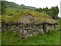
<< Text Pages >> Auchindrain - Cairn in Scotland in Argyll
Submitted by vicky on Sunday, 21 July 2002 Page Views: 3651
Neolithic and Bronze AgeSite Name: AuchindrainCountry: Scotland
NOTE: This site is 3.538 km away from the location you searched for.
County: Argyll Type: Cairn
Map Ref: NN03790337 Landranger Map Number: 55
Latitude: 56.182426N Longitude: 5.163024W
Condition:
| 5 | Perfect |
| 4 | Almost Perfect |
| 3 | Reasonable but with some damage |
| 2 | Ruined but still recognisable as an ancient site |
| 1 | Pretty much destroyed, possibly visible as crop marks |
| 0 | No data. |
| -1 | Completely destroyed |
| 5 | Superb |
| 4 | Good |
| 3 | Ordinary |
| 2 | Not Good |
| 1 | Awful |
| 0 | No data. |
| 5 | Can be driven to, probably with disabled access |
| 4 | Short walk on a footpath |
| 3 | Requiring a bit more of a walk |
| 2 | A long walk |
| 1 | In the middle of nowhere, a nightmare to find |
| 0 | No data. |
| 5 | co-ordinates taken by GPS or official recorded co-ordinates |
| 4 | co-ordinates scaled from a detailed map |
| 3 | co-ordinates scaled from a bad map |
| 2 | co-ordinates of the nearest village |
| 1 | co-ordinates of the nearest town |
| 0 | no data |
Be the first person to rate this site - see the 'Contribute!' box in the right hand menu.
Internal Links:
External Links:
Cairn in Argyll
Canmore site no. 23405.
You may be viewing yesterday's version of this page. To see the most up to date information please register for a free account.
Do not use the above information on other web sites or publications without permission of the contributor.
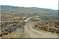
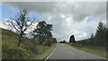
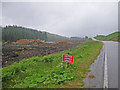
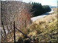
Nearby Images from Geograph Britain and Ireland:
©2013(licence)
©2022(licence)
©2010(licence)
©2006(licence)
©2012(licence)
The above images may not be of the site on this page, they are loaded from Geograph.
Please Submit an Image of this site or go out and take one for us!
Click here to see more info for this site
Nearby sites
Key: Red: member's photo, Blue: 3rd party photo, Yellow: other image, Green: no photo - please go there and take one, Grey: site destroyed
Download sites to:
KML (Google Earth)
GPX (GPS waypoints)
CSV (Garmin/Navman)
CSV (Excel)
To unlock full downloads you need to sign up as a Contributory Member. Otherwise downloads are limited to 50 sites.
Turn off the page maps and other distractions
Nearby sites listing. In the following links * = Image available
671m NNW 327° Creag Mhor Chambered Cairn (NN03450395)
2.6km NE 49° Barmore Wood Chambered Cairn (NN05820496)
3.2km NE 43° Achnagoul 1* Chambered Cairn (NN061056)
3.4km NE 42° Achnagoul 2* Chambered Cairn (NN062058)
7.8km SW 217° Fairy Knowe Argyll Cairn (NR98749736)
8.0km SW 218° Crarae* Chambered Cairn (NR9859097283)
8.0km NE 42° Inveraray Castle* Standing Stone (Menhir) (NN0946809048)
8.6km SSW 196° Kilmorie Cross* Ancient Cross (NS0108595167)
8.7km SSW 196° Tobar Cill Moire* Holy Well or Sacred Spring (NS0106295054)
8.9km SSE 156° Kilmartin Timber Circle Timber Circle (NS070950)
9.4km SSW 198° Cnoc Mor (Garbhallt) Standing Stone (Menhir) (NS005945)
10.3km SW 214° Brainport Bay Standing stones and Alignment* Standing Stone (Menhir) (NR9759595075)
10.4km NNW 332° Ardchonnell* Chambered Cairn (NM99321275)
10.6km SW 218° Barr (Minard) Rock Art (NR96899535)
10.6km NW 323° Innis Chonnel Crannog* Crannog (NM97841220)
10.9km WNW 291° Rubna na Fidhle* Class III Pictish Cross Slab (NM9377607789)
12.3km NNE 20° Drimfern Chambered Cairn (NN086147)
12.7km ENE 66° Ardno* Cairn (NN15680808)
14.6km NE 40° Dron Rocking Stone* Rock Art (NN137141)
14.8km NNW 343° Carn Dubh, Crannog (Loch Awe)* Crannog (NN00131775)
14.9km W 273° Loch Awe (South) Crannog (NM889048)
14.9km W 274° Inverliever Cairn (NM889052)
15.7km W 272° Dun Toiseach (Kilmartin) Stone Fort or Dun (NM88080475)
15.8km W 272° Torran Cup-marked rock* Rock Art (NM87960461)
15.9km W 273° Torran Standing Stone* Standing Stone (Menhir) (NM8790104877)
View more nearby sites and additional images


 We would like to know more about this location. Please feel free to add a brief description and any relevant information in your own language.
 Wir möchten mehr über diese Stätte erfahren. Bitte zögern Sie nicht, eine kurze Beschreibung und relevante Informationen in Deutsch hinzuzufügen.
 Nous aimerions en savoir encore un peu sur les lieux. S'il vous plaît n'hesitez pas à ajouter une courte description et tous les renseignements pertinents dans votre propre langue.
 Quisieramos informarnos un poco más de las lugares. No dude en añadir una breve descripción y otros datos relevantes en su propio idioma.