

<< Image Pages >> Baixao-Tocantins rock art - Rock Art in Brazil
Submitted by durhamnature on Tuesday, 29 January 2013 Page Views: 4304
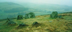
Rock ArtSite Name: Baixao-Tocantins rock artCountry: Brazil
NOTE: This site is 357.366 km away from the location you searched for.
Type: Rock Art
Nearest Village: Baixao-Tocantins
Latitude: 12.8S Longitude: 46.633333W
Condition:
| 5 | Perfect |
| 4 | Almost Perfect |
| 3 | Reasonable but with some damage |
| 2 | Ruined but still recognisable as an ancient site |
| 1 | Pretty much destroyed, possibly visible as crop marks |
| 0 | No data. |
| -1 | Completely destroyed |
| 5 | Superb |
| 4 | Good |
| 3 | Ordinary |
| 2 | Not Good |
| 1 | Awful |
| 0 | No data. |
| 5 | Can be driven to, probably with disabled access |
| 4 | Short walk on a footpath |
| 3 | Requiring a bit more of a walk |
| 2 | A long walk |
| 1 | In the middle of nowhere, a nightmare to find |
| 0 | No data. |
| 5 | co-ordinates taken by GPS or official recorded co-ordinates |
| 4 | co-ordinates scaled from a detailed map |
| 3 | co-ordinates scaled from a bad map |
| 2 | co-ordinates of the nearest village |
| 1 | co-ordinates of the nearest town |
| 0 | no data |
Be the first person to rate this site - see the 'Contribute!' box in the right hand menu.
Internal Links:
External Links:
")
Rock art engraved in Brazil, including human figures, spirals and possibly sexual images.
The lat-long reference is to the village, not the actual site.
You may be viewing yesterday's version of this page. To see the most up to date information please register for a free account.
Do not use the above information on other web sites or publications without permission of the contributor.
Click here to see more info for this site
Nearby sites
Click here to view sites on an interactive map of the areaKey: Red: member's photo, Blue: 3rd party photo, Yellow: other image, Green: no photo - please go there and take one, Grey: site destroyed
Download sites to:
KML (Google Earth)
GPX (GPS waypoints)
CSV (Garmin/Navman)
CSV (Excel)
To unlock full downloads you need to sign up as a Contributory Member. Otherwise downloads are limited to 50 sites.
Turn off the page maps and other distractions
Nearby sites listing. In the following links * = Image available
369.8km SE 136° Peruaçu* Rock Art
792.5km SSE 160° Lapa do Santo Rock shelter* Cave or Rock Shelter
1147.7km WSW 255° Santa Elena (Brazil)* Rock Art
1173.1km SW 227° Taboco* Rock Art
1179.5km NE 51° Erere rock art* Rock Art
1353.7km ENE 64° Pedra do Ingá* Rock Art
1456.6km NW 322° Santarém Settlements Ancient Village or Settlement
1526.3km NW 321° Serra da Escama rock art* Rock Art
1721.3km S 190° Avencal 1* Rock Art
1766.6km NNW 344° Calçoene Stone Circle* Stone Circle
1770.8km S 188° Jabuticabeira II Barrow Cemetery
1812.8km W 267° Loma Chacolatalito Artificial Mound
1825.2km NW 305° Area das Lajes Rock Art
1825.3km NW 304° Hatahara* Ancient Village or Settlement
1826.1km NW 304° Dona Stella Quarry Ancient Mine, Quarry or other Industry
1836.4km NW 305° Acutuba Ancient Village or Settlement
1935.1km WSW 250° El Fuerte de Samaipata Pyramid / Mastaba
1947.9km WSW 250° Mairana Circular Pyramid Pyramid / Mastaba
1983.7km NNW 344° Mont d'Argent rock art* Rock Art
2107.7km WSW 248° Sucre Museum of Anthropology Museum
2174.9km WSW 248° Tarapaya* Natural Stone / Erratic / Other Natural Feature
2175.4km WSW 247° Cerro Rico* Ancient Mine, Quarry or other Industry
2250.2km W 275° Rio Branco Geoglyph 23 Misc. Earthwork
2254.1km W 275° Rio Branco Geoglyph 24 Misc. Earthwork
2255.8km W 275° Rio Branco Geoglyph 25 Misc. Earthwork
View more nearby sites and additional images


 We would like to know more about this location. Please feel free to add a brief description and any relevant information in your own language.
 Wir möchten mehr über diese Stätte erfahren. Bitte zögern Sie nicht, eine kurze Beschreibung und relevante Informationen in Deutsch hinzuzufügen.
 Nous aimerions en savoir encore un peu sur les lieux. S'il vous plaît n'hesitez pas à ajouter une courte description et tous les renseignements pertinents dans votre propre langue.
 Quisieramos informarnos un poco más de las lugares. No dude en añadir una breve descripción y otros datos relevantes en su propio idioma.