<< Our Photo Pages >> Cairn Hill (Dalquharran) - Cairn in Scotland in South Ayrshire
Submitted by markj99 on Wednesday, 02 August 2023 Page Views: 195
Neolithic and Bronze AgeSite Name: Cairn Hill (Dalquharran)Country: Scotland
NOTE: This site is 0.665 km away from the location you searched for.
County: South Ayrshire Type: Cairn
Nearest Town: Girvan Nearest Village: Dailly
Map Ref: NS26690219
Latitude: 55.283259N Longitude: 4.730384W
Condition:
| 5 | Perfect |
| 4 | Almost Perfect |
| 3 | Reasonable but with some damage |
| 2 | Ruined but still recognisable as an ancient site |
| 1 | Pretty much destroyed, possibly visible as crop marks |
| 0 | No data. |
| -1 | Completely destroyed |
| 5 | Superb |
| 4 | Good |
| 3 | Ordinary |
| 2 | Not Good |
| 1 | Awful |
| 0 | No data. |
| 5 | Can be driven to, probably with disabled access |
| 4 | Short walk on a footpath |
| 3 | Requiring a bit more of a walk |
| 2 | A long walk |
| 1 | In the middle of nowhere, a nightmare to find |
| 0 | No data. |
| 5 | co-ordinates taken by GPS or official recorded co-ordinates |
| 4 | co-ordinates scaled from a detailed map |
| 3 | co-ordinates scaled from a bad map |
| 2 | co-ordinates of the nearest village |
| 1 | co-ordinates of the nearest town |
| 0 | no data |
Internal Links:
External Links:
I have visited· I would like to visit
markj99 visited on 1st Aug 2023 - their rating: Cond: 1 Amb: 3 Access: 4 Directions to Cairn Hill (Dalquharran) : Take the B741 Dailly road off the A77, N of Girvan. After c. 5 miles stay straight on for Maybole at the Dailly junction. Continue for 75 yards to park up in estate gates on the right. Walk c. 100 yards S into the estate to reach a path heading E into a wood. Follow the path E for c. 150 yards then head S for c. 50 yards along a path heading into a field. The cairn is c. 130 yards SE of the entrance into the field.
 (PID:261657)")
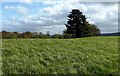
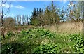
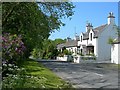
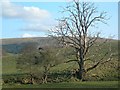
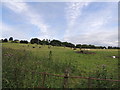
Cairn Hill (Dalquharran) Cairn is a ploughed-out cairn c. 0.5 miles north of Dailly in South Ayrshire. The grassy mound is located on the crest of Cairn Hill in arable land. According to Canmore ID 40870 the cairn measured 21m in diameter by 0.9m in height in 1982. Canmore also stated that in 1820 four cists were found in it.
You may be viewing yesterday's version of this page. To see the most up to date information please register for a free account.
 (PID:261656)")
 (PID:261655)")
 (PID:261654)")
Do not use the above information on other web sites or publications without permission of the contributor.
Nearby Images from Geograph Britain and Ireland:
©2016(licence)
©2016(licence)
©2007(licence)
©2008(licence)
©2012(licence)
The above images may not be of the site on this page, they are loaded from Geograph.
Please Submit an Image of this site or go out and take one for us!
Click here to see more info for this site
Nearby sites
Key: Red: member's photo, Blue: 3rd party photo, Yellow: other image, Green: no photo - please go there and take one, Grey: site destroyed
Download sites to:
KML (Google Earth)
GPX (GPS waypoints)
CSV (Garmin/Navman)
CSV (Excel)
To unlock full downloads you need to sign up as a Contributory Member. Otherwise downloads are limited to 50 sites.
Turn off the page maps and other distractions
Nearby sites listing. In the following links * = Image available
2.1km NNW 335° East Threave* Cairn (NS25870411)
2.3km NE 52° Captain's Bridge (Drummochreen) SE* Stone Fort or Dun (NS28530351)
2.3km NE 51° Captain's Bridge (Drummochreen) W* Hillfort (NS28510356)
3.3km S 191° Maxwelstone Camp* Hillfort (NX25959895)
6.1km NNE 29° Kildoon Hillfort* Hillfort (NS29860738)
7.1km NW 315° Shanter Knowe* Artificial Mound (NS21890738)
7.7km E 100° Knockinculloch* Ancient Village or Settlement (NS34200050)
8.1km NW 311° Bains Hill* Standing Stone (Menhir) (NS20750773)
9.0km N 352° Balchriston* Stone Fort or Dun (NS2572911176)
9.2km NNE 25° Lyonston Stone* Standing Stone (Menhir) (NS30991039)
9.7km N 4° Howmoor* Stone Fort or Dun (NS2770711809)
10.5km SE 136° Bencallen Hill* Chambered Cairn (NX33779440)
11.2km SW 214° Dinvin Earthworks* Misc. Earthwork (NX2002993173)
14.3km ESE 105° Cairnwhapple Stone* Natural Stone / Erratic / Other Natural Feature (NX40399796)
15.1km SSW 197° Glake Stone* Standing Stone (Menhir) (NX21678790)
15.6km NE 38° Barbieston Farm cist* Cist (NS36751417)
15.8km NNE 22° Wallace's Stone (Blairstone Mains)* Early Christian Sculptured Stone (NS3321416579)
17.4km NNE 16° Stonefield Park, Ayr* Standing Stone (Menhir) (NS32271869)
17.5km SSE 147° Cairnfore* Cairn (NX35548707)
17.6km S 179° Balmalloch Chambered Cairn* Chambered Cairn (NX2638784532)
17.8km S 178° Balmalloch Cairnfield* Barrow Cemetery (NX26488439)
18.1km ESE 119° Moss Knowes* Natural Stone / Erratic / Other Natural Feature (NX42239281)
19.2km S 182° Laggan Cairn (Barrhill)* Cairn (NX25358297)
19.6km SSE 157° Sheuchan's Cairn* Chambered Cairn (NX33798387)
20.0km SE 144° Kirriemore* Chambered Cairn (NX37738544)
View more nearby sites and additional images


 We would like to know more about this location. Please feel free to add a brief description and any relevant information in your own language.
 Wir möchten mehr über diese Stätte erfahren. Bitte zögern Sie nicht, eine kurze Beschreibung und relevante Informationen in Deutsch hinzuzufügen.
 Nous aimerions en savoir encore un peu sur les lieux. S'il vous plaît n'hesitez pas à ajouter une courte description et tous les renseignements pertinents dans votre propre langue.
 Quisieramos informarnos un poco más de las lugares. No dude en añadir una breve descripción y otros datos relevantes en su propio idioma.