 with our Megalithic Portal iPhone app")

<< Text Pages >> Ladyland Barrow - Barrow Cemetery in Scotland in North Ayrshire
Submitted by AstroGeologist on Tuesday, 21 May 2019 Page Views: 713
Neolithic and Bronze AgeSite Name: Ladyland Barrow Alternative Name: Ladyland Tumulus, Ford Farmhouse BarrowCountry: Scotland County: North Ayrshire Type: Barrow Cemetery
Nearest Town: Kilbirnie Nearest Village: Glengarnock
Map Ref: NS32015759
Latitude: 55.782353N Longitude: 4.680352W
Condition:
| 5 | Perfect |
| 4 | Almost Perfect |
| 3 | Reasonable but with some damage |
| 2 | Ruined but still recognisable as an ancient site |
| 1 | Pretty much destroyed, possibly visible as crop marks |
| 0 | No data. |
| -1 | Completely destroyed |
| 5 | Superb |
| 4 | Good |
| 3 | Ordinary |
| 2 | Not Good |
| 1 | Awful |
| 0 | No data. |
| 5 | Can be driven to, probably with disabled access |
| 4 | Short walk on a footpath |
| 3 | Requiring a bit more of a walk |
| 2 | A long walk |
| 1 | In the middle of nowhere, a nightmare to find |
| 0 | No data. |
| 5 | co-ordinates taken by GPS or official recorded co-ordinates |
| 4 | co-ordinates scaled from a detailed map |
| 3 | co-ordinates scaled from a bad map |
| 2 | co-ordinates of the nearest village |
| 1 | co-ordinates of the nearest town |
| 0 | no data |
Internal Links:
External Links:
Barrow Cemetery in North Ayrshire
Situated 123m above sea level on the SW edge of Pyet Wood, it overlooks Maich Water in Ayrshire.
The NSA reported that sometime around 1810, "Mr Cochran" of Ladyland helped remove a Tumulus from near Ford farmhouse during agricultural improvements. He found an Urn containing Burnt Bones (Now in the Hunterian Museum)
When "R.W. Cochran-Patrick" re-excavated the Tumulus remains in 1855 he described it as "a small, scarcely observable mound". No further finds were made at the Tumulus, but 30 years later he did find a Bronze Age Axe nearby.
An OS visit in 1956 indicated the remains of a mound 30m in diameter, with a maximum height of 2m on the North side. It now has the appearance of a natural knoll.
For more information : Canmore ID 42155
You may be viewing yesterday's version of this page. To see the most up to date information please register for a free account.
Do not use the above information on other web sites or publications without permission of the contributor.
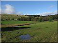
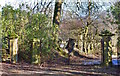
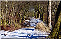
Nearby Images from Geograph Britain and Ireland:
©2007(licence)
©2020(licence)
©2020(licence)
©2014(licence)
©2011(licence)
The above images may not be of the site on this page, they are loaded from Geograph.
Please Submit an Image of this site or go out and take one for us!
Click here to see more info for this site
Nearby sites
Key: Red: member's photo, Blue: 3rd party photo, Yellow: other image, Green: no photo - please go there and take one, Grey: site destroyed
Download sites to:
KML (Google Earth)
GPX (GPS waypoints)
CSV (Garmin/Navman)
CSV (Excel)
To unlock full downloads you need to sign up as a Contributory Member. Otherwise downloads are limited to 50 sites.
Turn off the page maps and other distractions
Nearby sites listing. In the following links * = Image available
1.6km SSW 192° Langlands Tumulus Cairn (NS31625602)
2.2km NNE 28° Dun Connel Hillfort (NS3311459497)
4.0km N 3° Glenward Cairn Cairn (NS32356159)
4.0km S 173° Kilbirnie Crannog Crannog (NS32385356)
4.2km ENE 68° Loch Winnoch Crannog Crannog (NS3600358999)
5.3km NE 34° Knockmade Tumulus Barrow Cemetery (NS35126184)
5.8km SSW 213° Carwinning Hill Hillfort (NS28715286)
6.4km ESE 112° Four Stones (North Ayrshire) Stone Circle (NS379550)
6.5km NE 53° Clochodrick Stone* Natural Stone / Erratic / Other Natural Feature (NS37366127)
7.0km ESE 108° Cuff Hill* Chambered Cairn (NS386552)
7.1km N 6° Ladymuir Cairn Cairn (NS3299964600)
7.2km NE 44° Dun Bower Hillfort (NS3721962579)
8.5km SSW 197° Courthill Cairn* Round Barrow(s) (NS29244958)
8.7km NE 40° Lawmarnock Cup Marks Rock Art (NS3794264004)
8.7km N 353° Smeath Hill Cairn Cairn (NS3131566308)
8.8km NNE 15° Dun Gotter Hillfort (NS3458666033)
9.0km W 269° Fechan Menhir Standing Stone (Menhir) (NS22975775)
9.2km E 80° Walls Hill Fort Hillfort (NS4117058800)
9.4km NNW 342° Dunnairbuck Cairn Cairn (NS2944166642)
10.1km S 179° Cleaves Cove* Cave or Rock Shelter (NS31774744)
10.2km WSW 244° Kaim Hill Cairn Cairn (NS22715342)
10.5km W 274° Castle Hill Fort (Largs)* Hillfort (NS2156558800)
10.7km NNW 337° Knockdal Ring Cairn Cairn (NS2820467621)
10.8km NE 54° Barr Hill Fort Hillfort (NS40946365)
10.8km NE 41° Broom Cist Cist (NS39356552)
View more nearby sites and additional images


 We would like to know more about this location. Please feel free to add a brief description and any relevant information in your own language.
 Wir möchten mehr über diese Stätte erfahren. Bitte zögern Sie nicht, eine kurze Beschreibung und relevante Informationen in Deutsch hinzuzufügen.
 Nous aimerions en savoir encore un peu sur les lieux. S'il vous plaît n'hesitez pas à ajouter une courte description et tous les renseignements pertinents dans votre propre langue.
 Quisieramos informarnos un poco más de las lugares. No dude en añadir una breve descripción y otros datos relevantes en su propio idioma.