

<< Our Photo Pages >> Top Castle, Eglwyscummin - Hillfort in Wales in Carmarthenshire
Submitted by pab on Friday, 05 August 2011 Page Views: 5718
Iron Age and Later PrehistorySite Name: Top Castle, EglwyscumminCountry: Wales
NOTE: This site is 0.975 km away from the location you searched for.
County: Carmarthenshire Type: Hillfort
Nearest Village: Amroth
Map Ref: SN19460772
Latitude: 51.739027N Longitude: 4.616199W
Condition:
| 5 | Perfect |
| 4 | Almost Perfect |
| 3 | Reasonable but with some damage |
| 2 | Ruined but still recognisable as an ancient site |
| 1 | Pretty much destroyed, possibly visible as crop marks |
| 0 | No data. |
| -1 | Completely destroyed |
| 5 | Superb |
| 4 | Good |
| 3 | Ordinary |
| 2 | Not Good |
| 1 | Awful |
| 0 | No data. |
| 5 | Can be driven to, probably with disabled access |
| 4 | Short walk on a footpath |
| 3 | Requiring a bit more of a walk |
| 2 | A long walk |
| 1 | In the middle of nowhere, a nightmare to find |
| 0 | No data. |
| 5 | co-ordinates taken by GPS or official recorded co-ordinates |
| 4 | co-ordinates scaled from a detailed map |
| 3 | co-ordinates scaled from a bad map |
| 2 | co-ordinates of the nearest village |
| 1 | co-ordinates of the nearest town |
| 0 | no data |
Internal Links:
External Links:
I have visited· I would like to visit
PAB has visited here
")
Top Castle - well-deserved name!
It really is a delightful place to visit - both the views and the atmosphere are absolutely magnificent.
COFLEIN (Reference: NPRN 304232) describes the location in the following terms:
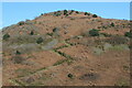
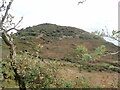
"The SW summit of a NE-SW spur is scarped about to define a D-shaped/oval enclosure known as Top Castle, Eglwyscummin. It measures c.100m NE-SW by 66m, the circuit being bivallate except on the NE, where features may have been lost to cultivation. "
The defensive mounds etc are rather obscured during the summer due to the vegetation, especially those of a prickly variety - but some do have the compensation of bearing fruit.
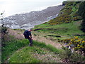
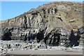
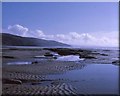
The site is just within the Carmarthenshire side of the border with Pembrokeshire. Access in easiest by the coastal path as the beach is only accessible at low tides.
You may be viewing yesterday's version of this page. To see the most up to date information please register for a free account.
")
")
Do not use the above information on other web sites or publications without permission of the contributor.
Nearby Images from Geograph Britain and Ireland:
©2022(licence)
©2023(licence)
©2015(licence)
©2022(licence)
©2005(licence)
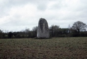
The above images may not be of the site on this page, they are loaded from Geograph.
Please Submit an Image of this site or go out and take one for us!
Click here to see more info for this site
Nearby sites
Key: Red: member's photo, Blue: 3rd party photo, Yellow: other image, Green: no photo - please go there and take one, Grey: site destroyed
Download sites to:
KML (Google Earth)
GPX (GPS waypoints)
CSV (Garmin/Navman)
CSV (Excel)
To unlock full downloads you need to sign up as a Contributory Member. Otherwise downloads are limited to 50 sites.
Turn off the page maps and other distractions
Nearby sites listing. In the following links * = Image available
2.2km NE 49° Marros settlement* Ancient Village or Settlement (SN212091)
2.7km E 93° Morfa Bychan* Chambered Cairn (SN22130749)
2.8km E 98° Forest Chamber* Burial Chamber or Dolmen (SN22180724)
2.8km N 355° Parc-y-Twmp* Round Barrow(s) (SN19341051)
3.3km E 90° Gilman Point fort* Promontory Fort / Cliff Castle (SN228076)
3.5km WSW 252° Amroth Submerged Forest Not Known (by us) (SN16070678)
3.5km WSW 252° Amroth Submerged Forest Not Known (by us) (SN16070678)
3.7km E 86° Pendine Bone Cave* Cave or Rock Shelter (SN23200782)
4.9km NNW 337° Crug Swllt* Round Barrow(s) (SN17711231)
5.0km WNW 295° Longstone Camp* Hillfort (SN14990996)
5.1km WNW 287° The Longstone (Pembrokeshire)* Standing Stone (Menhir) (SN146094)
5.3km NW 313° Newhouse Barrows* Barrow Cemetery (SN15711141)
5.6km NW 309° Belle Vue* Standing Stone (Menhir) (SN15211146)
7.2km NE 43° Castell Pen-Y-Coed Hillfort (SN24531278)
7.9km NW 321° Llan Chambered Tomb* Chambered Tomb (SN147140)
8.0km ENE 67° Holy Stones Llansadurnan Sculptured Stone
8.3km NE 37° Vaynor Farm Henge* Henge (SN24701417)
9.0km WNW 293° Templeton Cross* Early Christian Sculptured Stone (SN1131011528)
9.1km E 79° Coygan Cave Cave or Rock Shelter (SN28480913)
9.1km NE 39° Cross Stones, Llanddowror* Early Christian Sculptured Stone (SN25531458)
9.3km SW 217° Tenby Museum Museum (SN136005)
9.3km WNW 294° St Margaret's Well (Pembrokeshire)* Holy Well or Sacred Spring (SN11101186)
9.4km NE 39° Llanddowror Standing stone* Standing Stone (Menhir) (SN25621487)
9.5km SW 221° St John's Well (Tenby)* Holy Well or Sacred Spring (SN130008)
9.5km ENE 66° Llandawke Inscribed Stone* Early Christian Sculptured Stone (SN2827111214)
View more nearby sites and additional images


 We would like to know more about this location. Please feel free to add a brief description and any relevant information in your own language.
 Wir möchten mehr über diese Stätte erfahren. Bitte zögern Sie nicht, eine kurze Beschreibung und relevante Informationen in Deutsch hinzuzufügen.
 Nous aimerions en savoir encore un peu sur les lieux. S'il vous plaît n'hesitez pas à ajouter une courte description et tous les renseignements pertinents dans votre propre langue.
 Quisieramos informarnos un poco más de las lugares. No dude en añadir una breve descripción y otros datos relevantes en su propio idioma.