<< Text Pages >> La Batanera Pinturas Rupestres - Rock Art in Spain in Castilla La Mancha y Madrid
Submitted by holger_rix on Friday, 04 December 2015 Page Views: 943
Rock ArtSite Name: La Batanera Pinturas RupestresCountry: Spain
NOTE: This site is 28.444 km away from the location you searched for.
Region: Castilla La Mancha y Madrid Type: Rock Art
Latitude: 38.434070N Longitude: 4.28866W
Condition:
| 5 | Perfect |
| 4 | Almost Perfect |
| 3 | Reasonable but with some damage |
| 2 | Ruined but still recognisable as an ancient site |
| 1 | Pretty much destroyed, possibly visible as crop marks |
| 0 | No data. |
| -1 | Completely destroyed |
| 5 | Superb |
| 4 | Good |
| 3 | Ordinary |
| 2 | Not Good |
| 1 | Awful |
| 0 | No data. |
| 5 | Can be driven to, probably with disabled access |
| 4 | Short walk on a footpath |
| 3 | Requiring a bit more of a walk |
| 2 | A long walk |
| 1 | In the middle of nowhere, a nightmare to find |
| 0 | No data. |
| 5 | co-ordinates taken by GPS or official recorded co-ordinates |
| 4 | co-ordinates scaled from a detailed map |
| 3 | co-ordinates scaled from a bad map |
| 2 | co-ordinates of the nearest village |
| 1 | co-ordinates of the nearest town |
| 0 | no data |
Be the first person to rate this site - see the 'Contribute!' box in the right hand menu.
Internal Links:
External Links:
Rock Art in Castilla La Mancha y Madrid
You may be viewing yesterday's version of this page. To see the most up to date information please register for a free account.
Do not use the above information on other web sites or publications without permission of the contributor.
Nearby Images from Flickr
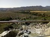
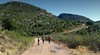
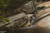
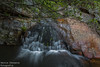
The above images may not be of the site on this page, but were taken nearby. They are loaded from Flickr so please click on them for image credits.
Click here to see more info for this site
Nearby sites
Click here to view sites on an interactive map of the areaKey: Red: member's photo, Blue: 3rd party photo, Yellow: other image, Green: no photo - please go there and take one, Grey: site destroyed
Download sites to:
KML (Google Earth)
GPX (GPS waypoints)
CSV (Garmin/Navman)
CSV (Excel)
To unlock full downloads you need to sign up as a Contributory Member. Otherwise downloads are limited to 50 sites.
Turn off the page maps and other distractions
Nearby sites listing. In the following links * = Image available
1.3km SE 145° Cueva de Peña Escrita* Cave or Rock Shelter
61.4km S 171° Cerrillo Blanco Ancient Village or Settlement
63.3km S 172° San Benito de Porcuna Ancient Village or Settlement
64.7km NE 49° Cerro de La Encatada* Castro or Chafurdão
66.1km E 99° Los Escolares* Cave or Rock Shelter
74.0km SE 132° Conjunto Arqueológico de Cástulo* Ancient Village or Settlement
74.9km SW 215° Museo Arqueológico y Etnológico de Córdoba* Museum
75.0km SW 216° Conjunto Arqueológico de Cercadillas Ancient Village or Settlement
79.2km SW 220° Medinat al-Zahra Ancient Village or Settlement
79.5km SSW 198° Ategua Yacimiento Arqueológico Ancient Village or Settlement
82.0km WSW 256° Dolmen of Casas de Don Pedro* Burial Chamber or Dolmen
92.5km NNW 342° Menhir de La Quinquiruela Standing Stone (Menhir)
92.7km SE 146° La Guardia de Jaén Catacumbas Ancient Village or Settlement
94.5km SSE 151° Dólmen del Collado de los Bastianes* Burial Chamber or Dolmen
96.4km NE 45° Motilla del Azuer* Hillfort
97.7km SE 133° La Cueva de la Graja* Rock Art
103.1km S 178° Dolmen de Dehesa de la Lastra* Burial Chamber or Dolmen
106.3km WSW 258° Tholos Los Delgados Burial Chamber or Dolmen
112.1km W 259° La Cardenchosa Dolmen 2 Burial Chamber or Dolmen
112.2km W 259° La Cardenchosa Dolmen 1 Burial Chamber or Dolmen
112.2km W 259° Menhir de Cardenchosa* Standing Stone (Menhir)
115.1km ESE 121° Cámara Sepulcral Ibérica de Toya* Ancient Village or Settlement
119.3km SSW 199° Villa Romana de Fuente Álamo Ancient Village or Settlement
122.6km W 261° Loma del Trillo Burial Chamber or Dolmen
122.6km W 261° La Casilla Burial Chamber or Dolmen
View more nearby sites and additional images


 We would like to know more about this location. Please feel free to add a brief description and any relevant information in your own language.
 Wir möchten mehr über diese Stätte erfahren. Bitte zögern Sie nicht, eine kurze Beschreibung und relevante Informationen in Deutsch hinzuzufügen.
 Nous aimerions en savoir encore un peu sur les lieux. S'il vous plaît n'hesitez pas à ajouter une courte description et tous les renseignements pertinents dans votre propre langue.
 Quisieramos informarnos un poco más de las lugares. No dude en añadir una breve descripción y otros datos relevantes en su propio idioma.