<< Our Photo Pages >> Aldourie - Ring Cairn in Scotland in Highlands
Submitted by mattchapman on Thursday, 14 April 2016 Page Views: 3203
Neolithic and Bronze AgeSite Name: AldourieCountry: Scotland
NOTE: This site is 1.373 km away from the location you searched for.
County: Highlands Type: Ring Cairn
Nearest Town: Inverness Nearest Village: Dorres
Map Ref: NH59993587
Latitude: 57.391631N Longitude: 4.331143W
Condition:
| 5 | Perfect |
| 4 | Almost Perfect |
| 3 | Reasonable but with some damage |
| 2 | Ruined but still recognisable as an ancient site |
| 1 | Pretty much destroyed, possibly visible as crop marks |
| 0 | No data. |
| -1 | Completely destroyed |
| 5 | Superb |
| 4 | Good |
| 3 | Ordinary |
| 2 | Not Good |
| 1 | Awful |
| 0 | No data. |
| 5 | Can be driven to, probably with disabled access |
| 4 | Short walk on a footpath |
| 3 | Requiring a bit more of a walk |
| 2 | A long walk |
| 1 | In the middle of nowhere, a nightmare to find |
| 0 | No data. |
| 5 | co-ordinates taken by GPS or official recorded co-ordinates |
| 4 | co-ordinates scaled from a detailed map |
| 3 | co-ordinates scaled from a bad map |
| 2 | co-ordinates of the nearest village |
| 1 | co-ordinates of the nearest town |
| 0 | no data |
Internal Links:
External Links:
I have visited· I would like to visit
PeteCrane5 has visited here
")
Steve Feltham of Nessie hunting fame told me about this site whilst chatting about Megaliths and Monsters. He said it had been moved to its present position which ties in with the Canmore notes below. Only one or two stones were visible from the road as the field had animals in it at the time. 20/03/16
From Canmore:-
Event ID 660828
Category Descriptive Accounts
Type Archaeology Notes
Permalink http://canmore.org.uk/event/660828
NH53NE 4 5999 3587.
(NH 5999 3587) Stone Circle (NAT) (NH 6000 3587) Site of Stone Circle (NR) OS 6"map, Inverness-shire, 2nd ed., (1905)
This site is marked on the 1870 edition of the 6-inch O.S. map as "Stone Circle (Removed from east to west side of fence)". There are eighteen stones, either boulders or split slabs, set in a circle evenly spaced except on the south-west side where the largest stone, a pointed slab 4ft 10ins high, is flanked by two small contiguous stones. In the centre lies a large flat stone. This arrangement is obviously artificial, and the stones may well come from a dismembered Clava-type tomb. It is possible that the tallest stone is in situ and it could well be one of the monoliths at such a site.
A S Henshall 1963, visited 21 April 1958
The stone circle is as described above; it measures 14.5m NE-SW x 10.0m NW-SE. See GP: AO/62/114/1. There is no evidence of a stone circle at the site at NH 60003587 shown on the O.S. map. Published 25" survey.
Visited by OS (EGC) 20 March 1962
'In Durris (ie. Dores) at the North end of Loch-Ness is a Druid temple of three concentric circles: in all of these druidical circles there was an altar stone at the centre, but that at Dirris is taken away, and near the centre is a hollowed stone, which either was a laver to wash in, or a bason(sic) to receive the blood of the sacrifice.'
T Pennent 1769
The above description, prior to the moving of the stones, seems to confirm Henshall's suggestion that this was originally a Clava-type structure, and most probably a ring-cairn.
Information from R B Gourlay (Highland Regional Archaeologist to OS 18 March 1987
You may be viewing yesterday's version of this page. To see the most up to date information please register for a free account.
")
Do not use the above information on other web sites or publications without permission of the contributor.
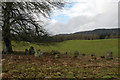
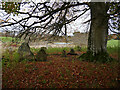
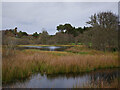
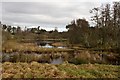
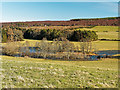
Nearby Images from Geograph Britain and Ireland:
©2018(licence)
©2021(licence)
©2021(licence)
©2018(licence)
©2016(licence)
The above images may not be of the site on this page, they are loaded from Geograph.
Please Submit an Image of this site or go out and take one for us!
Click here to see more info for this site
Nearby sites
Key: Red: member's photo, Blue: 3rd party photo, Yellow: other image, Green: no photo - please go there and take one, Grey: site destroyed
Download sites to:
KML (Google Earth)
GPX (GPS waypoints)
CSV (Garmin/Navman)
CSV (Excel)
To unlock full downloads you need to sign up as a Contributory Member. Otherwise downloads are limited to 50 sites.
Turn off the page maps and other distractions
Nearby sites listing. In the following links * = Image available
3.8km NNE 33° Kinchyle Of Dores* Stone Circle (NH62153898)
3.9km SE 145° West Town* Chambered Cairn (NH62173258)
5.4km SE 127° Eastertown Cairn* Cairn (NH64203245)
5.5km ENE 62° Essich Moor* Chambered Cairn (NH649383)
6.3km NE 42° Torbreck* Stone Circle (NH64384039)
7.7km NNE 15° Ladystone Farm* Stone Row / Alignment (NH62204330)
7.8km E 88° Gask Henge* Henge (NH67833590)
7.9km E 88° Gask Cairn* Ring Cairn (NH6794435860)
7.9km ENE 77° Tomfat Plantation* Chambered Cairn (NH678374)
8.2km ESE 104° Tordarroch cup-marked stone* Rock Art (NH679336)
8.3km ESE 105° Tordarroch Cairn* Clava Cairn (NH68013349)
8.5km NW 315° Castle Spynie Broch or Nuraghe (NH54144204)
8.7km ESE 107° Croftcroy Chambered Tomb Chambered Tomb (NH683331)
8.8km ESE 106° Croftcroy Stone Circle* Stone Circle (NH6835133191)
8.8km NNE 18° Leachkin* Chambered Cairn (NH62964416)
8.8km NNW 330° Giant's Grave (Highlands) Chambered Cairn (NH55904369)
8.8km WNW 299° Allt Eoghainn* Chambered Tomb (NH5236240392)
9.1km NW 326° Balblair Class I Pictish Symbol Stone (NH55184357)
9.1km SW 228° Holy Well (Drumnadrochit)* Holy Well or Sacred Spring (NH530300)
9.9km WNW 301° Meg's Stone* Standing Stone (Menhir) (NH5164541196)
10.1km WNW 302° Belladrum South Chambered Tomb (NH5161041578)
10.1km NNE 21° Craig Phadraig* Vitrified Fort (NH640452)
10.2km SSE 152° Dhuallow Clava Cairn (NH644267)
10.5km NE 52° Druidtemple* Stone Circle (NH685420)
10.6km NW 304° Belladrum Chambered Cairn* Chambered Cairn (NH5141742120)
View more nearby sites and additional images


 We would like to know more about this location. Please feel free to add a brief description and any relevant information in your own language.
 Wir möchten mehr über diese Stätte erfahren. Bitte zögern Sie nicht, eine kurze Beschreibung und relevante Informationen in Deutsch hinzuzufügen.
 Nous aimerions en savoir encore un peu sur les lieux. S'il vous plaît n'hesitez pas à ajouter une courte description et tous les renseignements pertinents dans votre propre langue.
 Quisieramos informarnos un poco más de las lugares. No dude en añadir una breve descripción y otros datos relevantes en su propio idioma.