<< Our Photo Pages >> Druim Mor (Callander) - Standing Stone (Menhir) in Scotland in Perth and Kinross
Submitted by Anne T on Tuesday, 08 August 2017 Page Views: 2602
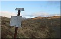
Neolithic and Bronze AgeSite Name: Druim Mor (Callander)Country: Scotland
NOTE: This site is 1.916 km away from the location you searched for.
County: Perth and Kinross Type: Standing Stone (Menhir)
Nearest Town: Callandar
Map Ref: NN6354209721
Latitude: 56.260320N Longitude: 4.204519W
Condition:
| 5 | Perfect |
| 4 | Almost Perfect |
| 3 | Reasonable but with some damage |
| 2 | Ruined but still recognisable as an ancient site |
| 1 | Pretty much destroyed, possibly visible as crop marks |
| 0 | No data. |
| -1 | Completely destroyed |
| 5 | Superb |
| 4 | Good |
| 3 | Ordinary |
| 2 | Not Good |
| 1 | Awful |
| 0 | No data. |
| 5 | Can be driven to, probably with disabled access |
| 4 | Short walk on a footpath |
| 3 | Requiring a bit more of a walk |
| 2 | A long walk |
| 1 | In the middle of nowhere, a nightmare to find |
| 0 | No data. |
| 5 | co-ordinates taken by GPS or official recorded co-ordinates |
| 4 | co-ordinates scaled from a detailed map |
| 3 | co-ordinates scaled from a bad map |
| 2 | co-ordinates of the nearest village |
| 1 | co-ordinates of the nearest town |
| 0 | no data |
Internal Links:
External Links:
I have visited· I would like to visit
Klingon visited on 3rd Oct 2017 - their rating: Cond: 4 Amb: 5 Access: 3
 (PID:173251)")
Described as a new find in March 2016, The Northern Antiquarian (TNA) have a page for this standing stone - see their entry for Druim Mor, Callander, Perthshire.
The TNA page includes directions for finding this stone, described as 3 feet high and "barely a foot thick, it may once have had a companion standing just a few yards away." TNA include photographs, a brief archaeology & history and local folklore about the general setting of this stone. From their photographs, the countryside looks amazing!
You may be viewing yesterday's version of this page. To see the most up to date information please register for a free account.
 (PID:173252)")
Do not use the above information on other web sites or publications without permission of the contributor.
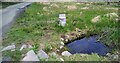
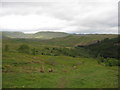
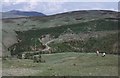
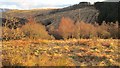
Nearby Images from Geograph Britain and Ireland:
©2023(licence)
©2009(licence)
©2008(licence)
©2013(licence)
©2013(licence)
The above images may not be of the site on this page, they are loaded from Geograph.
Please Submit an Image of this site or go out and take one for us!
Click here to see more info for this site
Nearby sites
Key: Red: member's photo, Blue: 3rd party photo, Yellow: other image, Green: no photo - please go there and take one, Grey: site destroyed
Download sites to:
KML (Google Earth)
GPX (GPS waypoints)
CSV (Garmin/Navman)
CSV (Excel)
To unlock full downloads you need to sign up as a Contributory Member. Otherwise downloads are limited to 50 sites.
Turn off the page maps and other distractions
Nearby sites listing. In the following links * = Image available
1.5km E 85° West Bracklinn* Chambered Cairn (NN6501809794)
2.9km SSE 149° Auchenlaich Cairn* Chambered Cairn (NN64980715)
3.7km WSW 237° Samson Stone (Callendar) Ancient Village or Settlement (NN6039807821)
4.4km SSE 158° St Mary's Well (Callender)* Holy Well or Sacred Spring (NN65070556)
4.6km SSE 152° Ballochallan* Modern Stone Circle etc (NN65580559)
5.2km SSE 158° Wester Torrie Stone Circle (NN65340480)
5.5km SE 124° Ballachraggan Chambered Cairn (NN68050650)
8.9km S 188° The Ruskie Stane* Modern Stone Circle etc (NN6203800912)
9.6km SW 222° Upper Glenny* Rock Art (NN56880277)
10.1km SSW 210° Lake of Menteith Crannogs* Crannog (NN5821901097)
10.3km SW 222° Nether Glenny (42) Rock Art (NN56430229)
10.4km SW 221° Nether Glenny (35) Rock Art (NN5642502099)
10.5km SW 221° Nether Glenny (02) Cairn (NN56440202)
10.5km SW 220° Nether Glenny Cairn* Cairn (NN56460192)
10.7km SW 222° Nether Glenny (28) Rock Art (NN56190197)
10.8km SW 221° Nether Glenny Rock Art* Rock Art (NN56140179)
10.9km SW 221° Mask Stone (Port of Menteith) Rock Art (NN5610701712)
10.9km SW 221° Ballochraggan 12 Rock Art (NN5610601711)
11.1km SW 221° Ballochraggan 5 Rock Art (NN5604401549)
11.1km ESE 110° The Judge's Cairn (Dunblane) Cairn (NN7394405618)
11.6km SW 219° Ballochraggan 1 Rock Art (NN5590001005)
11.8km SE 134° Tulloch Knowe (Doune)s Cairn (NN7178201194)
11.9km SE 129° Trysting Stone* Standing Stone (Menhir) (NN72550185)
12.4km SSW 213° The Peace Stone* Rock Art (NS56419954)
12.6km NW 323° Balquhidder* Modern Stone Circle etc (NN563201)
View more nearby sites and additional images


 We would like to know more about this location. Please feel free to add a brief description and any relevant information in your own language.
 Wir möchten mehr über diese Stätte erfahren. Bitte zögern Sie nicht, eine kurze Beschreibung und relevante Informationen in Deutsch hinzuzufügen.
 Nous aimerions en savoir encore un peu sur les lieux. S'il vous plaît n'hesitez pas à ajouter une courte description et tous les renseignements pertinents dans votre propre langue.
 Quisieramos informarnos un poco más de las lugares. No dude en añadir una breve descripción y otros datos relevantes en su propio idioma.