<< Text Pages >> Carreg Bicca - Stone Row / Alignment in Wales in Carmarthenshire
Submitted by vicky on Monday, 30 September 2002 Page Views: 5808
Neolithic and Bronze AgeSite Name: Carreg BiccaCountry: Wales
NOTE: This site is 1.175 km away from the location you searched for.
County: Carmarthenshire Type: Stone Row / Alignment
Nearest Town: Brechfa Nearest Village: Llandeilo
Map Ref: SN5637228779 Landranger Map Number: 146
Latitude: 51.938925N Longitude: 4.090777W
Condition:
| 5 | Perfect |
| 4 | Almost Perfect |
| 3 | Reasonable but with some damage |
| 2 | Ruined but still recognisable as an ancient site |
| 1 | Pretty much destroyed, possibly visible as crop marks |
| 0 | No data. |
| -1 | Completely destroyed |
| 5 | Superb |
| 4 | Good |
| 3 | Ordinary |
| 2 | Not Good |
| 1 | Awful |
| 0 | No data. |
| 5 | Can be driven to, probably with disabled access |
| 4 | Short walk on a footpath |
| 3 | Requiring a bit more of a walk |
| 2 | A long walk |
| 1 | In the middle of nowhere, a nightmare to find |
| 0 | No data. |
| 5 | co-ordinates taken by GPS or official recorded co-ordinates |
| 4 | co-ordinates scaled from a detailed map |
| 3 | co-ordinates scaled from a bad map |
| 2 | co-ordinates of the nearest village |
| 1 | co-ordinates of the nearest town |
| 0 | no data |
Internal Links:
External Links:
Stone Row (Alignment) in Caramarthenshire
Originally a row of three stones, now destroyed.
Have you visited this site? Please contribute a description or any thoughts by adding a comment.
You may be viewing yesterday's version of this page. To see the most up to date information please register for a free account.
Do not use the above information on other web sites or publications without permission of the contributor.
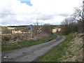
Nearby Images from Geograph Britain and Ireland:
©2020(licence)
©2020(licence)
©2009(licence)
©2013(licence)
©2006(licence)
The above images may not be of the site on this page, they are loaded from Geograph.
Please Submit an Image of this site or go out and take one for us!
Click here to see more info for this site
Nearby sites
Key: Red: member's photo, Blue: 3rd party photo, Yellow: other image, Green: no photo - please go there and take one, Grey: site destroyed
Download sites to:
KML (Google Earth)
GPX (GPS waypoints)
CSV (Garmin/Navman)
CSV (Excel)
To unlock full downloads you need to sign up as a Contributory Member. Otherwise downloads are limited to 50 sites.
Turn off the page maps and other distractions
Nearby sites listing. In the following links * = Image available
2.2km NW 326° Carreg Castell-y-Gwynt* Burial Chamber or Dolmen (SN552306)
5.0km W 263° Llech Ciste* Stone Row / Alignment (SN51422832)
5.8km W 262° Crug i'r de* Cairn (SN5054228147)
6.1km W 266° Crug Melyn* Cairn (SN50282850)
6.3km W 266° Crug Canol* Cairn (SN50012855)
6.5km W 267° Crugiau Round Barrow* Cairn (SN49882864)
6.7km W 267° Crug Bach Cairn (SN49632863)
7.4km S 185° Cae'r Garn Round Barrow* Round Barrow(s) (SN55522140)
7.9km NW 317° Hafod Tridrws* Round Barrow(s) (SN51153466)
8.0km N 349° Crug Cnwc Round Barrow(s) (SN55103667)
9.1km NW 316° Crug Penheol* Cairn (SN50233547)
9.1km WSW 258° Crug-y-Rhyd-Hir* Cairn (SN47422714)
9.3km SE 133° St. Teilo's Holy Well* Holy Well or Sacred Spring (SN62962224)
9.3km WNW 297° Crugiau Rhos-Wen 2* Round Barrow(s) (SN48213326)
9.5km SE 137° Ffairfach Standing Stone* Standing Stone (Menhir) (SN62642160)
9.5km NW 304° Crugyn Amlwg* Round Barrow(s) (SN48613432)
9.5km NW 313° Crug-Y-Bedw* Cairn (SN49523543)
9.7km WNW 297° Cruigau Ros-Wen 1* Round Barrow(s) (SN47883348)
9.9km WSW 246° Parc-y-Gaer* Hillfort (SN47212500)
9.9km S 171° Berrach Earthwork Misc. Earthwork (SN576189)
10.1km WNW 289° Eirth dant* Standing Stone (Menhir) (SN469324)
10.2km WSW 252° Croes Arthur Hillfort* Hillfort (SN46602585)
10.2km ESE 110° Capel Isaf Holy Well Holy Well or Sacred Spring (SN659251)
10.3km NW 321° Crugiau Giar, South Cairn* Round Cairn (SN50193700)
10.3km WSW 255° Pant-y-llyn Cairn Cairn (SN46352635)
View more nearby sites and additional images


 We would like to know more about this location. Please feel free to add a brief description and any relevant information in your own language.
 Wir möchten mehr über diese Stätte erfahren. Bitte zögern Sie nicht, eine kurze Beschreibung und relevante Informationen in Deutsch hinzuzufügen.
 Nous aimerions en savoir encore un peu sur les lieux. S'il vous plaît n'hesitez pas à ajouter une courte description et tous les renseignements pertinents dans votre propre langue.
 Quisieramos informarnos un poco más de las lugares. No dude en añadir una breve descripción y otros datos relevantes en su propio idioma.