

<< Text Pages >> St Michael's Well (Crossmichael) - Holy Well or Sacred Spring in Scotland in Dumfries and Galloway
Submitted by Anne T on Saturday, 02 July 2022 Page Views: 405
Springs and Holy WellsSite Name: St Michael's Well (Crossmichael)Country: Scotland
NOTE: This site is 4.847 km away from the location you searched for.
County: Dumfries and Galloway Type: Holy Well or Sacred Spring
Nearest Town: Castle Douglas Nearest Village: Crossmichael
Map Ref: NX7783865566
Latitude: 54.969691N Longitude: 3.909877W
Condition:
| 5 | Perfect |
| 4 | Almost Perfect |
| 3 | Reasonable but with some damage |
| 2 | Ruined but still recognisable as an ancient site |
| 1 | Pretty much destroyed, possibly visible as crop marks |
| 0 | No data. |
| -1 | Completely destroyed |
| 5 | Superb |
| 4 | Good |
| 3 | Ordinary |
| 2 | Not Good |
| 1 | Awful |
| 0 | No data. |
| 5 | Can be driven to, probably with disabled access |
| 4 | Short walk on a footpath |
| 3 | Requiring a bit more of a walk |
| 2 | A long walk |
| 1 | In the middle of nowhere, a nightmare to find |
| 0 | No data. |
| 5 | co-ordinates taken by GPS or official recorded co-ordinates |
| 4 | co-ordinates scaled from a detailed map |
| 3 | co-ordinates scaled from a bad map |
| 2 | co-ordinates of the nearest village |
| 1 | co-ordinates of the nearest town |
| 0 | no data |
Be the first person to rate this site - see the 'Contribute!' box in the right hand menu.
Internal Links:
External Links:
Holy Well or Sacred Spring in Dumfries and Galloway
Not recorded on Canmore, this well has been researched by the Can You Dig It: Lost Wells of Galloway (LWoG) project. Their researcher, Claire Williamson, tells us: "St Michael's Well sits within a small enclosure within enclosed fields to the south of Mollance Farm. It first appears on the 1st edition Ordnance Survey 6-inch map of 1853 and continues to appear on current mapping (2022)."
She adds: "The Ordnance Survey name book ... describes it as 'a good spring well near the farm house or mansion of Mollance. The water of this well is considered of superior quality'".
The Village of Crossmichael was "first recorded in the 12th century, Crossmichael takes its name from St Michael, the patron saint of the parish kirk. The current church was built around 1750, but take a closer a look and you’ll notice the tall round tower which survives from an earlier period. Round towers such as this are extremely rare ..."
The well is also recorded on the Saints in Scottish Places Names website, but not specifically listed as a holy well. It is also not really connected with Crossmichael Parish Church, being over 5km to the east of the church - unless anyone knows different?
Still visible within its enclosure on Google Earth images, does anyone know anything more about this well? Does anyone know if its water have any healing and/or restorative powers? If so, please add a comment to this site page. Also, have you visited the site of this well? Do you have any photographs you can add to this site page? Thank you.
The Lost Wells of Galloway project is a community project, "setting out to map and better understand lost wells in Galloway, considering how we relate to these historic features now and how this has changed over time".
You may be viewing yesterday's version of this page. To see the most up to date information please register for a free account.
Do not use the above information on other web sites or publications without permission of the contributor.
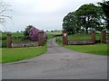
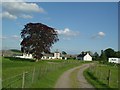
Nearby Images from Geograph Britain and Ireland:
©2007(licence)
©2007(licence)
©2008(licence)
©2007(licence)
©2007(licence)
The above images may not be of the site on this page, they are loaded from Geograph.
Please Submit an Image of this site or go out and take one for us!
Click here to see more info for this site
Nearby sites
Key: Red: member's photo, Blue: 3rd party photo, Yellow: other image, Green: no photo - please go there and take one, Grey: site destroyed
Download sites to:
KML (Google Earth)
GPX (GPS waypoints)
CSV (Garmin/Navman)
CSV (Excel)
To unlock full downloads you need to sign up as a Contributory Member. Otherwise downloads are limited to 50 sites.
Turn off the page maps and other distractions
Nearby sites listing. In the following links * = Image available
2.4km S 187° Ernespie* Stone Circle (NX77476321)
3.1km WSW 239° Greenlaw Cairn (NX75186404)
4.8km SW 226° Little Wood Hill* Causewayed Enclosure (NX7433862318)
4.8km SE 145° Rumbling Well (Buittle) Holy Well or Sacred Spring (NX8050061547)
5.3km SE 137° Slot Well (Buittle) Holy Well or Sacred Spring (NX8134861618)
7.4km SSW 196° Gelston White Cairn* Cairn (NX75555850)
8.2km WNW 300° St Ninian's Well (Parton) Holy Well or Sacred Spring (NX7079369806)
8.5km NE 44° Milton Loch Central* Crannog (NX83947149)
8.5km NE 43° Green Island (Milton Loch)* Misc. Earthwork (NX83857164)
8.5km NE 47° Milton Loch SE* Crannog (NX84287120)
8.7km NE 42° Milton Loch NW* Crannog (NX83887188)
8.8km E 79° St Winning's Well (Kirkgunzeon)* Holy Well or Sacred Spring (NX86526699)
8.8km E 81° Kirkgunzeon Stone Circle (NX86576668)
10.3km SSW 214° St Ringan's Well (Kelton) Holy Well or Sacred Spring (NX71905713)
10.3km WSW 240° Giant's Dike* Hillfort (NX68736065)
10.4km SSE 166° St Mirrans Well (Kelton) Holy Well or Sacred Spring (NX80045535)
11.4km SW 219° Park of Tongland Marked Stone Rock Art (NX70475685)
11.9km SW 222° Holy Well (Parton) Holy Well or Sacred Spring (NX696570)
12.2km WSW 249° Lairdmannoch* Stone Circle (NX66286143)
12.3km SW 218° Park Of Tongland Stones* Standing Stones (NX69965609)
13.0km W 266° Lochenbreck Well (Balmaghie) Holy Well or Sacred Spring (NX6479065025)
13.3km SSE 148° Motte of Mark* Hillfort (NX8450454023)
13.8km W 264° Spa Well (Balmaghie) Holy Well or Sacred Spring (NX6400964416)
13.9km SW 230° Fairies Well (Tongland) Holy Well or Sacred Spring (NX6695556911)
14.1km ENE 57° Lochrutton Loch* Crannog (NX89837299)
View more nearby sites and additional images


 We would like to know more about this location. Please feel free to add a brief description and any relevant information in your own language.
 Wir möchten mehr über diese Stätte erfahren. Bitte zögern Sie nicht, eine kurze Beschreibung und relevante Informationen in Deutsch hinzuzufügen.
 Nous aimerions en savoir encore un peu sur les lieux. S'il vous plaît n'hesitez pas à ajouter une courte description et tous les renseignements pertinents dans votre propre langue.
 Quisieramos informarnos un poco más de las lugares. No dude en añadir una breve descripción y otros datos relevantes en su propio idioma.