


<< Our Photo Pages >> Strata Florida Sculptured Stone - Early Christian Sculptured Stone in Wales in Ceredigion
Submitted by PAB on Saturday, 29 August 2015 Page Views: 2706
Early Medieval (Dark Age)Site Name: Strata Florida Sculptured StoneCountry: Wales County: Ceredigion Type: Early Christian Sculptured Stone
Map Ref: SN74646577
Latitude: 52.275742N Longitude: 3.838816W
Condition:
| 5 | Perfect |
| 4 | Almost Perfect |
| 3 | Reasonable but with some damage |
| 2 | Ruined but still recognisable as an ancient site |
| 1 | Pretty much destroyed, possibly visible as crop marks |
| 0 | No data. |
| -1 | Completely destroyed |
| 5 | Superb |
| 4 | Good |
| 3 | Ordinary |
| 2 | Not Good |
| 1 | Awful |
| 0 | No data. |
| 5 | Can be driven to, probably with disabled access |
| 4 | Short walk on a footpath |
| 3 | Requiring a bit more of a walk |
| 2 | A long walk |
| 1 | In the middle of nowhere, a nightmare to find |
| 0 | No data. |
| 5 | co-ordinates taken by GPS or official recorded co-ordinates |
| 4 | co-ordinates scaled from a detailed map |
| 3 | co-ordinates scaled from a bad map |
| 2 | co-ordinates of the nearest village |
| 1 | co-ordinates of the nearest town |
| 0 | no data |
Internal Links:
External Links:
I have visited· I would like to visit
PAB has visited here
")
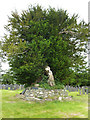
Early Christian inscribed stone. Within the grounds of the former Abbey at Strata Florida, but pre-dating the Abbey.
As reported in a recent project undertaken by University of Wales Trinity St Davids:
"At the east end of the church is a stone resting against the wall. It has a cross shape embedded into it and there are five sunken depressions in the stone. This is the earliest grave-marker from the graveyard.
It is 10th century and dates to long before the Abbey was founded. The stone seems to have been discovered when the graveyard was being extended in the mid - 19th century, and may indicate that there was a church and burial ground here at the time of the Welsh kings".
COFLEIN NPRN 275649
You may be viewing yesterday's version of this page. To see the most up to date information please register for a free account.
")
")
Do not use the above information on other web sites or publications without permission of the contributor.
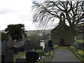
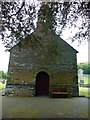
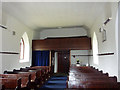
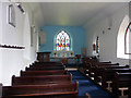
Nearby Images from Geograph Britain and Ireland:
©2011(licence)
©2011(licence)
©2011(licence)
©2011(licence)
©2011(licence)
The above images may not be of the site on this page, they are loaded from Geograph.
Please Submit an Image of this site or go out and take one for us!
Click here to see more info for this site
Nearby sites
Key: Red: member's photo, Blue: 3rd party photo, Yellow: other image, Green: no photo - please go there and take one, Grey: site destroyed
Download sites to:
KML (Google Earth)
GPX (GPS waypoints)
CSV (Garmin/Navman)
CSV (Excel)
To unlock full downloads you need to sign up as a Contributory Member. Otherwise downloads are limited to 50 sites.
Turn off the page maps and other distractions
Nearby sites listing. In the following links * = Image available
1.2km NNW 337° Pen-y-Bannau* Hillfort (SN74196689)
1.3km SE 128° Ffynnon Llygaid (Drefach)* Holy Well or Sacred Spring (SN7564064940)
1.8km ENE 70° Troed Y Rhiw 2 Cairn (SN76336634)
2.2km SE 141° Glasffrwyd Holy Well* Holy Well or Sacred Spring (SN75996399)
3.1km NNE 32° Troed Y Rhiw 1 Cairn (SN7636468372)
3.5km SE 138° Blaen Glas ffrwd Standing Stone Standing Stone (Menhir) (SN769631)
3.5km ESE 122° Pen-Y-Bwlch W ,Cairn Cairn (SN776638)
3.6km SE 136° Blaen Glasffrwd Cairn Field Cairn (SN771631)
3.9km ESE 120° Pen-Y-Bwlch E ,Cairn Cairn (SN780637)
4.6km N 352° Carreg Samson, Llethr* Standing Stone (Menhir) (SN74157038)
4.8km NW 308° Pen y Ffrwd* Hillfort (SN709688)
5.5km NW 325° Banc-Y-Geufron* Cairn (SN71637033)
5.5km NE 54° Craig Fawr Cairn (SN792689)
5.6km NNE 33° Blaen Marchnant Cairn (SN77857040)
5.8km ESE 109° Crug Gynon Cairn (SN801637)
5.9km NE 43° Llan Ddu Fawr Cairn* Cairn (SN78766998)
6.0km NE 46° Waun Claerddu Cist* Cist (SN79106980)
6.0km NW 310° Garreg Lwyd Ancient Village or Settlement (SN70106972)
6.1km SSW 192° Castell Rhyfel Hillfort (SN7320059870)
6.2km SSW 196° Groes Fawr Cairn* Round Cairn (SN7273059860)
6.4km NE 42° Carn-Y-Rhyrddod* Cairn (SN7906670426)
6.5km NE 49° Carreg Naw Llyn* Standing Stone (Menhir) (SN79716989)
6.6km NW 314° Nant Byr Isaf Cairn (SN70037044)
6.9km S 174° Blaen Camddwr Cairn* Cairn (SN7516558906)
7.2km WNW 300° Llanwnnws Inscribed Stone Early Christian Sculptured Stone (SN68516950)
View more nearby sites and additional images


 We would like to know more about this location. Please feel free to add a brief description and any relevant information in your own language.
 Wir möchten mehr über diese Stätte erfahren. Bitte zögern Sie nicht, eine kurze Beschreibung und relevante Informationen in Deutsch hinzuzufügen.
 Nous aimerions en savoir encore un peu sur les lieux. S'il vous plaît n'hesitez pas à ajouter une courte description et tous les renseignements pertinents dans votre propre langue.
 Quisieramos informarnos un poco más de las lugares. No dude en añadir una breve descripción y otros datos relevantes en su propio idioma.