


<< Our Photo Pages >> Graig Fawr (Dyserth) - Standing Stone (Menhir) in Wales in Denbighshire
Submitted by TimPrevett on Thursday, 24 May 2007 Page Views: 7841
Neolithic and Bronze AgeSite Name: Graig Fawr (Dyserth)Country: Wales County: Denbighshire Type: Standing Stone (Menhir)
Nearest Village: Dyserth
Map Ref: SJ06288013
Latitude: 53.309786N Longitude: 3.408054W
Condition:
| 5 | Perfect |
| 4 | Almost Perfect |
| 3 | Reasonable but with some damage |
| 2 | Ruined but still recognisable as an ancient site |
| 1 | Pretty much destroyed, possibly visible as crop marks |
| 0 | No data. |
| -1 | Completely destroyed |
| 5 | Superb |
| 4 | Good |
| 3 | Ordinary |
| 2 | Not Good |
| 1 | Awful |
| 0 | No data. |
| 5 | Can be driven to, probably with disabled access |
| 4 | Short walk on a footpath |
| 3 | Requiring a bit more of a walk |
| 2 | A long walk |
| 1 | In the middle of nowhere, a nightmare to find |
| 0 | No data. |
| 5 | co-ordinates taken by GPS or official recorded co-ordinates |
| 4 | co-ordinates scaled from a detailed map |
| 3 | co-ordinates scaled from a bad map |
| 2 | co-ordinates of the nearest village |
| 1 | co-ordinates of the nearest town |
| 0 | no data |
Internal Links:
External Links:
 (PID:264684)")
Possibly felled and split during tank practice in WW2.
You may be viewing yesterday's version of this page. To see the most up to date information please register for a free account.
Do not use the above information on other web sites or publications without permission of the contributor.
Nearby Images from Geograph Britain and Ireland:
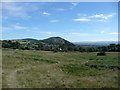
©2010(licence)
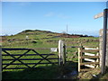
©2012(licence)
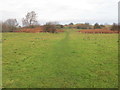
©2018(licence)
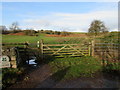
©2020(licence)
©2021(licence)
The above images may not be of the site on this page, they are loaded from Geograph.
Please Submit an Image of this site or go out and take one for us!
Click here to see more info for this site
Nearby sites
Key: Red: member's photo, Blue: 3rd party photo, Yellow: other image, Green: no photo - please go there and take one, Grey: site destroyed
Download sites to:
KML (Google Earth)
GPX (GPS waypoints)
CSV (Garmin/Navman)
CSV (Excel)
To unlock full downloads you need to sign up as a Contributory Member. Otherwise downloads are limited to 50 sites.
Turn off the page maps and other distractions
Nearby sites listing. In the following links * = Image available
1.2km SW 215° Dyserth Church* Ancient Cross (SJ056792)
1.6km NNE 30° Coed-Yr-Esgob Round Barrow(s) (SJ07098146)
1.6km S 178° Moel Hiraddug* Hillfort (SJ063785)
1.8km E 80° Gop Farm Bone Cave Cave or Rock Shelter (SJ08028041)
1.8km ENE 61° Ty-Uchaf* Round Barrow(s) (SJ07868095)
2.2km SW 232° Ffynnon Fair (Rhuddlan)* Holy Well or Sacred Spring (SJ045788)
2.3km ESE 104° Hen Dy Round Barrow(s) (SJ08547950)
2.4km E 90° Gop Caves* Cave or Rock Shelter (SJ08648009)
2.4km E 88° Gop-y-Goleuni* Cairn (SJ08668015)
2.5km SSE 150° Marian Ffrith Hillfort (SJ0746877947)
2.5km SSE 157° Marion Bach 2 Round Barrow(s) (SJ07217782)
2.6km E 89° Gop Wood Mound* Cairn (SJ08928012)
2.7km SSE 162° Marion Bach 1 Round Barrow(s) (SJ07057759)
3.2km SSE 155° Aelwyd Uchaf (Cottage) Barrows Round Barrow(s) (SJ0758577185)
3.2km E 85° Bryn-Y-Odyn* Round Barrow(s) (SJ0952380376)
3.2km SE 125° Cae Bryn Round Barrow(s) (SJ08917821)
3.8km SSE 158° Llyn-Y-Gorseddau 3 Round Barrow(s) (SJ07647662)
3.8km SSE 157° Llyn-Y-Gorseddau 2 Round Barrow(s) (SJ07687657)
3.9km SSE 158° Llyn-Y-Gorseddau 1 Round Barrow(s) (SJ07657651)
4.1km E 86° Axton Barrows Round Barrow(s) (SJ104803)
5.0km SE 142° Criafol* Round Barrow(s) (SJ09317611)
5.1km WNW 293° Rhyl Gorsedd Circle* Modern Stone Circle etc (SJ0158382243)
5.1km SE 131° Hendre Bach Round Barrow(s) (SJ10137671)
5.2km SE 138° Pany Y Dulath Round Barrow(s) (SJ09677624)
6.3km SSE 156° Moel Maen Efa* Barrow Cemetery (SJ087743)
View more nearby sites and additional images


 We would like to know more about this location. Please feel free to add a brief description and any relevant information in your own language.
 Wir möchten mehr über diese Stätte erfahren. Bitte zögern Sie nicht, eine kurze Beschreibung und relevante Informationen in Deutsch hinzuzufügen.
 Nous aimerions en savoir encore un peu sur les lieux. S'il vous plaît n'hesitez pas à ajouter une courte description et tous les renseignements pertinents dans votre propre langue.
 Quisieramos informarnos un poco más de las lugares. No dude en añadir una breve descripción y otros datos relevantes en su propio idioma.