<< Text Pages >> Complutum Alcalá de Henares - Ancient Village or Settlement in Spain in Castilla La Mancha y Madrid
Submitted by holger_rix on Saturday, 05 December 2015 Page Views: 1756
Multi-periodSite Name: Complutum Alcalá de HenaresCountry: Spain
NOTE: This site is 25.649 km away from the location you searched for.
Region: Castilla La Mancha y Madrid Type: Ancient Village or Settlement
Latitude: 40.473780N Longitude: 3.3849W
Condition:
| 5 | Perfect |
| 4 | Almost Perfect |
| 3 | Reasonable but with some damage |
| 2 | Ruined but still recognisable as an ancient site |
| 1 | Pretty much destroyed, possibly visible as crop marks |
| 0 | No data. |
| -1 | Completely destroyed |
| 5 | Superb |
| 4 | Good |
| 3 | Ordinary |
| 2 | Not Good |
| 1 | Awful |
| 0 | No data. |
| 5 | Can be driven to, probably with disabled access |
| 4 | Short walk on a footpath |
| 3 | Requiring a bit more of a walk |
| 2 | A long walk |
| 1 | In the middle of nowhere, a nightmare to find |
| 0 | No data. |
| 5 | co-ordinates taken by GPS or official recorded co-ordinates |
| 4 | co-ordinates scaled from a detailed map |
| 3 | co-ordinates scaled from a bad map |
| 2 | co-ordinates of the nearest village |
| 1 | co-ordinates of the nearest town |
| 0 | no data |
Be the first person to rate this site - see the 'Contribute!' box in the right hand menu.
Internal Links:
External Links:
I have visited· I would like to visit
HChavez visited - their rating: Cond: 3 Amb: 3 Access: 4
You may be viewing yesterday's version of this page. To see the most up to date information please register for a free account.
Do not use the above information on other web sites or publications without permission of the contributor.
Nearby Images from Flickr
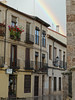


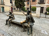

The above images may not be of the site on this page, but were taken nearby. They are loaded from Flickr so please click on them for image credits.
Click here to see more info for this site
Nearby sites
Click here to view sites on an interactive map of the areaKey: Red: member's photo, Blue: 3rd party photo, Yellow: other image, Green: no photo - please go there and take one, Grey: site destroyed
Download sites to:
KML (Google Earth)
GPX (GPS waypoints)
CSV (Garmin/Navman)
CSV (Excel)
To unlock full downloads you need to sign up as a Contributory Member. Otherwise downloads are limited to 50 sites.
Turn off the page maps and other distractions
Nearby sites listing. In the following links * = Image available
26.3km WSW 258° Museo Arqueológico Nacional* Museum
27.1km S 171° Cuevas de Perales de Tajuña* Cave or Rock Shelter
28.7km W 259° Templo de Debod* Ancient Temple
39.9km NW 309° Yacimiento Arqueológico de Navalvillar Ancient Village or Settlement
58.1km WSW 237° Yacimiento Romano de Carranque Ancient Village or Settlement
85.9km W 272° Necropolis Navaserrada Barrow Cemetery
87.1km SW 219° Museo de Santa Cruz* Museum
91.6km WSW 258° Toros de Guisando* Sculptured Stone
93.3km WSW 254° Piedra Escrita* Standing Stone (Menhir)
94.4km WSW 256° Las Cogotas. Castro or Chafurdão
97.3km NNE 12° Montejo de la Sierra Castro or Chafurdão
105.0km NE 51° El Portillo de las Cortes* Burial Chamber or Dolmen
105.1km ENE 62° La Cueva de Los Casares Cave or Rock Shelter
105.1km WNW 283° Prado de las Cruces dolmen* Burial Chamber or Dolmen
105.2km WNW 283° Dolmen de Bernuy* Passage Grave
105.7km NE 42° La Laguna de la Sima Chambered Tomb
105.8km NE 44° Peña de la Abuel Ancient Village or Settlement
107.6km NNW 342° Castroserracín* Cairn
108.9km NW 311° Domingo García Rock Art
113.0km W 281° Vettonia Museum* Museum
114.6km WNW 285° Castro de Las Cogotas* Castro or Chafurdão
125.0km N 11° Uxama* Ancient Village or Settlement
127.0km W 273° Ulaca* Castro or Chafurdão
133.8km SE 135° Honrubia Castro or Chafurdão
134.5km NW 307° Museo de las Villas Romanas de Almenara-Puras Ancient Village or Settlement
View more nearby sites and additional images


 We would like to know more about this location. Please feel free to add a brief description and any relevant information in your own language.
 Wir möchten mehr über diese Stätte erfahren. Bitte zögern Sie nicht, eine kurze Beschreibung und relevante Informationen in Deutsch hinzuzufügen.
 Nous aimerions en savoir encore un peu sur les lieux. S'il vous plaît n'hesitez pas à ajouter une courte description et tous les renseignements pertinents dans votre propre langue.
 Quisieramos informarnos un poco más de las lugares. No dude en añadir una breve descripción y otros datos relevantes en su propio idioma.